Showers Moving East Warm Front Moving North
Showers Moving East Warm Front Moving North
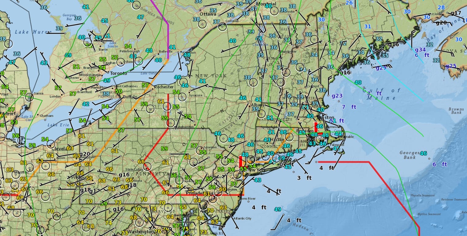
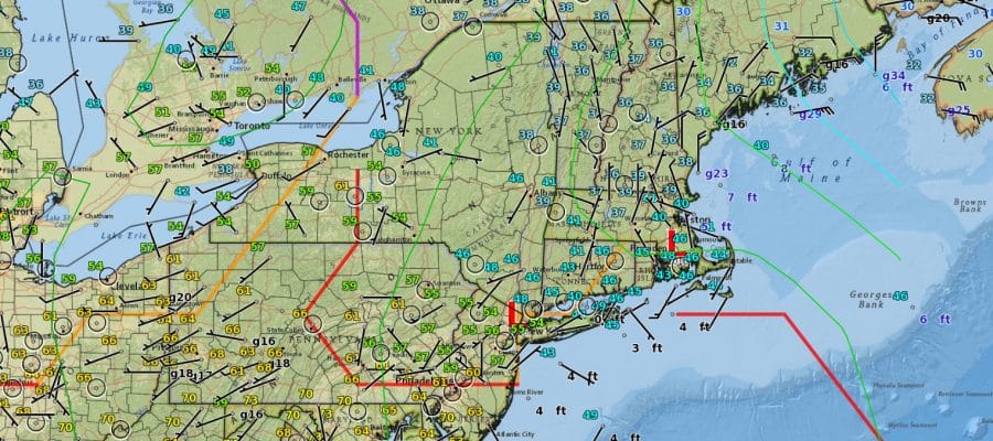
We are still dealing with the same warm front that has been going back and forth, back and forth since Friday. This time it is moving northward again though it will come to a grinding halt somewhere overnight. Showers moving east from the Ohio Valley are with a low pressure area that is moving northeast and heading for somewhere off the New Jersey coast later Tuesday and Tuesday night. Clouds are going to be around overnight and patchy fog will likely develop again especially along coastal areas. Then we watch showers now moving through Kentucky and Tennessee on the radar move through here with one batch late tonight which some areas may see and others not. Latest HRRR model shows some heavier downpours and thunderstorms possible in Southern New Jersey and Southeastern Pennsylvania during the Tuesday morning commute. That area will move northeasward during the day Tuesday into Tuesday evening before finally clearing the coast.
SATELLITE LOOP

REGIONAL RADAR

LOCAL RADAR NEW YORK CITY

LOCAL RADAR PHILADELPHIA


Weather conditions will improve on Wednesday with sunshine and Thursday looks good too. Both days highs should be in the 50s though Thursday will be cooler than Wednesday. Then here comes the next storm system for Friday and Saturday as low pressure heads south of us from the Tennessee Valley. This means a cold rain and a raw northeast wind for Friday and Saturday and temperatures just in the 40s. UGH!
JOESTRADAMUS has more on the long range in his latest post.
 GET JOE A CIGAR IF YOU LIKE

LANDSCAPE COMPANIES FOR YOUR NEEDS
LONG ISLAND ROCKLAND COUNTY Connecticut

![]()

ROCKLAND COUNTY TRI STATE SNOW REMOVAL JOHNSTOWN PA


FiOS1 News Weather Forecast For Long Island
FiOS1 News Weather Forecast For New Jersey
FiOS1 News Weather Forecast For Hudson Valley
NATIONAL WEATHER SERVICE SNOW FORECASTS
LATEST JOESTRADAMUS ON THE LONG RANGE
Weather App

Don’t be without Meteorologist Joe Cioffi’s weather app. It is really a meteorologist app because you get my forecasts and my analysis and not some automated computer generated forecast based on the GFS model. This is why your app forecast changes every 6 hours. It is model driven with no human input at all. It gives you an icon, a temperature and no insight whatsoever.
It is a complete weather app to suit your forecast needs. All the weather information you need is right on your phone. Android or I-phone, use it to keep track of all the latest weather information and forecasts. This weather app is also free of advertising so you don’t have to worry about security issues with your device. An accurate forecast and no worries that your device is being compromised.
Use it in conjunction with my website and my facebook and twitter and you have complete weather coverage of all the latest weather and the long range outlook. The website has been redone and upgraded. Its easy to use and everything is archived so you can see how well Joe does or doesn’t do when it comes to forecasts and outlooks.
Just click on the google play button or the apple store button on the sidebar for my app which is on My Weather Concierge. Download the app for free. Subscribe to my forecasts on an ad free environment for just 99 cents a month.
Get my forecasts in the palm of your hand for less than the cost of a cup of Joe!


