
Heavy Downpours Moving Northeastward
 Heavy Downpours Moving Northeastward
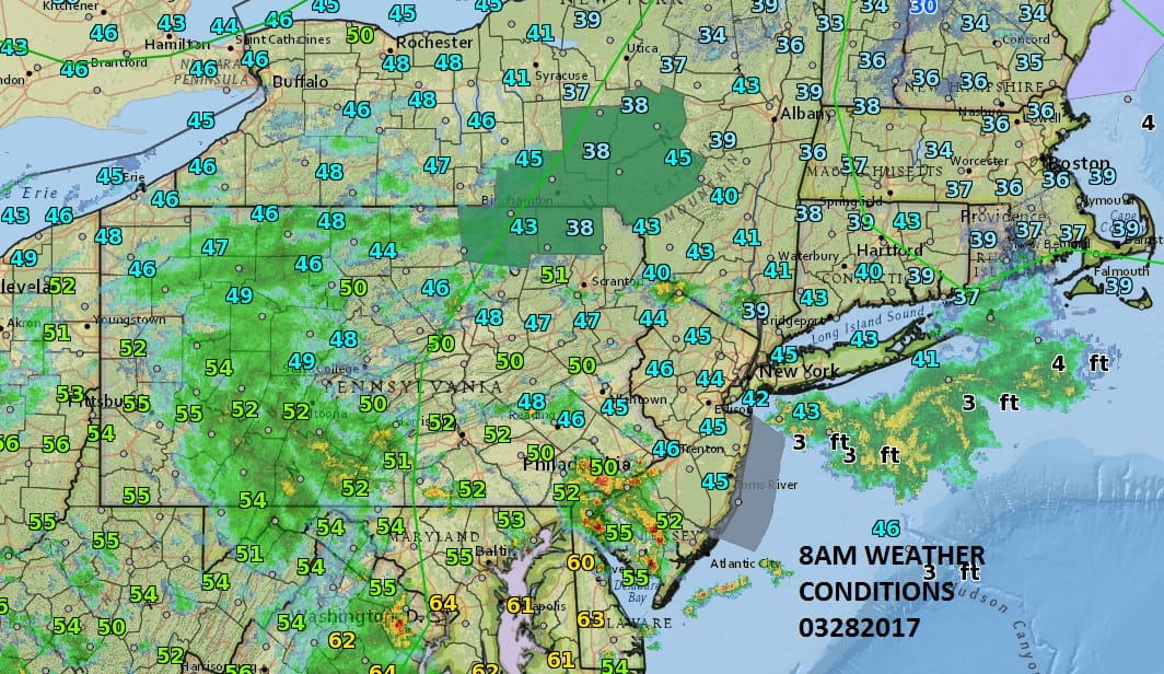
We are seeing some heavy downpours and possible thunderstorms this morning over Southern New Jersey and Southeastern Pennsylvania and some more rain and thunderstorms behind the lead area that are moving to the northeast. This is going to make for a cloudy showery day for the entire area with showers moving through from time to time. The heavy thunderstorms in Southern New Jersey are developing ahead of a warm front that is trying to push northward while low pressure moves east across Southern Pennsylvania and Western Maryland at the same time.
The satellite loop below shows the comma shaped cloud structure swinging across West Virginia and Virginia as low pressure moves east. Also evident on the satellite loop is a gale center out in the Southwest Atlantic headed south and east of Bermuda and offshore. Dry air covers the mid west and that dry air finally arrives here for Wednesday and Thursday.
SATELLITE LOOP

REGIONAL RADAR

LOCAL RADAR NEW YORK CITY

LOCAL RADAR PHILADELPHIA


Radars both regional and local will be busy today as we deal with these clusters of showers and heavy downpours throughout the day and into this evening though obviously it does not rain all the time. Temperatures will be in the 50s and 60s across the area with the coolest north and northeast of NYC and warmest in Southern New Jersey and Southeastern Pennsylvania. Once the showers end later this evening weather conditions will improve and Wednesday and Thursday look like 2 very good days with sunshine and highs in the 50s. Then the next system brings rain for Friday into Saturday with dry weather returning Sunday and Monday. We will explore that rain event later today.
 GET JOE A CIGAR IF YOU LIKE

LANDSCAPE COMPANIES FOR YOUR NEEDS
LONG ISLAND ROCKLAND COUNTY Connecticut

![]()

ROCKLAND COUNTY TRI STATE SNOW REMOVAL JOHNSTOWN PA


FiOS1 News Weather Forecast For Long Island
FiOS1 News Weather Forecast For New Jersey
FiOS1 News Weather Forecast For Hudson Valley
NATIONAL WEATHER SERVICE SNOW FORECASTS
LATEST JOESTRADAMUS ON THE LONG RANGE
Weather App

Don’t be without Meteorologist Joe Cioffi’s weather app. It is really a meteorologist app because you get my forecasts and my analysis and not some automated computer generated forecast based on the GFS model. This is why your app forecast changes every 6 hours. It is model driven with no human input at all. It gives you an icon, a temperature and no insight whatsoever.
It is a complete weather app to suit your forecast needs. All the weather information you need is right on your phone. Android or I-phone, use it to keep track of all the latest weather information and forecasts. This weather app is also free of advertising so you don’t have to worry about security issues with your device. An accurate forecast and no worries that your device is being compromised.
Use it in conjunction with my website and my facebook and twitter and you have complete weather coverage of all the latest weather and the long range outlook. The website has been redone and upgraded. Its easy to use and everything is archived so you can see how well Joe does or doesn’t do when it comes to forecasts and outlooks.
Just click on the google play button or the apple store button on the sidebar for my app which is on My Weather Concierge. Download the app for free. Subscribe to my forecasts on an ad free environment for just 99 cents a month.
Get my forecasts in the palm of your hand for less than the cost of a cup of Joe!


