
Rain Downpours Into Evening Commute
Rain Downpours Into Evening Commute
Radar and satellite loops continue to show rain and some heavier downpours moving through the area this afternoon and the latest HRRR model has the rain continuing this evening before it begins to pull away to the east. Rainfall amounts have been on the order of a quarter to a half inch in most places and we should see some areas double that before this is all said and done. Areas in Central and Southern New Jersey and Southeastern Pennsylvania are through with the bulk of the steadier rain and downpours. Some residual showers could move through those areas this evening.
HRRR MODEL TUESDAY EVENING CLICK TO ANIMATE
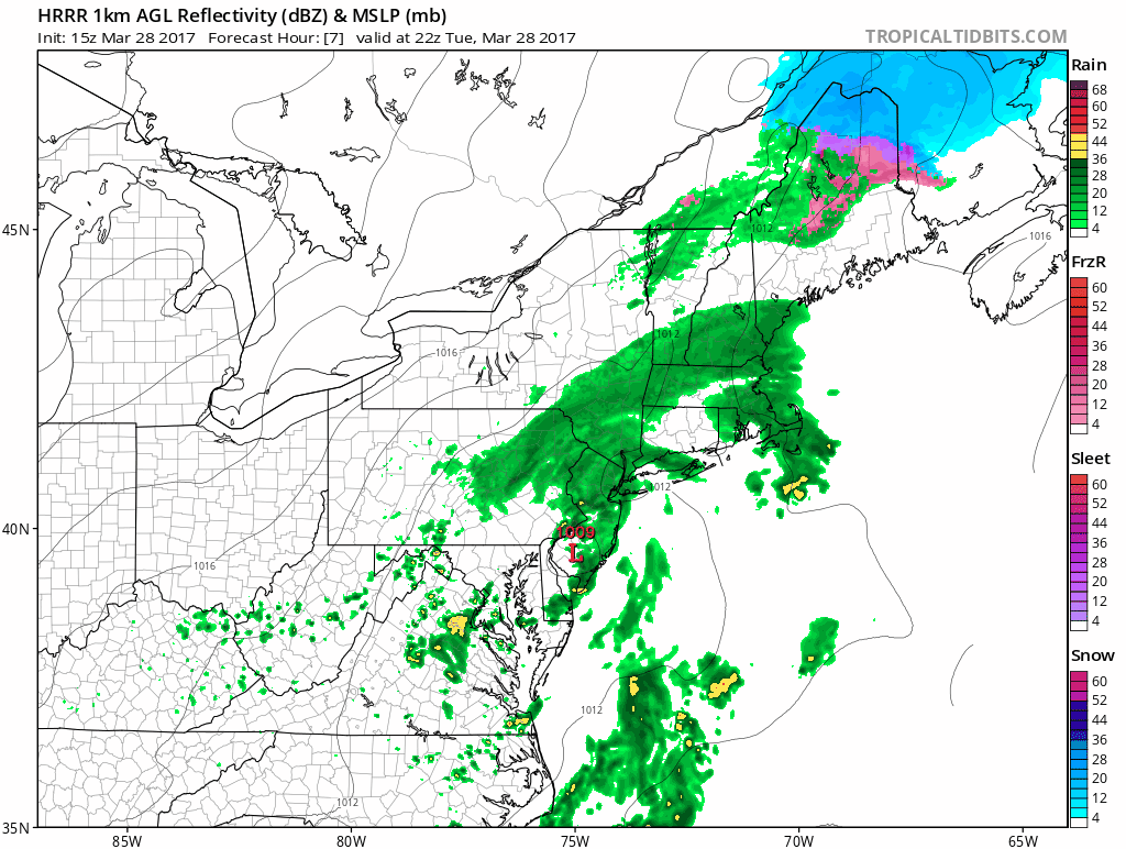
Low pressure is finally moving offshore this evening and once it pulls away to the east, drier air now moving into the midwest will begin to move slowly in. Clearing of skies may take some time but we should see a fair amount of sunshine developing on Wednesday along with a gusty breeze and temperatures in the 50s. At least we will break the gloomy streak of weather at 4 days.
SATELLITE LOOP

REGIONAL RADAR

LOCAL RADAR NEW YORK CITY

LOCAL RADAR PHILADELPHIA


Thursday looks dry with lots of sunshine and highs in the 50s. Then the next weather system coming out of the Ohio and Tennessee Valley will put us back in the soup with a cold rain developing Friday and lasting into at least part of Saturday. This system is likely to produce some accumulating snow in parts of Central and Northern New England but for here it is a cold rain followed by improving weather conditions later Saturday into Sunday. We are in a pattern of weather systems coming through every couple of days so the next one will probably follow on Tuesday and Wednesday of next week.
 GET JOE A CIGAR IF YOU LIKE

LANDSCAPE COMPANIES FOR YOUR NEEDS
LONG ISLAND ROCKLAND COUNTY Connecticut

![]()

ROCKLAND COUNTY TRI STATE SNOW REMOVAL JOHNSTOWN PA


FiOS1 News Weather Forecast For Long Island
FiOS1 News Weather Forecast For New Jersey
FiOS1 News Weather Forecast For Hudson Valley
NATIONAL WEATHER SERVICE SNOW FORECASTS
LATEST JOESTRADAMUS ON THE LONG RANGE
Weather App

Don’t be without Meteorologist Joe Cioffi’s weather app. It is really a meteorologist app because you get my forecasts and my analysis and not some automated computer generated forecast based on the GFS model. This is why your app forecast changes every 6 hours. It is model driven with no human input at all. It gives you an icon, a temperature and no insight whatsoever.
It is a complete weather app to suit your forecast needs. All the weather information you need is right on your phone. Android or I-phone, use it to keep track of all the latest weather information and forecasts. This weather app is also free of advertising so you don’t have to worry about security issues with your device. An accurate forecast and no worries that your device is being compromised.
Use it in conjunction with my website and my facebook and twitter and you have complete weather coverage of all the latest weather and the long range outlook. The website has been redone and upgraded. Its easy to use and everything is archived so you can see how well Joe does or doesn’t do when it comes to forecasts and outlooks.
Just click on the google play button or the apple store button on the sidebar for my app which is on My Weather Concierge. Download the app for free. Subscribe to my forecasts on an ad free environment for just 99 cents a month.
Get my forecasts in the palm of your hand for less than the cost of a cup of Joe!


