Severe Weather Stays West Showers Thunder Tonight Weekend Sees Improvement Cooler Temps
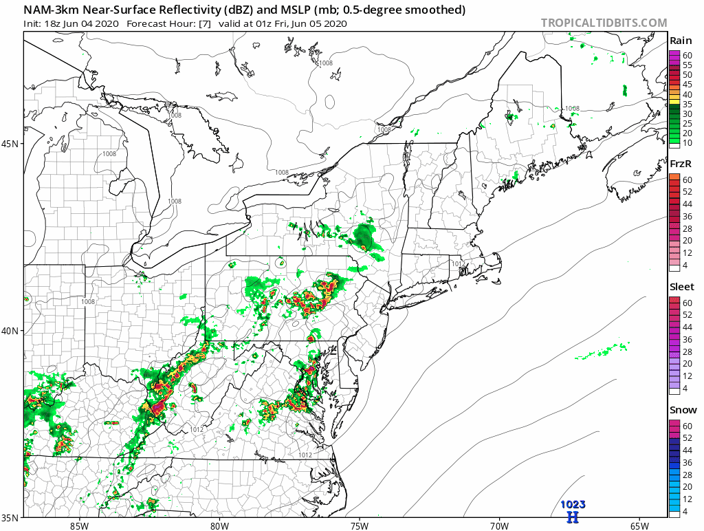
The severe weather risk area continues tonight per the Storm Prediction Center across the area and right now virtually the entire state of Pennsylvania is under a severe thunderstorm watch. Warm and humid conditions cover the Northeast today. Highs reached the mid to upper 80s from Eastern Pennsylvania to Southern New England and we have another short wave trough that is moving through triggering off some thunderstorms this evening.
SATELLITE

REGIONAL RADAR

Watching the radars two areas are noted with severe weather across Central Pennsylvania moving east and a large area of downpours and thunderstorms now in Western Pennsylvania moving eastward. The Upton NY radar over Central Long Island remains out of service so we have switched to the Albany radar which isn’t showing too much in our area nor is the Mount Holly NJ Radar at least for now.
LOCAL RADAR ALBANY NJ

LOCAL RADAR PHILADELPHIA


The threat for showers or a thunderstorm will likely hold off until late evening or even until the early morning hours as we see some scattered showers or thunderstorms moving through. They should be gone before daybreak and temperatures will be in the 60s.

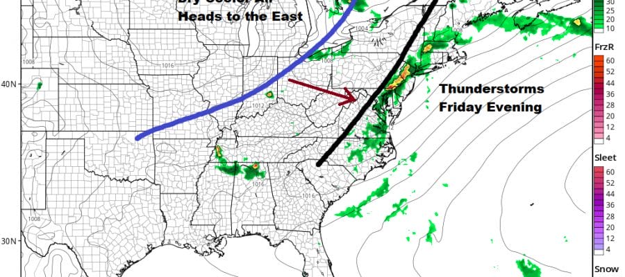
Friday’s severe weather risk zone is a bit smaller and for now only a marginal risk is indicated though with warm humid conditions and an approaching upper air trough we might see this get elevated a bit to a slight risk. It generally covers the same area for the third day in a row. Look for another warm humid day with some sunshine and highs in the 80s. There is the chance for thunderstorms late tomorrow afternoon and evening.
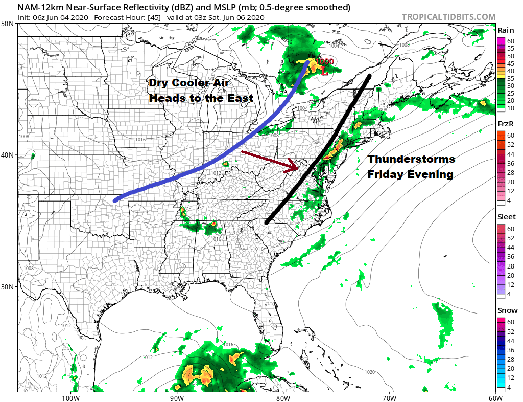
On to the weekend where that cold front you see on the map above comes through and while we should see some sun for most of the day, there is the outside chance for a passing shower or even a thunderstorm as the front passes. Humidity levels drop behind it. Saturday’s highs will be in the 80s. Sunday and Monday look to mostly sunny cooler and dry with highs both days in the 70s. Next week at first glance looks to be rather nice at least into Tuesday and if everything behaves itself, possibly lasting through Wednesday before the next cold front arrives. There is also a weak low in the Atlantic that gets pushed back westward off the Carolinas and Virginia. For now we see no complications from this feature.
BE SURE TO DOWNLOAD THE FREE METEOROLOGIST JOE CIOFFI WEATHER APP &
ANGRY BEN’S FREE WEATHER APP “THE ANGRY WEATHERMAN!
MANY THANKS TO TROPICAL TIDBITS FOR THE USE OF MAPS
Please note that with regards to any severe weather, tropical storms, or hurricanes, should a storm be threatening, please consult your local National Weather Service office or your local government officials about what action you should be taking to protect life and property.


