Severe Weather Risk Over Parts of Area Late Today Tonight
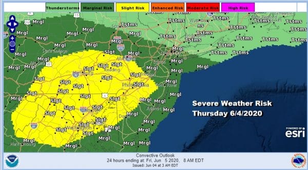
Yesterday was certainly quite the day regarding severe weather. Southeastern Pennsylvania and Southern New Jersey got hit with two rounds of severe thunderstorms while areas to the north of NYC missed the first round but participated in the second. Today we have severe weather risk again because last night’s cold front basically fell apart and now we are sitting in a warm humid air mass today with a frontal boundary to our north. High temperatures will be in the 80s. Add a short wave trough moving through late today into tonight and you have the risk for severe weather per the Storm Prediction Center.
SATELLITE
REGIONAL RADAR
Not much is happening this morning on the radars both on the regional and on the local views. The Upton radar has been down for the last two days and hopefully it will come up later today. I don’t expect much action until later this afternoon and evening.
LOCAL RADAR NEW YORK CITY
LOCAL RADAR PHILADELPHIA

Short weather models handled things relatively well yesterday though they had huge issues with the first round of severe weather that developed into a derecho in the early afternoon. It was moving at ridiculous speeds of 80 mph or more. I don’t see a repeat of that today but we will see cells develop in the slight risk zone and then watch those cells move to the northeast late this evening.
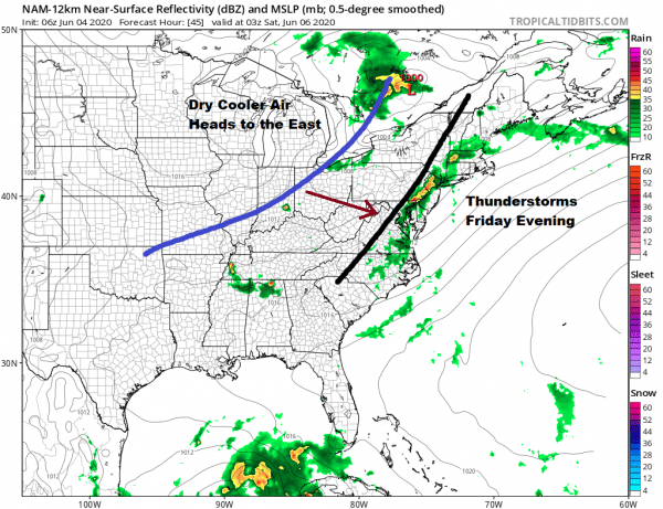
Once storms move out tonight it will be a warm humid night with most lows in the 60s. Friday we will do it all over again as we watch a cold front approach. Some sunshine Friday will take highs again in the 80s. Then we see showers and thunderstorms Friday night as a trough nears the coast. I expect the Storm Prediction Center to show some severe weather risk for Friday..probably a marginal risk.
A cold front will follow for early Saturday however this should move along with little consequence and we should see improving weather conditions over the weekend. It will still be warm on Saturday with highs into the 80s but dew points and humidity levels will drop as the day wears on and there should be a fair amount of sunshine. Sunday looks mostly sunny nice an seasonal with highs mostly in the 70s. The dry and seasonal air should carry into early next week.
BE SURE TO DOWNLOAD THE FREE METEOROLOGIST JOE CIOFFI WEATHER APP &
ANGRY BEN’S FREE WEATHER APP “THE ANGRY WEATHERMAN!
MANY THANKS TO TROPICAL TIDBITS FOR THE USE OF MAPS
Please note that with regards to any severe weather, tropical storms, or hurricanes, should a storm be threatening, please consult your local National Weather Service office or your local government officials about what action you should be taking to protect life and property.


