Severe Weather Shifts Into the East Thursday Easter Sunday Dry But Storm Nears At Night

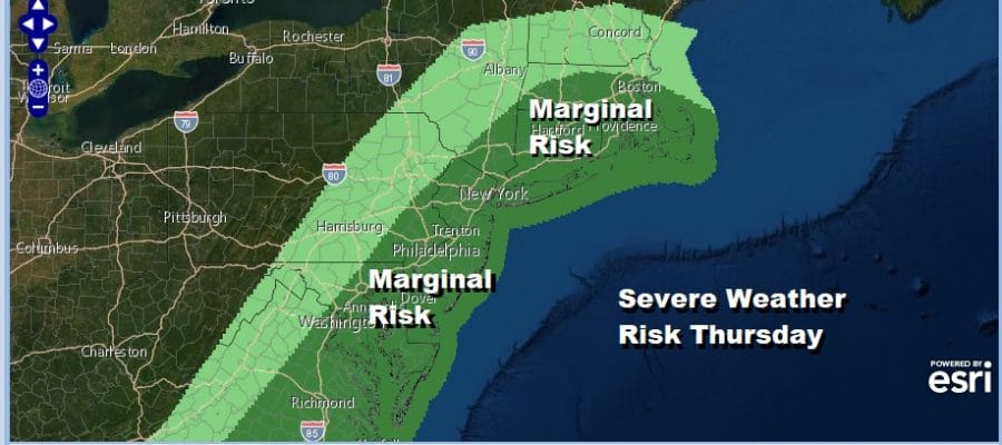
We are having a busy night severe weather wise across the Ohio Valley as well as parts of the Middle Atlantic states. That activity will increase tonight and then shift to the coastal plain on Thursday. The Storm Prediction Center has expanded the area of marginal severe weather risk Thursday to Southeastern New England as well as much of the Hudson Valley and then extending south through Eastern Pennsylvania and New Jersey down into Delaware Maryland & Eastern Virginia.
SATELLITE

REGIONAL RADAR

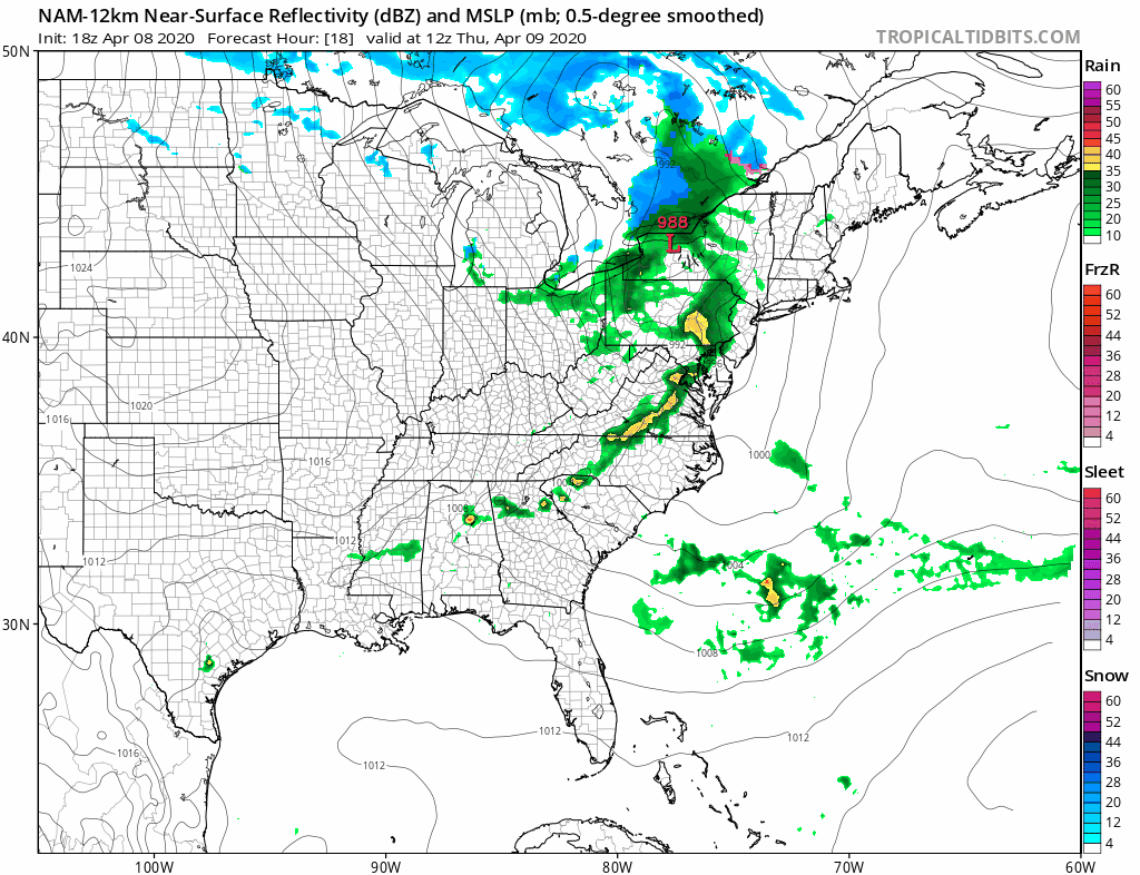
Meanwhile tonight a cluster of showers moved off the New Jersey coast and we are seeing some other showers and thunderstorms starting to gel up on the regional radars. Our local radars will start filling in with showers and thunderstorms after midnight.
LOCAL RADAR NEW YORK CITY

LOCAL RADAR PHILADELPHIA


Thursday morning into the afternoon look for some showers and thunderstorms to roll through. Once the cold front passes in the early afternoon we will see winds pick up sharply especially along the coast. Wind Advisories have been posted for NYC and the counties that surround the city. We may wind up seeing that advisory zone expanded.
Temperatures Friday will be in the chilly 50s and note that in upstate NY and parts of Western Pennsylvania you will see the lake effect snow machine turned on at least for a short time. Colder air continues to come in Friday night and Saturday morning lows will be in the upper 20s to mid 30s.

As far as Easter Weekend is concerned, Saturday will be the better of the two weekend days with sunshine, a gusty breeze especially in the morning. Highs will be just in the 50s. Sunday low pressure is coming out of the Southern Plains and heading toward the Great Lakes as a very powerful spring storm. Clouds will increase Sunday and we could see a soaking heavy rain and thunderstorms Sunday night into Monday morning. The associated front moves through Monday morning leaving us with improving weather conditions Monday afternoon. Sunday’s highs will reach into the 60s and if we get some sun we could see highs reach into the 70s briefly Monday afternoon before colder air arrives at night and for Tuesday. The stormy weather pattern continues in the long range.
BE SURE TO DOWNLOAD THE FREE METEOROLOGIST JOE CIOFFI WEATHER APP &
ANGRY BEN’S FREE WEATHER APP “THE ANGRY WEATHERMAN!
MANY THANKS TO TROPICAL TIDBITS FOR THE USE OF MAPS
Please note that with regards to any severe weather, tropical storms, or hurricanes, should a storm be threatening, please consult your local National Weather Service office or your local government officials about what action you should be taking to protect life and property.


