Severe Weather Risk Wind Advisories Expanded Stormy Sunday Night Into Monday
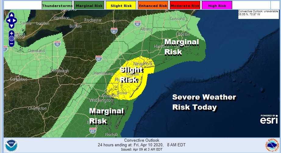
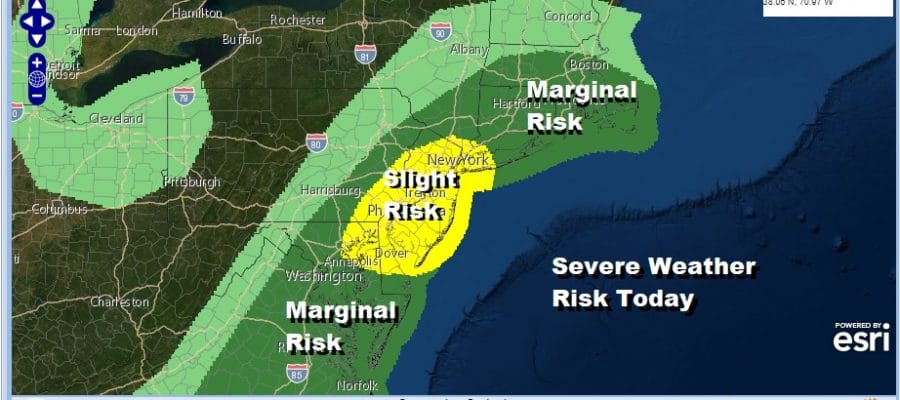
We have a cold front approaching this morning and will be reaching the coast by early afternoon. Ahead of it the Storm Prediction Center has expanded the risk area to include a slight risk of severe weather (15% chance) over New Jersey and Eastern Pennsylvania south into Delaware. Marginal risk is to the north into Southern New England. The other issue is wind and wind advisories are posted for this afternoon for all of the area from Eastern Pennsylvania to Southern New England south into Maryland and Virginia with winds gusting to 40-50 mph this afternoon into this evening after the front goes by.
SATELLITE

REGIONAL RADAR

We are watching the cold front approaching with showers and a few thunderstorms in the mix though the stronger cells as of 8:30am are south of NYC down to Delaware. There could be another burst of thunderstorms around midday as the front goes by so keep an eye on the radar and of course any severe weather warnings that could be issued.
LOCAL RADAR NEW YORK CITY

LOCAL RADAR PHILADELPHIA


Once the front passes the wind will pick up strongly and it will remain rather windy through Friday. Temperatures today will top out in the 60s and then colder air comes in for Friday and Saturday. Friday we will see clouds and some sunshine, gusty winds, and an isolated rain shower is possible. Snow showers and some lake effect snow will be going on in parts of Upstate NY and Western Pennsylvania. Friday’s highs will be in the 50s.
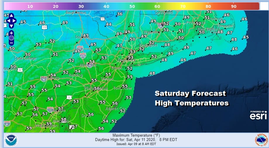
Saturday will be the better of the two weekend days from the standpoint of sunshine. It will still be breezy at the start of the day but winds will drop off. We will start the day in the upper 20s to mid 30s and highs will be back in the low to mid 50s. Easter Sunday we will cloud up rather quickly but no rain is forecast during the day Sunday. Highs will be in the mid 50s to lower 60s.

A major storm is going to be coming out of the Southern Plains and head to the Great Lakes. This is going to produce everything from heavy snow in the Western Lakes to severe weather in the Gulf States and the Southeast US. Heavy rain will arrive in our area Sunday night and last into Monday morning before weather conditions improve later Monday. This system could be a 2 inch plus rain producer in what is a very wet weather pattern ahead in the long range. We will be exploring this possibility later today.
BE SURE TO DOWNLOAD THE FREE METEOROLOGIST JOE CIOFFI WEATHER APP &
ANGRY BEN’S FREE WEATHER APP “THE ANGRY WEATHERMAN!
MANY THANKS TO TROPICAL TIDBITS FOR THE USE OF MAPS
Please note that with regards to any severe weather, tropical storms, or hurricanes, should a storm be threatening, please consult your local National Weather Service office or your local government officials about what action you should be taking to protect life and property.


