Severe Weather Shifting Southeast Cooler Air Moving South
Severe Weather Shifting Southeast Cooler Air Moving South
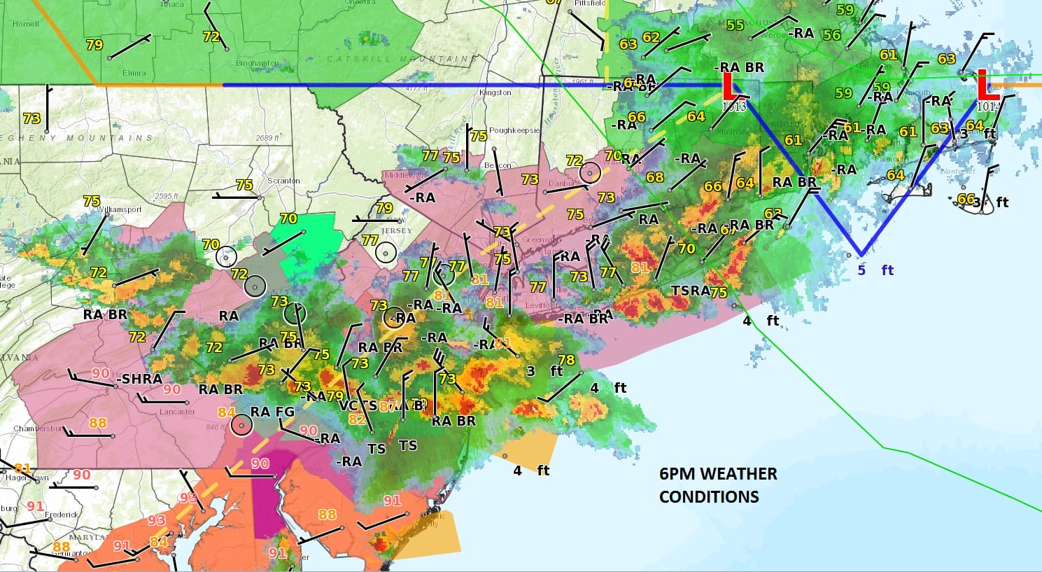
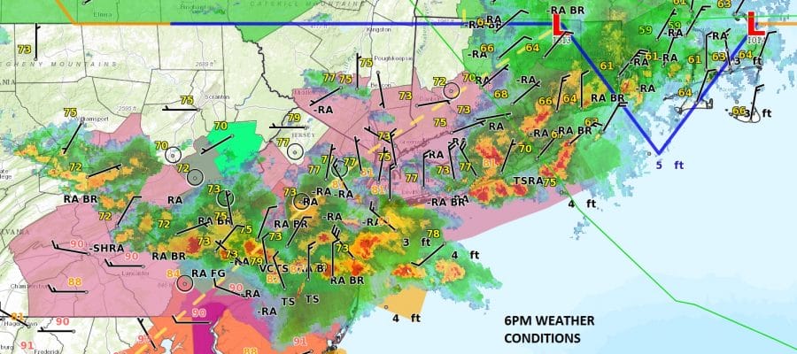
Severe weather continues this evening over Central New Jersey, Eastern Long Island and Southeastern Pennsylvania. Look at the big temperature changes that are underway. We have already seen 15 degree drops from the days highs and look at the cool air in Southeastern New England where temperatures have fallen into the upper 50s & lower 60s! The weather front is dropping southward this evening and will continue to push southward into Southern New Jersey overnight. Severe weather continues for another few hours before winding down and moving away to the east and offshore.
SATELLITE LOOP

REGIONAL RADAR

LOCAL RADAR NEW YORK CITY

LOCAL RADAR PHILADELPHIA


FLASH FLOOD WARNING IN EFFECT FOR PARTS OF CENTRAL NEW JERSEY
The National Weather Service in Mount Holly NJ has issued a
* Flash Flood Warning for…
Northern Ocean County in southern New Jersey…
Mercer County in central New Jersey…
Northern Burlington County in southern New Jersey…
Monmouth County in central New Jersey…
Middlesex County in northern New Jersey…
Southeastern Bucks County in southeastern Pennsylvania.
Overnight we should see clouds and a leftover shower. Friday an onshore flow will keep things much cooler from Central New Jersey northward with temperatures in the low to mid 70s..across Connecticut and parts of the Hudson Valley it won’t get out of the 60s. Occasional rain is possible into tomorrow night. In South Jersey & Southeastern Pennsylvania you will be closer to the frontal boundary so you will see temperatures in the 80s there and the chance for thunderstorms later in the day. Weather conditions should improve area wide through the weekend.
 GET JOE A CIGAR IF YOU LIKE
