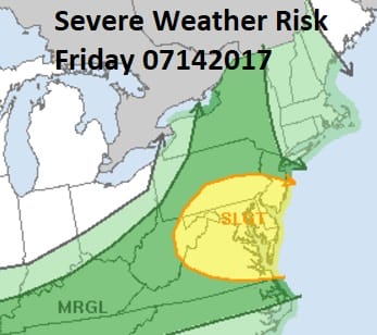
Severe Weather Risk Central NJ Southward
Severe Weather Risk Central NJ Southward
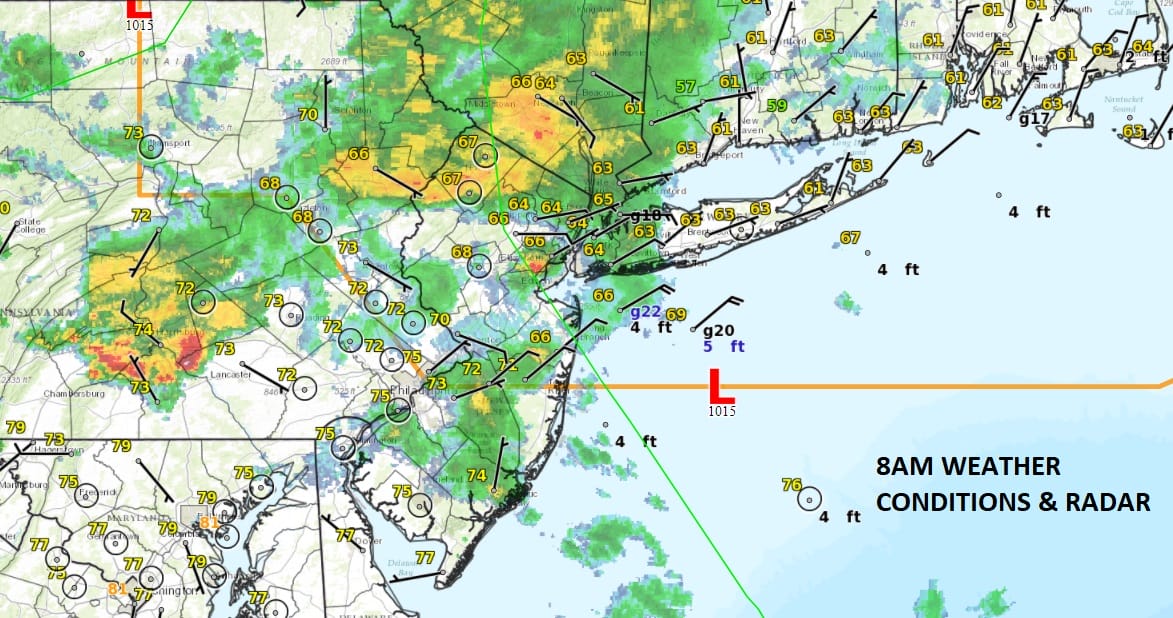
It is going to be a tale of two weather worlds today depending on where you are. It appears at least based on the surface map this morning that Route 195 in New Jersey which runs east west and cuts the state literally in half, and Route 78 in Pennsylvania are the dividing line. North and east of there the marine layer is in and a cool high from Northern New England has built its way down the coast. Temperatures are in the cool low to mid 60s this morning in this area and radar is showing an area of rain moving through.
South of the frontal bounadary we have temperatures in the 70s with some showers and even a few developing thunderstorms this morning. The Storm Prediction Center has the area of severe weather risk today outlined to match this up.

This will make for an interesting afternoon of sharp temperature contrasts with highs in the mid 80s to near 90 in Southern New Jersey & Southeastern Pennsylvania while north of the dividing line highs will only reach the low to mid 70s and in parts of the Hudson Valley & Connecticut it may not even get out of the 60s today! Look for cloudy conditions from Central NJ northward to Southern New England & Long Island with occasional rain and a few heavy downpours. South of that dividing line it will be very warm and humid with some breaks of sunshine and the risk for severe thunderstorms later this afternoon.
SATELLITE LOOP

REGIONAL RADAR

LOCAL RADAR NEW YORK CITY

LOCAL RADAR PHILADELPHIA


The satellite and radars all pretty much line things up this way at the moment in terms of where the clouds are and the radar echos. Rainfall amounts will vary widely depending on thunderstorms but some places in the severe weather risk area could see a few inches of rain and flash flooding in some heavier thunderstorms.
At least the weekend looks better with a mix of sun and clouds Saturday and lots of sunshine for Sunday. Humidity levels will drop somewhat especially on Sunday but it will not be as dry as the air mass we saw last weekend. Highs both days in the 80s and there is just a small risk for a shower or thunderstorm in a few spots later Saturday. The weekend as a whole looks pretty good to me.


