Severe Weather Risks Today Very Warm Humid Next Few Days

Weather in 5/Joe & Joe Weather Show Latest Podcast
Severe Weather Risks Today Very Warm Humid Next Few Days
Parts of the area along the coast in Southern New England and Long Island are still working through morning low clouds and fog but areas inland south and west have broken out or are about to break out into sunshine. We remain deep in a very warm and humid air mass so highs today will be in the mid 80s to near 90. Areas along the coast will have to wait for the clouds to clear out and they should catch up and reach into the 80s.
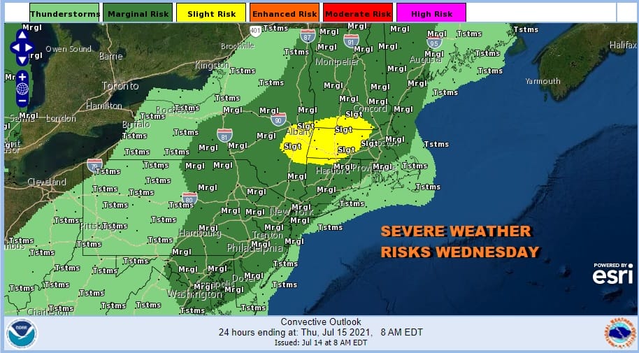
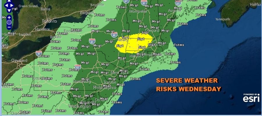
Daytime heating in a very warm humid and unstable air mass will put the area at risk for thunderstorms but as always with these things, some of you see them and some of you won’t. The highest chances are inland and north where the Storm Prediction Center has a marginal risk for severe weather. The marginal risk extends south into Northeastern Virginia.
SATELLITE

WEATHER RADAR


The best bet is to keep an eye on the radars above for development later today. The short range models don’t show much with two separate lines. One in Upstate NY and Central New England in the area of slight risk and the other in Southern Pennsylvania south into Northern Virginia with a gap in between.

There is some good news for those of you who are sick of the rainfall which is on a record pace so far this month in many areas. The next 2 days will be hot and humid but we are far from the next round of changes with cold fronts and upper troughs so other than pop up scattered thunderstorms, for most of you Thursday and Friday it will be sunshine (after some early morning low clouds) taking highs to the upper 80s to lower 90s.
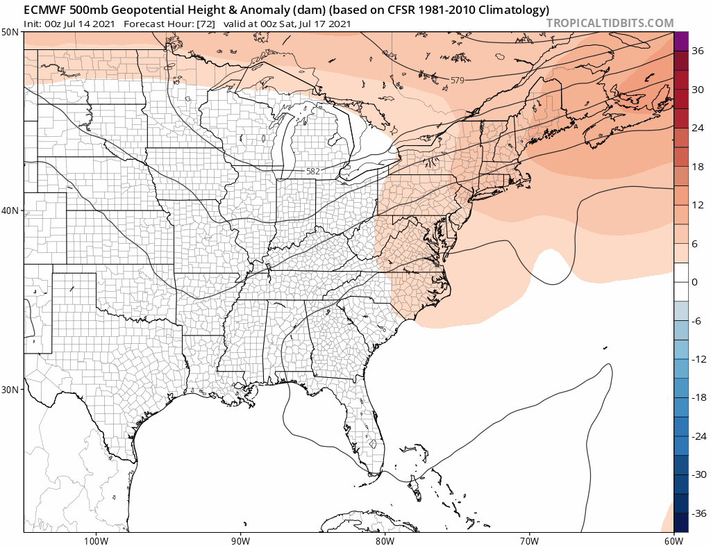
The weekend leaves us in a rather unsettled place because of an approaching cold front. In the upper atmosphere the trough dropping into the east stretches back westward and takes 3 days for it to pivot around By the middle of next week if the European model has its way we would see that trough amplify in the east and bring real relief to humidity and very warm temperatures for a few days. The issue will be getting there. This will put us in line for shower and thunderstorm chances over the weekend with highs Saturday in the mid to upper 80s and Sunday in the low to mid 80s. It doesn’t rain all day obviously but there will be opportunities. We may have to deal with a nearby stalled front through the weekend and into the first part of next week.
BE SURE TO DOWNLOAD THE FREE METEOROLOGIST JOE CIOFFI WEATHER APP &
ANGRY BEN’S FREE WEATHER APP “THE ANGRY WEATHERMAN!

MANY THANKS TO TROPICAL TIDBITS & F5 WEATHER FOR THE USE OF MAPS
Please note that with regards to any severe weather, tropical storms, or hurricanes, should a storm be threatening, please consult your local National Weather Service office or your local government officials about what action you should be taking to protect life and property.


