Severe Weather Risk Inland This Evening
Heat Humidity Thunderstorms Wednesday

Weather in 5/Joe & Joe Weather Show Latest Podcast
Severe Weather Risk Inland This Evening Heat Humidity Thunderstorms Wednesday
Severe weather risks this afternoon will be confined to areas inland of the coast There is a stationary front that runs across Southern New Jersey and Southern Pennsylvania. South of that front temperatures in the 80 while north of that front we have a northeast wind off the ocean, lots of clouds, and temperatures just in the 70s.
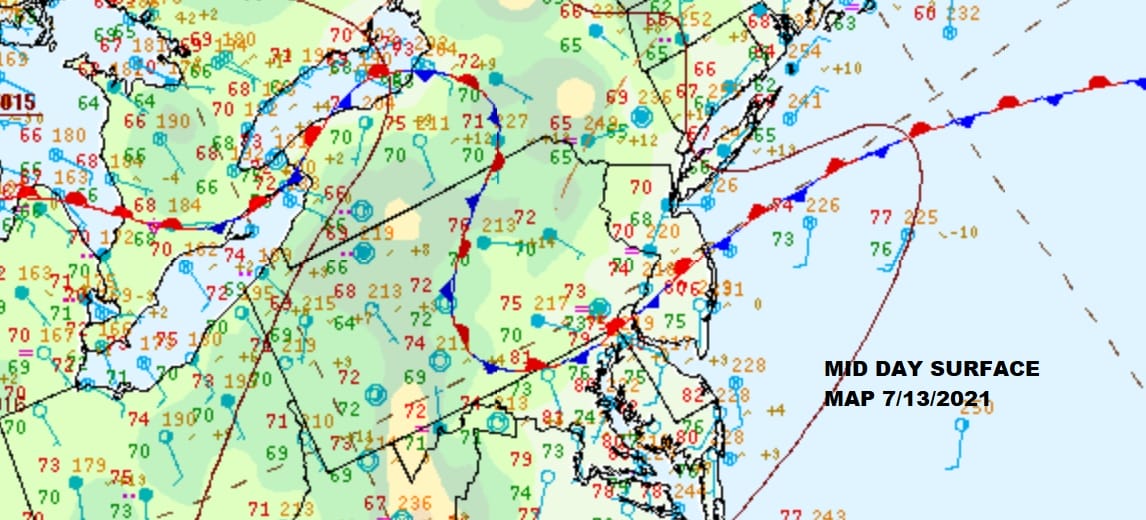
While the stationary front will start to move northward later today much of the area north and east of that front will probably avoid severe weather but to the west and south of that front it will be a different story.
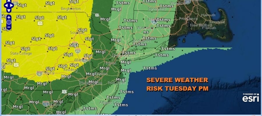
Marginal risk covers much of New Jersey except the northeast and southeast with slight risk in Pennsylvania. There is also a 2 percent tornado risk in that zone. General non severe thunderstorms are possible to the east. In the meantime clouds on the satellite will have a tough time breaking up this afternoon except in areas to the south and west of the stationary front.
SATELLITE

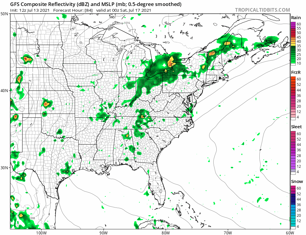
WEATHER RADAR


Temperatures this afternoon again will be in a wide range from the 70s or just into the 70s north and east of the front and 80s everywhere else. Showers and thunderstorms will develop in the late afternoon and evening and then once they are done, the warm front should move to north and that sets us up for another round of severe weather risk Wednesday.
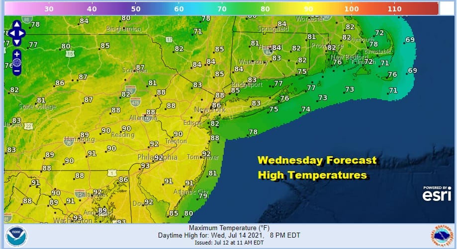
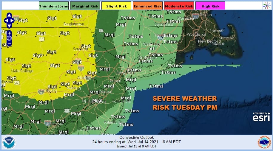
The warm front will be to our north on Wednesday and that means that while we may start the day with some low clouds, we should break out into sunshine. Highs will reach the mid 80s to around or just over 90 degrees. Late in the day as an upper trough moves through thunderstorms will develop and the Storm Prediction Center has us in a marginal risk for severe weather as of now and the area extends further east than today.

Thursday looks to be the one day where thunderstorms will be few and far between and the same could hold for Friday. Both days should be hot and humid with a decent amount of sunshine. Highs both days will be in the upper 80s to lower 90s with cooler temperatures along the shore.
The weekend is a bit unsettled. We have a cold front approaching Saturday so that means thunderstorm risk. The front may slow down to a crawl Sunday off shore keeping things unsettled at least for now. Eventually the front should push out and we could catch a short humidity break early next week.
BE SURE TO DOWNLOAD THE FREE METEOROLOGIST JOE CIOFFI WEATHER APP &
ANGRY BEN’S FREE WEATHER APP “THE ANGRY WEATHERMAN!

MANY THANKS TO TROPICAL TIDBITS & F5 WEATHER FOR THE USE OF MAPS
Please note that with regards to any severe weather, tropical storms, or hurricanes, should a storm be threatening, please consult your local National Weather Service office or your local government officials about what action you should be taking to protect life and property.


