Heat Humidity Next 3 Days Thunderstorms Late Saturday Unsettled Sunday

Weather in 5/Joe & Joe Weather Show Latest Podcast
Heat Humidity Next 3 Days Thunderstorms Late Saturday Unsettled Sunday
We have been playing games with a front going back and forth over the area the last few days but it has finally made up its mind and moved well to the northeast which means heat and humidity are with us for the next 3 days. The good news for today and Friday is that thunderstorm and downpour activity will be at a minimum other than an odd pop up. So sit back and enjoy the sunshine, heat and humidity because that what we have for today Friday and most of Saturday.
SATELLITE

Satellite doesn’t show much in the way of cloud cover up and down the East Coast today. The next front is still hanging back over the Western Great Lakes. The local radars are quiet and you can barely see the showers from the next front on the upper left of the regional radar.
WEATHER RADAR


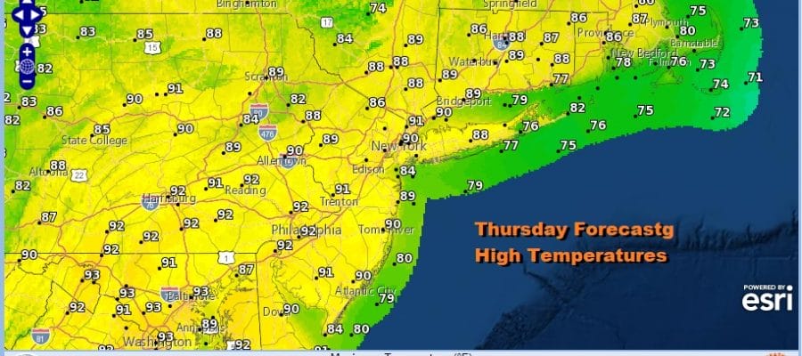
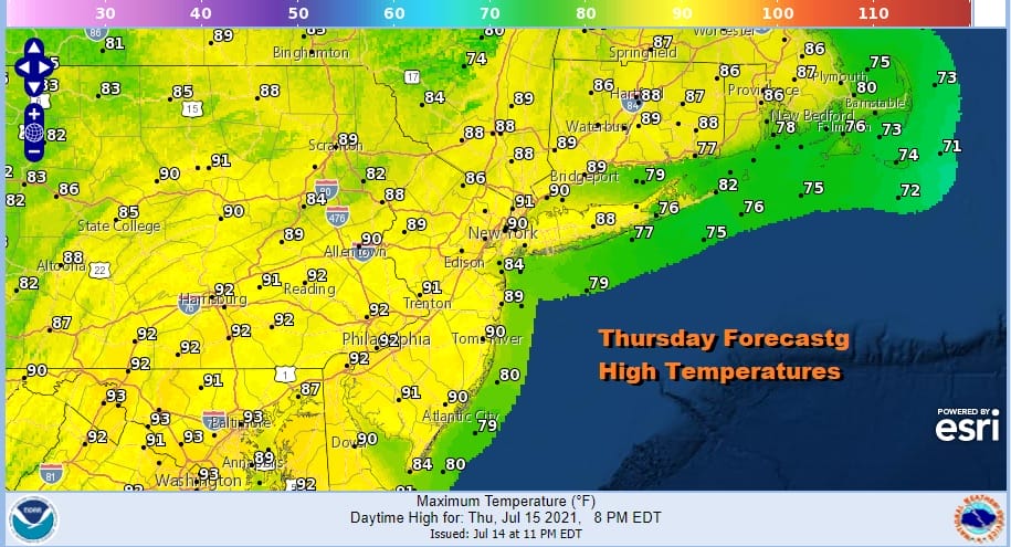
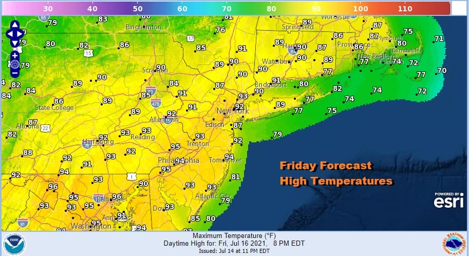
As for temperatures this afternoon, highs will be in the upper 80s to lower 90s with the usual caveat that temperatures will be cooler at the shore with local beach sea breezes. Friday will be a repeat performance of today with little if any chance of rain.
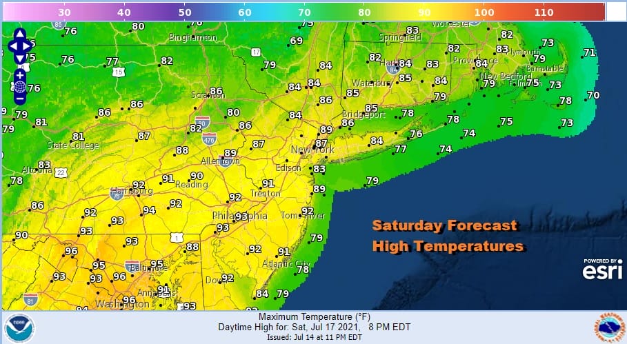
Saturday will be a hot humid day but we do have the cold front well to the west finally making its approach along with an upper trough and that should juice up the atmosphere for some thunderstorms late in the day Saturday or Saturday evening. Highs will be in the upper 80s and lower 90s.
This front will be the first in a series of fronts and upper troughs that will be moving through the Eastern US next week. This will put an end to 90 degree highs for awhile and behind each one will come a slight break in the humidity. It will also come with shower and thunderstorms chances.

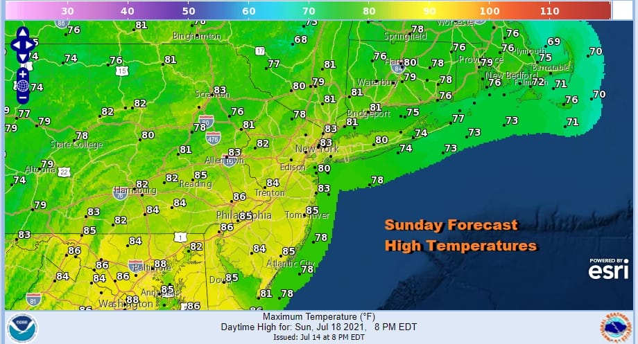
The front is going to get hung up nearby on Sunday which makes for a bit of an unsettled day. It will probably be a day with clouds and some sun. The humidity will come down slightly but not much. With the front nearby we will have to include the chance for showers or a thunderstorm. Highs Sunday will be in the low to mid 80s which will be a break from upper 80s and lower 90s.
The flow turning northwest will take a few days to set up so the weekend front lingers early next week with two stronger fronts, one on Wednesday and another on Friday. Those fronts will present shower risks with each passage. During the day we will probably see clouds mixed with sun and highs in the 80s. A real break in the humidity could come next weekend as a nice cool Canadian air mass attempts to make a visit to the Eastern US but it will only be for a couple of days. Then heat could return to finish the month of July.
BE SURE TO DOWNLOAD THE FREE METEOROLOGIST JOE CIOFFI WEATHER APP &
ANGRY BEN’S FREE WEATHER APP “THE ANGRY WEATHERMAN!

MANY THANKS TO TROPICAL TIDBITS & F5 WEATHER FOR THE USE OF MAPS
Please note that with regards to any severe weather, tropical storms, or hurricanes, should a storm be threatening, please consult your local National Weather Service office or your local government officials about what action you should be taking to protect life and property.


