Severe Weather Risks As Upper Trough Moves Through
Colder Sunday Into Tuesday

Weather in 5/Joe & Joe Weather Show Latest Podcast
Severe Weather Risks As Upper Trough Moves Through
Colder Sunday Into Tuesday
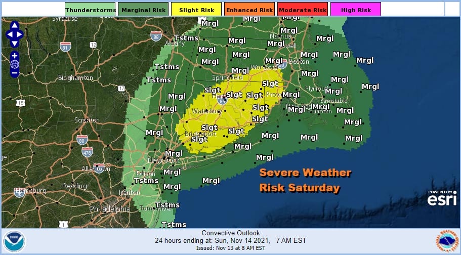
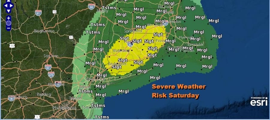
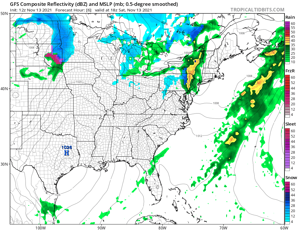
Usually the day after a cold front passes the weather is a bit more stable and often times nice. Not so today as we have the first of two upper troughs moving through the Northeast today. The air is very cold and unstable aloft and this has created a second cold front. Behind the front is colder air that will take temperatures down another 10 degrees for Sunday and Monday. Ahead of it we have some showers and even a few thunderstorms to deal with and they are showing up on the radars at midday moving eastward. The area of greatest risk for anything severe will be Southern New England to Long Island where the Storm Prediction Center has laid a slight risk zone. Marginal risk extends back to NYC and the northeastern counties of New Jersey as well as the Hudson Valley. Highs today will be in the 50s to near 60.
SATELLITE

WEATHER RADAR

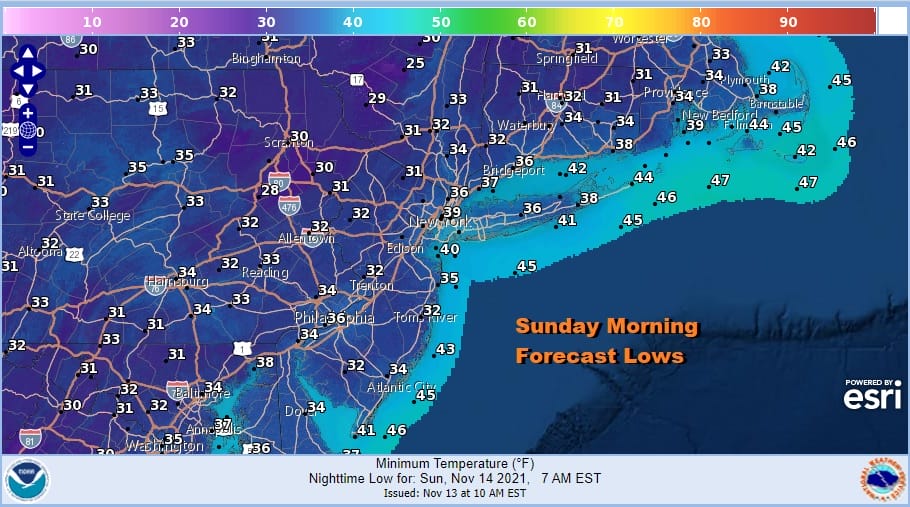
The afternoon will see showers and thunderstorms until the cold front passes and then weather conditions should improve tonight though it will be colder. Skies should partially clear with a gusty breeze. Sunday morning lows will be in the low to mid 30s.
Another cold front and upper trough will approach on Sunday but the timing of this is a little later and won’t move through until the overnight Sunday into Monday morning. The daytime Sunday will see sunshine giving way to arriving clouds. It will be breezy and cold with highs just in the 40s.
The second upper trough has a less unstable airmass to play with but it does have cold air aloft that will mix down to lower levels. That would change the rain to wet snow across Northern Pennsylvania and the Catskills. This is the first snow forecast map of the season for the Northeast. Snow amounts of a coating to an inch or so are possible mainly in higher elevations.

Monday and Tuesday will be two cold days with sunshine and a gusty breeze. Highs will be in the 40s both days. Monday night will be cold and clear with lows in the upper 20s to mid 30s. Finally the coldest of the cold air moves out Tuesday and we will warm up a bit Wednesday and Thursday before the next cold front arrives. Highs should be back into the 50s both Wednesday and Thursday. The front probably won’t have much rain with it. Colder air follows for Friday and next weekend. Overnight weather models in the long range are picking up on hints laid down this week of a colder pattern overall and some suggestion of storminess for midweek. Before we get too wrapped up in that idea we will see if today’s dayside model runs continue to go in that particular direction.
BE SURE TO DOWNLOAD THE FREE METEOROLOGIST JOE CIOFFI WEATHER APP &
ANGRY BEN’S FREE WEATHER APP “THE ANGRY WEATHERMAN!

MANY THANKS TO TROPICAL TIDBITS & F5 WEATHER FOR THE USE OF MAPS
Please note that with regards to any severe weather, tropical storms, or hurricanes, should a storm be threatening, please consult your local National Weather Service office or your local government officials about what action you should be taking to protect life and property.


