Severe Weather Risk Weekend Outlook

Severe Weather Risk Weekend Outlook
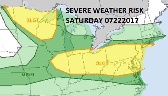
Going into the weekend it should be empasized that for much of the area the daytime Saturday looks fine. Southern New Jersey & Southeastern Pennsylvania will be at risk for some late day thunderstorms on Saturday while the rest of the area will be at risk for thunderstorms Saturday night. The Storm Prediction Center has a slight risk for severe weather indicated for a large area from the Southern half of Connecticut westward to the Ohio Valley and Southward into the Northern Middle Atlantic states.
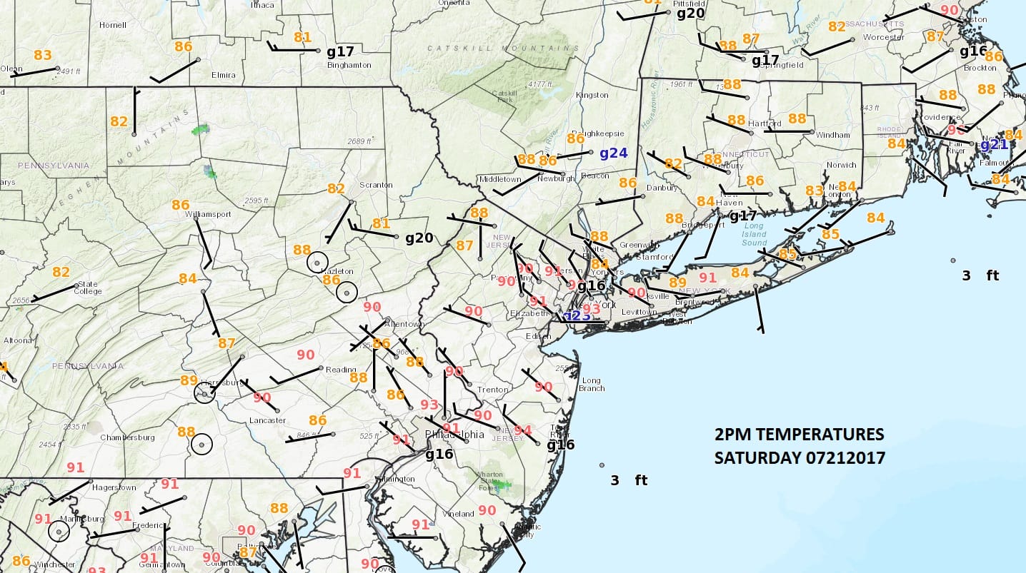
Meanwhile this afternoon it is hot but it is a few degrees lower than we were at this time yesterday. The dew points are also a touch lower so relatively speaking it does feel a bit better today. For now the radars are quiet and I’m betting that they remain so through tonight. For areas in Southeastern Pennsylvania & Southern New Jersey there could be a downpour or a thunderstorm around daybreak as the next weather system revs up to the west.
SATELLITE LOOP

REGIONAL RADAR

LOCAL RADAR NEW YORK CITY

LOCAL RADAR PHILADELPHIA


Saturday as we said early should be okay from Central New Jersey northeastward while in areas south of Route 195 in New Jersey some thunderstorms are possible later in the day. Then there is a risk for downpours or a thunderstorm everywhere Saturday night into Sunday morning. Temperatures Saturday should be in the 80s to near 90. Sunday clouds could be a problem as a bit of an onshore flow could be in play for awhile but some breaks of sun are possible. Late in the day another scattered downpour or thunderstorm is possible. Highs should be in the 80s with warmest temperatures as you go south.
Monday brings a cold front, very warm to hot humid conditions with the risk of a thunderstorm. Then real relief from the heat and humidity begin to arrive on Tuesday and while it could still on the warm side Tuesday with highs in the 80s, it will be much less humid. Wednesday next week looks like a beauty with lots of sunshine and highs in the upper 70s to lower 80s with very low humidity.
 GET JOE A CIGAR IF YOU LIKE

LANDSCAPE COMPANIES FOR YOUR NEEDS
LONG ISLAND ROCKLAND COUNTY Connecticut

![]()

ROCKLAND COUNTY TRI STATE SNOW REMOVAL JOHNSTOWN PA


FiOS1 News Weather Forecast For Long Island
FiOS1 News Weather Forecast For New Jersey
FiOS1 News Weather Forecast For Hudson Valley
NATIONAL WEATHER SERVICE SNOW FORECASTS
LATEST JOESTRADAMUS ON THE LONG RANGE
Weather App

Don’t be without Meteorologist Joe Cioffi’s weather app. It is really a meteorologist app because you get my forecasts and my analysis and not some automated computer generated forecast based on the GFS model. This is why your app forecast changes every 6 hours. It is model driven with no human input at all. It gives you an icon, a temperature and no insight whatsoever.
It is a complete weather app to suit your forecast needs. All the weather information you need is right on your phone. Android or I-phone, use it to keep track of all the latest weather information and forecasts. This weather app is also free of advertising so you don’t have to worry about security issues with your device. An accurate forecast and no worries that your device is being compromised.
Use it in conjunction with my website and my facebook and twitter and you have complete weather coverage of all the latest weather and the long range outlook. The website has been redone and upgraded. Its easy to use and everything is archived so you can see how well Joe does or doesn’t do when it comes to forecasts and outlooks.
Just click on the google play button or the apple store button on the sidebar for my app which is on My Weather Concierge. Download the app for free. Subscribe to my forecasts on an ad free environment for just 99 cents a month.
Get my forecasts in the palm of your hand for less than the cost of a cup of Joe!


