Severe Weather Risk Today & Wednesday Hot Humid Weather Continues
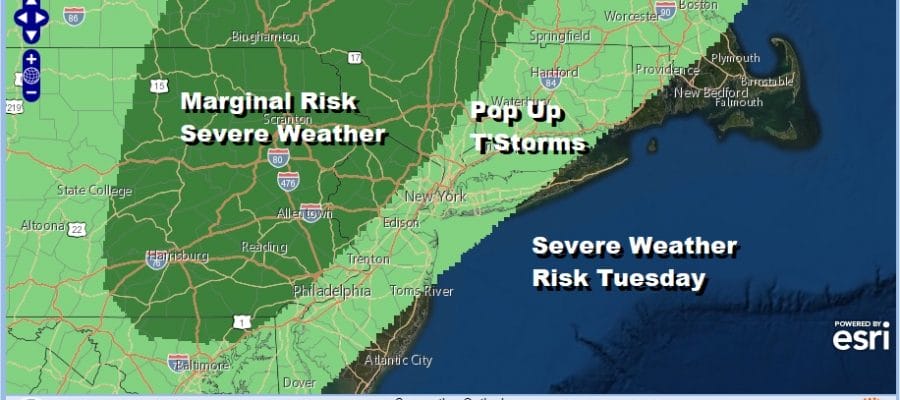
We have another day of hot humid conditions with sunshine as our summer hot weather pattern continues. This will be the third day in a row of 90 degrees plus and it will essentially be a repeat of Monday. Highs will reach 90 to 95 in most areas. There could be a few scattered downpoursor thunderstorms late today into tonight in areas from Western New Jersey westward. The Storm Prediction Center has a marginal risk for severe weather from Northwest New Jersey and the Catskills to Southern and Eastern Pennsylvania.
To the east of this area, we don’t expect much to happen other than an odd pop up thunderstorm or two. Meanwhile the heating is underway as the satellite picture shows cloud free conditions over much of the Eastern US and a temperature launching pad that will shoot us into the 90s.
SATELLITE

REGIONAL RADAR

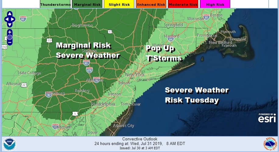
Wednesday however poses a different issue in that we have a cold front that today is moving through the Midwest and into the Pennsylvania with showers and thunderstorms. That front will arrive late in the day Wednesday. Ahead of it will be very warm and very humid with highs in the 80s to near 90. Thunderstorms are likely to develop in the afternoon and evening. The Storm Prediction Center has upped the ante for Wednesday with a marginal risk for severe weather Wednesday. Depending on the amount of daytime heating we get (which will be key), we could see the risk area elevated to slight risk come Wednesday so we will be watching for this. Thunderstorm activity this summer has outperformed in the weather pattern we have been in since June and I don’t see any reason to change that approach.
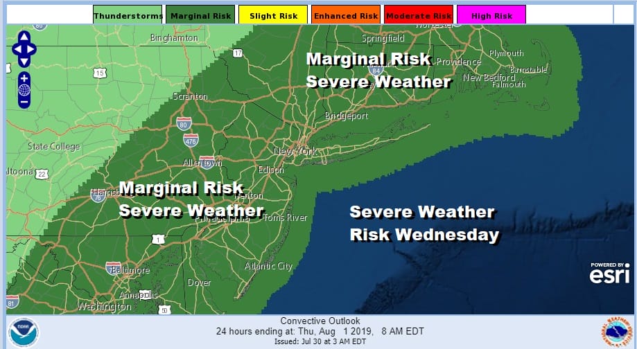
This cold front will be stalling off the East Coast much like the front from last week though this time around with a weaker upper air trough in play, the front will stall closer to the coast. This will open the door for waves of low pressure to move up along the coast. Thursday I believe though should be rain free with leftover clouds. The further south you go from NYC the more humid it will be..slightly less humid north and northwest of the coast. Temperatures will be in the 80s.
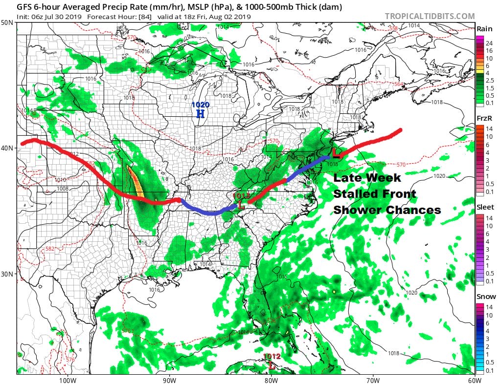
The upper air pattern makes it a bit complicated for the weekend. We still have that same battle of the flexing northern jet stream along the Canadian border which drops southward from time to time. The Wednesday system has a piece of it left in the Southeast US. Then we get another arm in the northern jet stream coming down over the weekend.
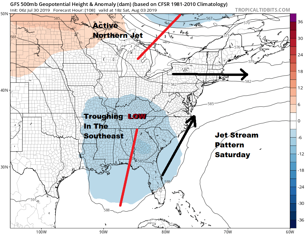
If that northern arm winds out it will suppress the southern system and gradually bring drier air into the Northeast over the weekend but there is some question regarding timing. There could still be some leftover clouds and moisture to deal with on Saturday especially early in the day before improvement develops from north to south later Saturday and Sunday. But if that northern stream is delayed it might take another wave of low pressure on the stalled frontal boundary to move through over the weekend. This is our forecast issue going forward. Another shot from the Canadian jet stream will be arriving along about Wednesday of next week which means another cold front will be approaching and moving through a week or so from today.
MANY THANKS TO TROPICAL TIDBITS FOR THE USE OF MAPS
Please note that with regards to any tropical storms or hurricanes, should a storm be threatening, please consult your local National Weather Service office or your local government officials about what action you should be taking to protect life and property.


