Severe Weather Risk Today Very Warm A Little Less Humid Father’s Day

Weather in 5/Joe & Joe Weather Show Latest Podcast
Severe Weather Risk Today Very Warm A Little Less Humid Father’s Day
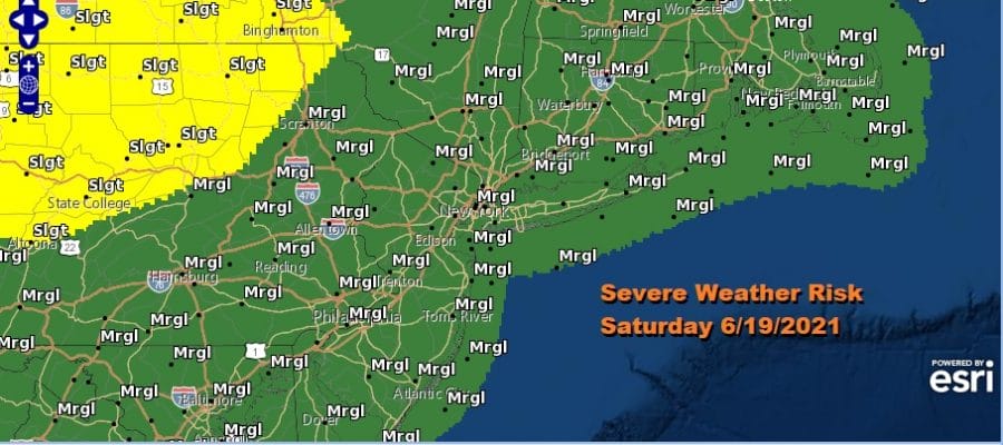
You are going to notice a big difference today as the humidity levels have come way up. Dew points will rise to the mid and upper 60s and temperatures this afternoon will also rise to 85 to near 90 degrees. Throw in a cold front late today and you have a mix for severe weather.
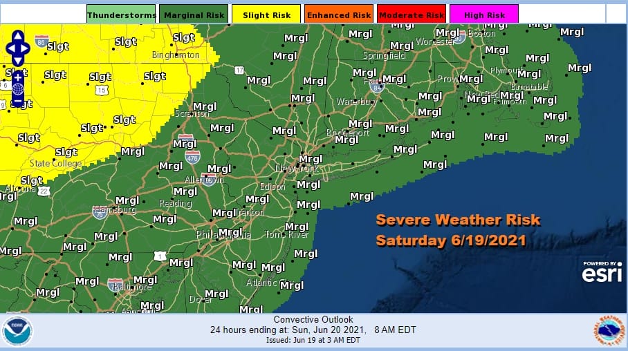
The Storm Prediction Center has much of Eastern Pennsylvania to New England. south to Northern Virginia at a marginal risk for severe weather today into tonight. The arrival of the humidity came with a warm front which passed through overnight.
SATELLITE

The satellite this morning shows clouds pushing through along with some scattered showers on the radar. The radar should go quiet for awhile before storms fire up late today. I think that in general these storms will be scattered in nature so not everyone will see them. Along the coast the winds will be from the west and that should keep stabilizing ocean air out of the equation today.
WEATHER RADAR


Weather conditions will improve tonight as the front passes offshore. Slightly drier air comes in late tonight and Sunday. The air behind the cold front is actually as warm as the air ahead of it. Father’s Day should be no worse than partly sunny and some areas will be mostly sunny. It will be more comfortable than Saturday though humidity will linger a bit across Southern Pennsylvania and Southern New Jersey and points to the south. Highs will be in the mid to upper 80s.
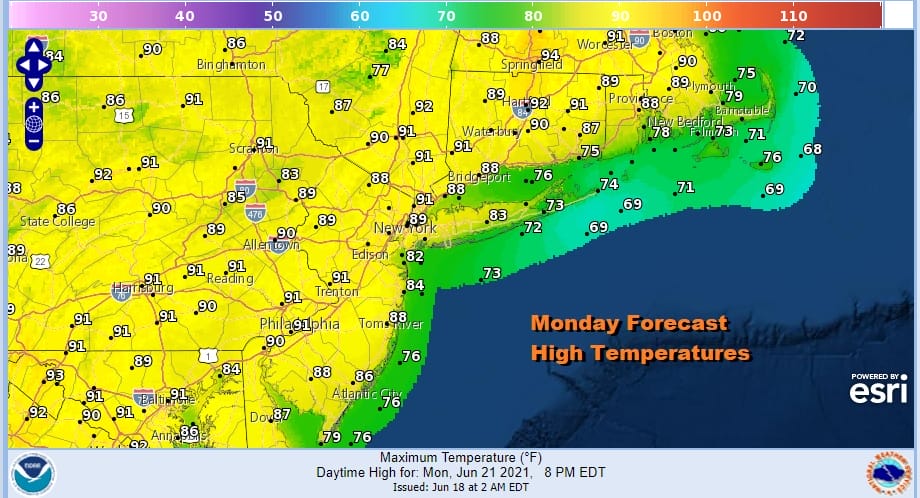
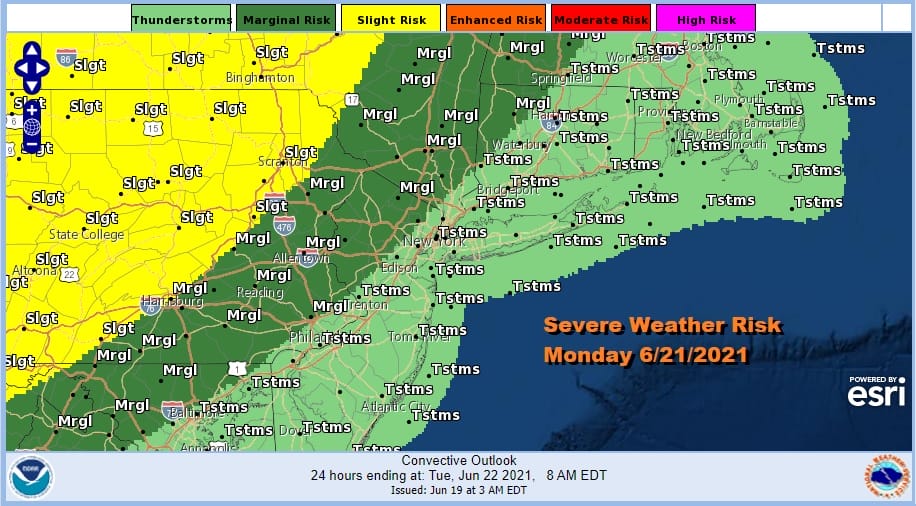
Monday it will turn more humid again as the next cold front begins its approach. Temperatures will be very warm to hot Monday with highs in the upper 80s to low 90s. This may be enough to trigger some scattered thunderstorms inland Monday evening but more numerous storms are likely Tuesday as the front moves on through. There could be severe weather risk late Monday into Tuesday .
Another deep trough will drop into the Eastern US but this time the trough axis will be further west. Another shot of pleasant air will come in for Wednesday and Thursday but the trough to the west means this dry air mass will have a shorter stay. Highs Tuesday will be in the 80s but Wednesday highs with sunshine will be in the pleasant 70s.
BE SURE TO DOWNLOAD THE FREE METEOROLOGIST JOE CIOFFI WEATHER APP &
ANGRY BEN’S FREE WEATHER APP “THE ANGRY WEATHERMAN!

MANY THANKS TO TROPICAL TIDBITS & F5 WEATHER FOR THE USE OF MAPS
Please note that with regards to any severe weather, tropical storms, or hurricanes, should a storm be threatening, please consult your local National Weather Service office or your local government officials about what action you should be taking to protect life and property.


