Severe Weather Risk Thursday Some Showers Ahead of Warm Air

Severe Weather Risk Thursday Some Showers Ahead of Warm Air
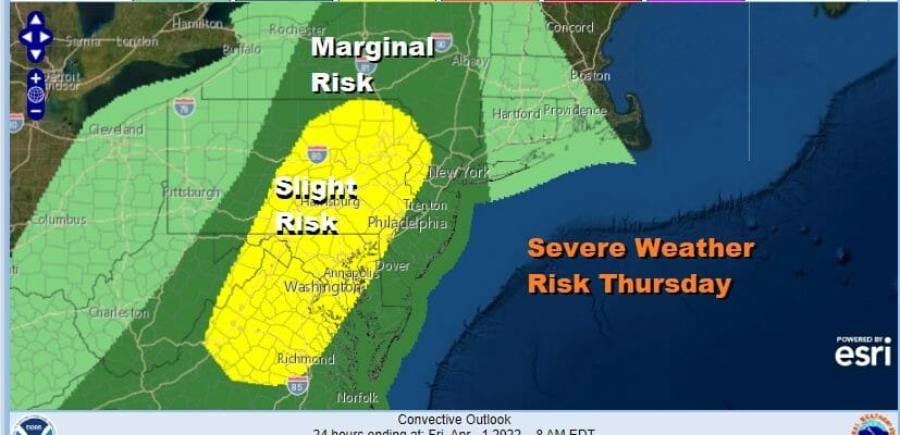
We are seeing a widespread severe weather outbreak today across the Gulf States with the risk fo EF2+ tornadoes and 75 mph winds. The cold front producing that severe weather heads into the Eastern US but it should be as fierce as today regarding severe weather. The Storm Prediction Center has a marginal to slight risk indicated for Thursday mainly in the late afternoon and evening. The risk zones my get moved around a bit more between now and Thursday and will ultimately depend on a warm front now moving northeastward from the Ohio Valley and Mid Atlantic states.
SATELLITE

WEATHER RADAR

Showers are showing up on the radar and there could be a few showers around this afternoon as the warm front goes by. In colder areas inland well north and west of the coast some sleet could be in the mix due to the cold air that is still trying to hang around. The showers won’t amount to much. Otherwise we will be in clouds today with most highs in the 40s.

Look for clouds tonight with just the chance for a little spotty light rain. Temperatures will hold in the 30s and 40s overnight which sets us up for a solid launching pad for Thursday. A south to southwest wind will pikc up and become gusty during the day. Look for clouds and some sun into Thursday afternoon.
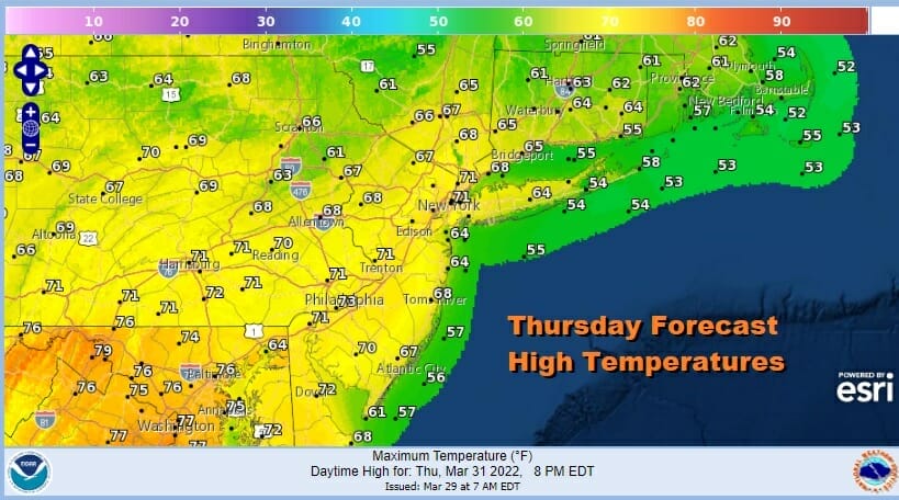
Think about the fact that we could not get out of the 30s for two days and now we are going to see temperatures shoot up into the 60s and 70s. Also shooting up are dew points from the teens and 20s to the 50s to near 60. That forcing of moisture coupled with a cold front to the west and a strong upper trough should trigger some thunderstorms late Thursday into Thursday night.

Once the front passes a cooler dry air mass comes in for Friday and Saturday. The air behind this front is cool but nothing like the extreme cold we just had. Look for sunshine and clouds Friday and Saturday. Highs both days will be in the 50s. A weak disturbance from the Ohio Valley heads to the coast Sunday with clouds and maybe a few showers Saturday night into Sunday morning. This leaves Saturday as being the better of the two weekend days.
BE SURE TO DOWNLOAD THE FREE METEOROLOGIST JOE CIOFFI WEATHER APP &
ANGRY BEN’S FREE WEATHER APP “THE ANGRY WEATHERMAN!
MANY THANKS TO TROPICAL TIDBITS & F5 WEATHER FOR THE USE OF MAPS
Please note that with regards to any severe weather, tropical storms, or hurricanes, should a storm be threatening, please consult your local National Weather Service office or your local government officials about what action you should be taking to protect life and property.


