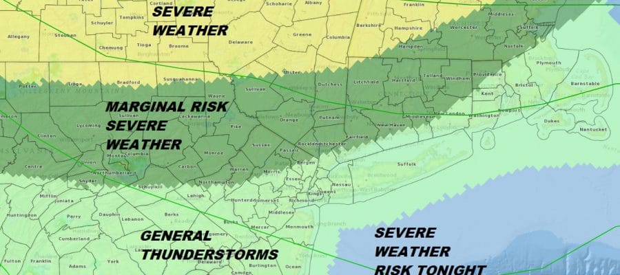
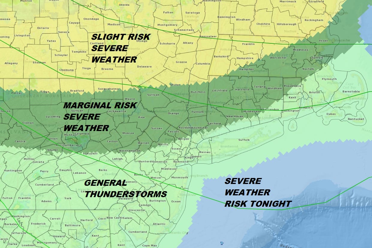
Severe Weather Risk Northern NJ, Hudson Valley NE PA Connecticut
Severe Weather Risk Northern NJ, Hudson Valley
NE PA Connecticut
The daytime heating and the high dew points and a cold front dropping southward are setting the table for some thunderstorms tonight. The risk for severe weather exists from Northern New Jersey (more toward the northwest), Eastern Pennsylvania to the Hudson Valley & Connecticut. General thunderstorms are possible to the south. Temperatures this afternoon have reached the 90s inland but Long Island and Coastal Connecticut are enjoying a south wind which is keeping temperatures cooler.

We are also beginning to see a few pop up thunderstorms across parts of Eastern Pennsylvania to the Catskills. but the main area of thunderstorms will come later this evneing and tonight. A close look at the visible satellite loop shows what could be the beginnings fo a broken line of thunderstorms across Western Pennsylvania and Western NY. Mid afternoon temperatures are into the lower 90s in many inland areas but the south facing coast lines continue to see a nice breeze off the ocean so Long Island and coastal Connecticut are about 10 degrees cooler than everyone else.
EASTERN SATELLITE

REGIONAL RADAR

LOCAL RADAR NEW YORK CITY

LOCAL RADAR PHILADELPHIA


Keep an eye on the radars after 7pm this evening. It looks like thunderstorms will be approaching from the northwest late this evening and the risk is that some could become strong or even some isolated severe storms. These storms might hold together for the cooler coastal areas if we see the south wind shut off this evening and turn more westerly. That could make the atmosphere more unstable later this evening along the coast.
Weather conditions on Tuesday will improve with lower humidity and sunshine but the northwest wind will be a warm one. Temperatures Tuesday will be in the 80s to near 90 everywhere including the coast. Wednesday starts with some sunshine but clouds will arrive with highs in the upper 70s to lower 80s.
GFS FORECAST 2AM THURSDAY
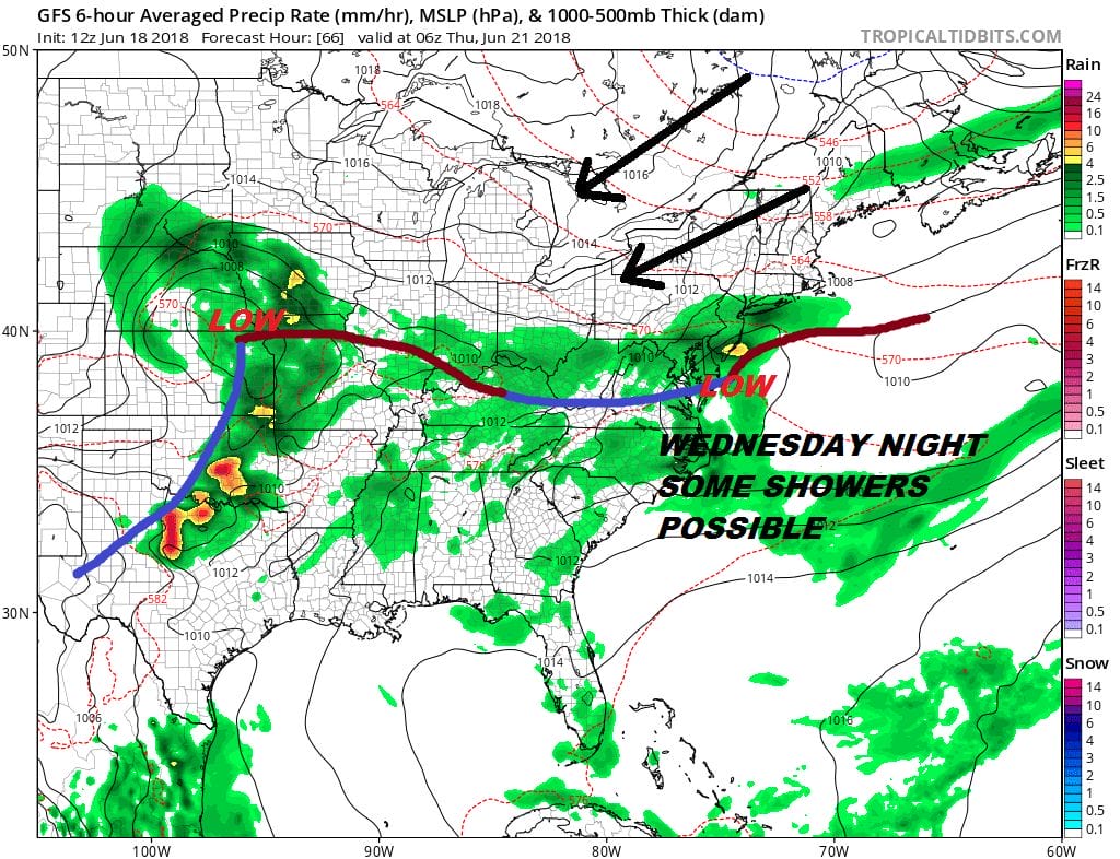
The weather front stalls to our south and a wave will be developing on it. This brings the chance for some showers Wednesday night into early Thursday. The wave is weak so once it moves out weather conditions improve for Thursday and Friday with some sunshine and highs into the 80s. The weather pattern overall continues to be unfavorable for prolonged heat or humidity through the long range.
 GET JOE A CIGAR IF YOU LIKE

LATEST JOESTRADAMUS ON THE LONG RANGE


