Severe Weather Risk New Jersey Southward Wednesday
Severe Weather Risk New Jersey Southward Wednesday
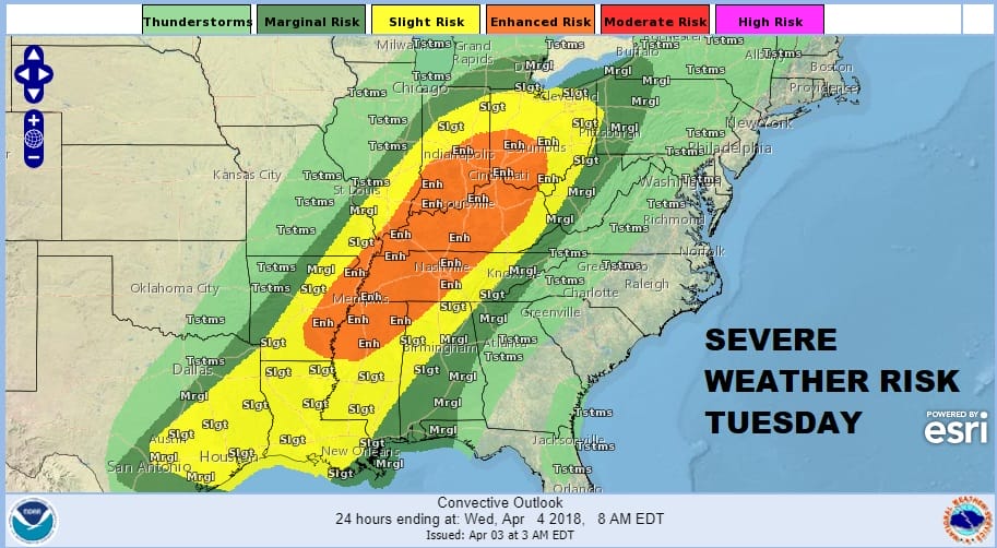
I suppose the good news out the next 2 days is that it isn’t snow this time around and that at least thunderstorms are a sign of spring out there…somewhere! A strong developing storm is moving northeastward into the Great Lakes today and it is their turn to see heavy snows today. To the south in the warm air we have a good chance for thunderstorms in the Ohio & Tennessee Valley south into the Gulf States. The Storm Prediction Center has a large area of risk with an area of enhanced risk for the Ohio and Tennessee Valley.
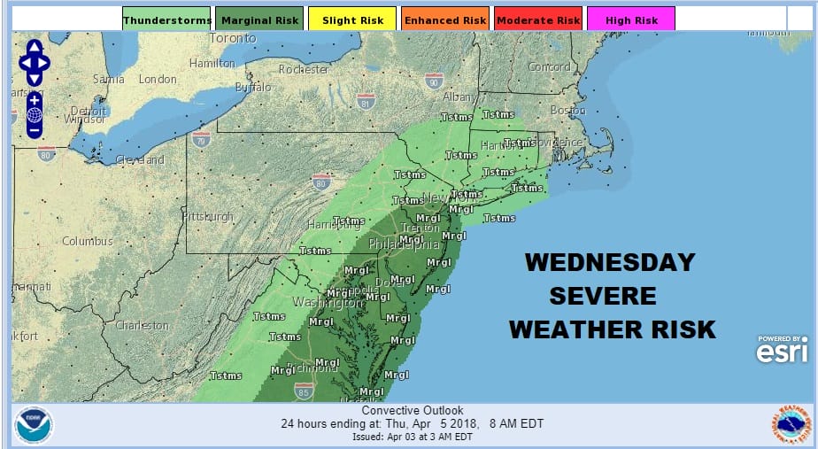
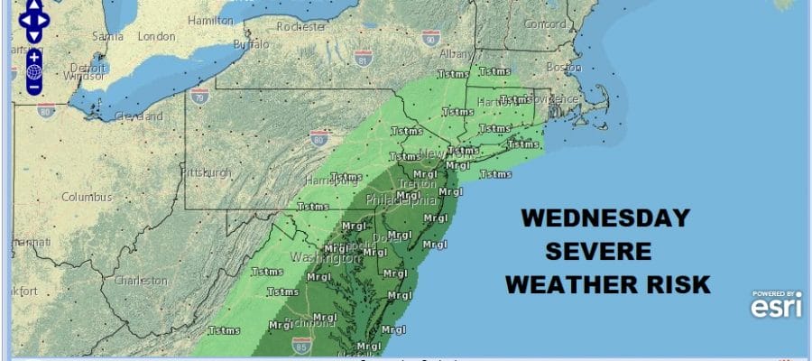
Wednesday that risk area turns to the East Coast and it will extend as far north as Route 80 in Northern New Jersey. A strong cold front from this Great Lakes storm will swing to the coast and the threat time will be around mid afternoon.
Ahead of this today a warm front and an onshore flow is setting up to bring us clouds and rain that will develop around mid to late morning and then play through this afternoon into this evening. Temperatures today will be hard pressed to get out of the 40s.
US SATELLITE

REGIONAL RADAR

Regional radar is showing the developing area of rain to the west and southwest advancing eastward and it should overtake the entire area from Eastern Pennsylvania into Southern New England through the afternoon and evening before it pulls out to the northeast.
LOCAL RADAR NEW YORK CITY

LOCAL RADAR PHILADELPHIA


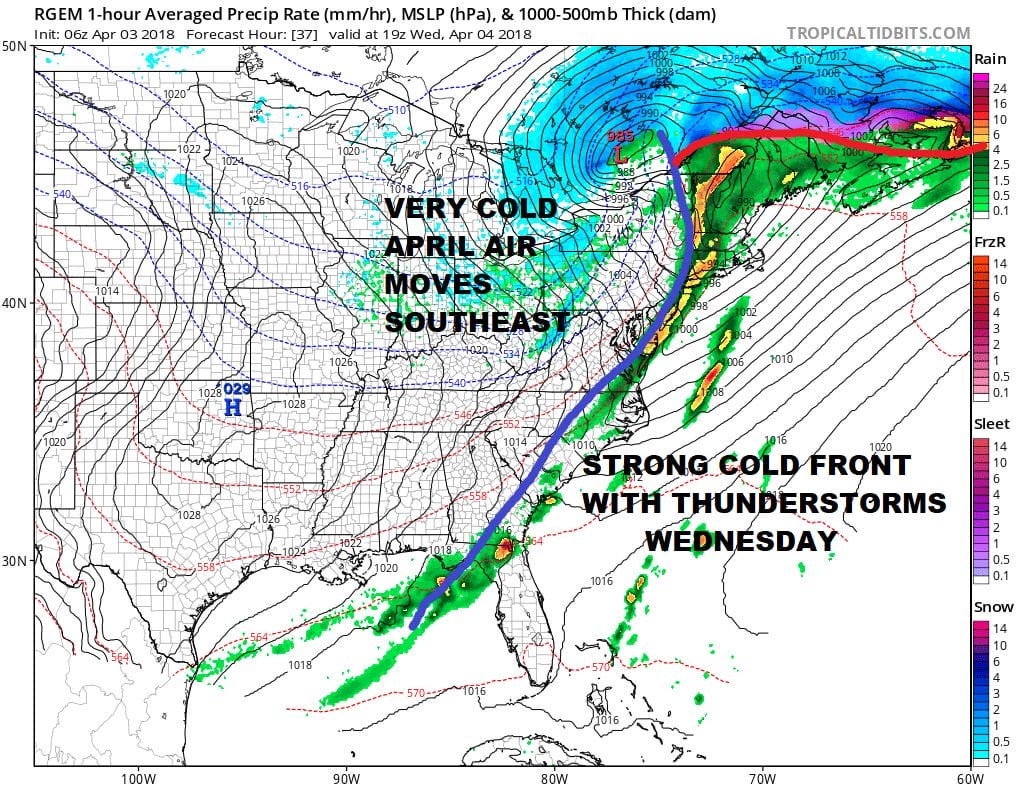
Tonight we wait for the warm front to come through with patchy dense fog and steady temperatures in the 40s and then rising toward morning into the 50s. Wednesday we sit and wait for the cold front. Temperatures should reach the 60s especially from Northern New Jersey and NYC southward and in fact if the sun breaks through in Central and South Jersey, 70s are possible. Of course all that heating means the risk for thunderstorms and possibly severe storms. The RGEM model fires up a rather impressive line of storms between 1pm & 4pm.
Once the front passes another shot of cold air comes in for Thursday and then we begin to watch a couple of weather systems for Friday and the weekend. Low pressure will be swinging to the east from the Lower Great Lakes with another warm front to the coast. There is a risk of snow from this late Thursday night early Friday morning but at the moment at least it appears that the risk for a burst of snow will be from Northeastern Pennsylvania & Northern New Jersey northeast into the Hudson Valley and Connecticut and not along the immediate coast. This will also be an instance of a low going by to our north and not to our south. Another cold front and another shot of cold air moves in and we do need to watch for a wave developing on that front for Saturday into Sunday. Right now we will focus on the severe weather threat for Wednesday before we get worked up over anything later in the week. Right now it seems neither system is anything major.
 GET JOE A CIGAR IF YOU LIKE

FiOS1 News Weather Forecast For Long Island
FiOS1 News Weather Forecast For New Jersey
FiOS1 News Weather Forecast For Hudson Valley


