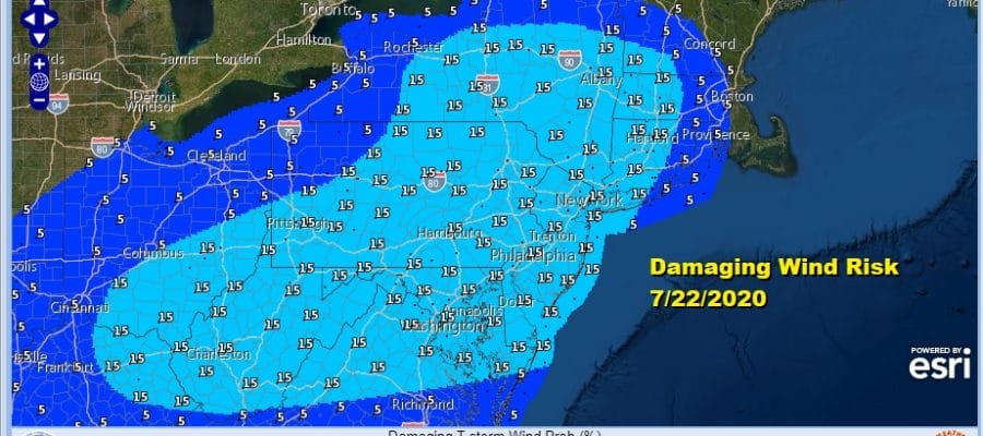
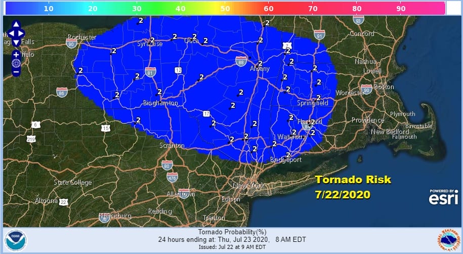
Severe Weather Risk Late Afternoon Evening And Again Thursday
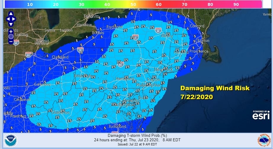
For many areas this will be the 5th day in a row of 90 degree highs and we are on our way as temperatures are approaching the 90 degree range as we head into mid day. Dew points are in the upper 60s and low 70s making it very tropical outside. The first of two weather fronts will be heading here late this afternoon and that means severe weather risks. The Storm Prediction Center has our area in a slight risk for severe weather. That translates into a 15 percent chance of damaging winds and a 2 percent risk for tornadoes though that area covers a smaller area of geography.
We have wide open skies and sunshine for now but to the west clouds are building up and they should start to push eastward during the afternoon.
SATELLITE

REGIONAL RADAR

Regional radar shows the beginnings of some showers and thundertorms in Western Pennsylvania moving eastward but nothing is showing up on the local radars at the moment. We did have a few passing showers around daybreak but those are long gone to the northeast,
LOCAL RADAR NEW YORK CITY

LOCAL RADAR PHILADELPHIA


Weather models seem to be backing off from the widespread activity they showed yesterday however we think that the models are underplaying this somewhat today. Watch for storms between 4pm and 10pm as this first front moves eastward.

Thing will calm down some tonight with most lows in the upper 60s to mid 70s. Then we will do this all over again on Thursday with another chance for thunderstorms developing. This second front has a little more punch than the first in that there may be more widespread showers and thunderstorms though the risk for severe weather Thursday could be a bit lower. Temperatures Thursday will likely be mostly in the 80s which means less in the way of daytime heating.

This front will linger around on Friday with clouds and some sun and another chance for some afternoon showers and thunderstorms with highs in the 80s. This should lead us to a better weekend with sunshine both Saturday and Sunday but with no showers and thunderstorms. Highs both days will be in the mid to upper 80s. The humidity will be a little lower over the weekend but it will still be moderately humid.
BE SURE TO DOWNLOAD THE FREE METEOROLOGIST JOE CIOFFI WEATHER APP &
ANGRY BEN’S FREE WEATHER APP “THE ANGRY WEATHERMAN!
MANY THANKS TO TROPICAL TIDBITS FOR THE USE OF MAPS
Please note that with regards to any severe weather, tropical storms, or hurricanes, should a storm be threatening, please consult your local National Weather Service office or your local government officials about what action you should be taking to protect life and property.


