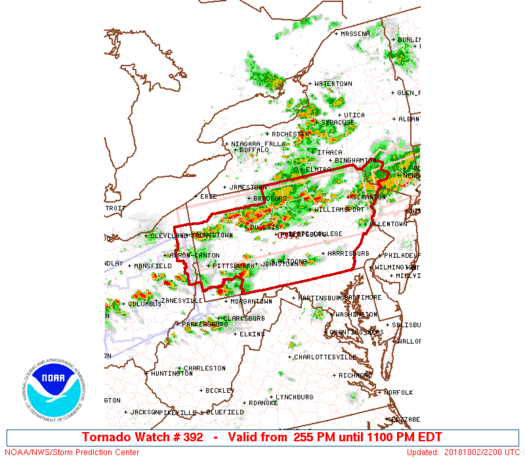
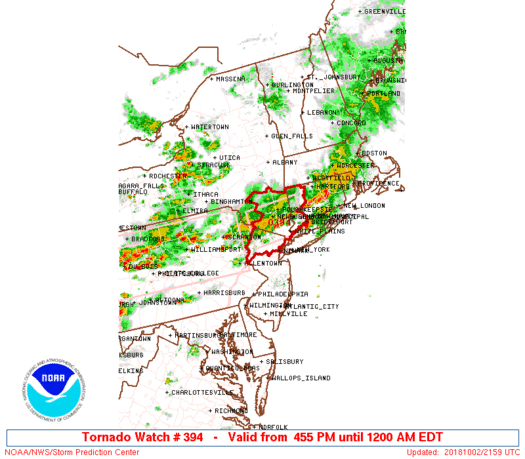
TORNADO WATCH UNTIL 11PM ACROSS PENNSYLVANIA INTO NORTHWEST NJ & HUDSON VALLEY
STRONG THUNDERSTORMS MOVING THROUGH ON RADAR THIS EVENING
After a warm day with temperatures in the 70s to near 80 we have a cold front moving through and we do have a severe weather threat going on this evening. There are two tornado watches that have been posted. There is one across Pennsylvania and a second one is now posted until 11pm for Northern New Jersey and the Hudson Valley.
We have already seen several severe thunderstorm and tornado warnings posted this evening and there will be more to go as several lines of storms seem to be firing up on the regional and local radars.
REGIONAL RADAR

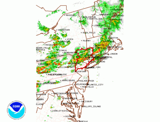
LOCAL RADAR NEW YORK CITY

LOCAL RADAR PHILADELPHIA


It looks like we will ahve a busy night ahead so keep your eye to the sky as severe weather is likely to continue to develop through the evening. There isn’t much change in the outlook for the next two days with sunshine and clouds and warm conditions Wednesday and Thursday. Another front and another chance for showers will arrive Thursday night. Cooler air with an onshore flow arrives Friday and the weekend.
SUBSCRIBE TO PATREON FOR A WEATHER EXPERIENCE FREE OF ADS, EXCLUSIVE VIDEOS FOR MEMBERS ONLY AND MUCH MORE…STARTS AT $2 A MONTH..MESSAGE ME AT ANY TIME

MANY THANKS TO TROPICAL TIDBITS FOR THE USE OF MAPS
Please note that with regards to any tropical storms or hurricanes, should a storm be threatening, please consult your local National Weather Service office or your local government officials about what action you should be taking to protect life and property.
LATEST JOESTRADAMUS ON THE LONG RANGE

