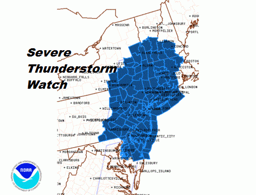
Severe Thunderstorm Watch Posted from Virginia to New England
We broke out wide open in some sunshine today so the daytime heating has been effective in destabilizing the atmosphere even more. The front and the upper trough are approaching so we have a Severe Thunderstorm Watch posted from Virginia to New England. This set up today is not that different from the severe weather outbreaks we have seen over the last 6 weeks. Scattered renegade thunderstorms have already developed a produced a few localized severe thunderstorm warnings in New Jersey and in a few other locations. The main line will develop and move through the area during the evening commute. The timing shown on the above map is for the main line of storms. There could be renegade scattered storms anywhere at any time
The NWS Storm Prediction Center has issued a
The NWS Storm Prediction Center has issued a
* Severe Thunderstorm Watch for portions of
Connecticut
Delaware
much of Massachusetts
eastern Maryland
southern New Hampshire
New Jersey
southeastern New York
eastern Pennsylvania
southern Vermont
Coastal Waters
* Effective this Wednesday afternoon and evening from 210 PM
until 900 PM EDT.
* Primary threats include…
Scattered damaging wind gusts to 70 mph possible
Isolated large hail events to 1 inch in diameter possible
SUMMARY…Strong/locally severe storms will continue to
develop/shift eastward this afternoon, with locally damaging winds
and hail expected. Threat will diminish gradually through early
evening.
The severe thunderstorm watch area is approximately along and 75
statute miles east and west of a line from 35 miles north northeast
of Albany NY to 25 miles west of Philadelphia PA. For a complete
depiction of the watch see the associated watch outline update

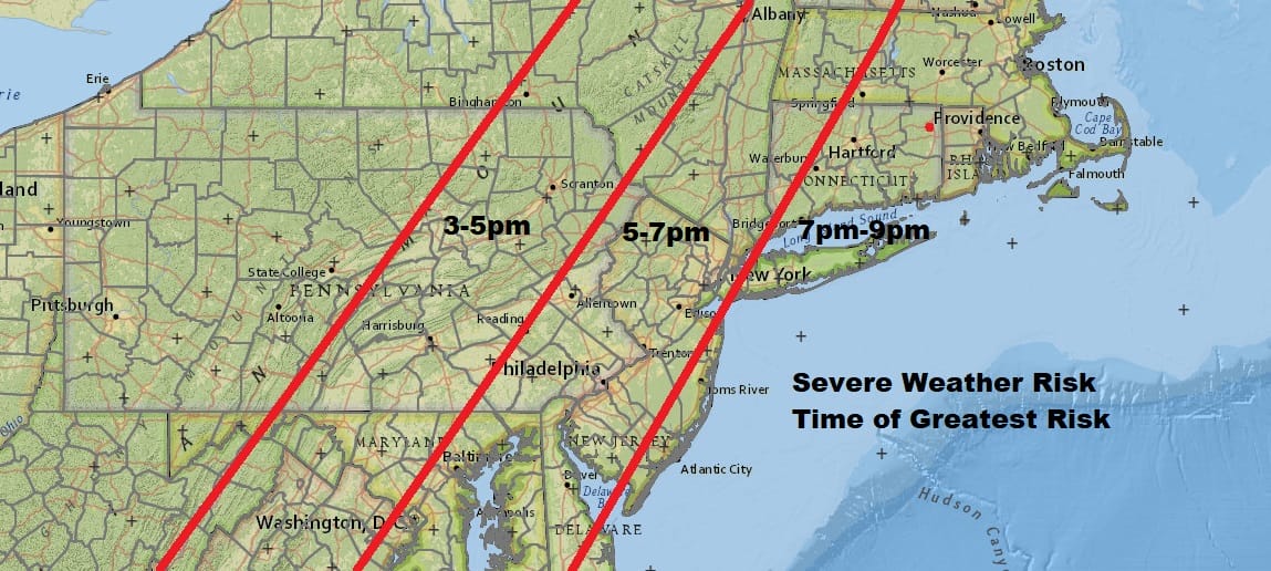
Timing remains about the same as we reported earlier with the bulk of the thunderstorms developing and moving through during the evening commute. This looks like a widespread severe weather event to take precautions and stay safe while the severe weather moves through.
SATELLITE

REGIONAL RADAR

Regional radar is beginning to show a developing line of thunderstorms across Eastern Pennsylvania while the local radars are picking up on the renegade scattered thunderstorms that have developed to the east of the main line.
LOCAL RADAR NEW YORK CITY

LOCAL RADAR PHILADELPHIA 

Once the thunderstorms play through we will see improving weather conditions later tonight until this first front and trough passes through. There are no changes in the outlook for Thursday. Look for sunshine and some clouds with a scattered shower or thunderstorms late in the day with a second front moving through. Today’s system will effectively take most of the juice out of the atmosphere so we are not expecting a widespread outbreak on Thursday. Highs Thursday will be in the mid 80s to near 90.
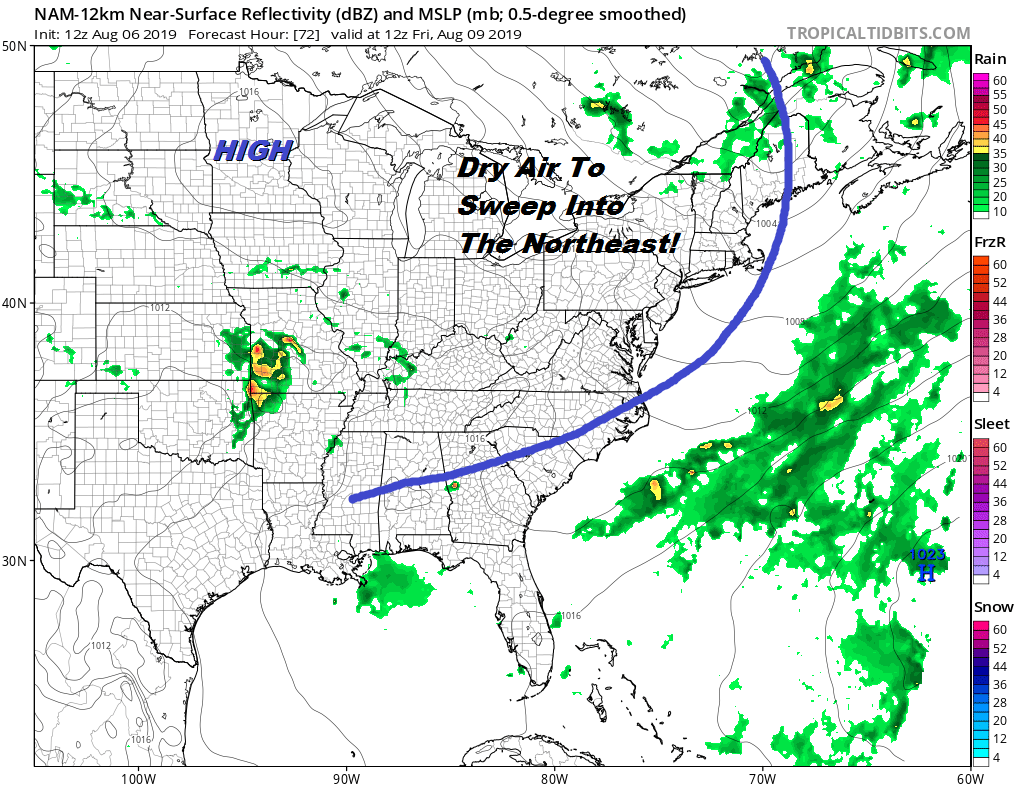
Then it is on to the payoff of nice weather with lowering humidity Friday with sunshine and nice breeze with highs in the low to mid 80s. The weekend looks great with sunshine both Saturday and Sunday with most highs in the upper 70s to lower 80s. It will turn more humid briefly Sunday night into Monday as another cold front passes. Another shot of dry air will be coming in for Tuesday and another front with perhaps a wave on it will approach for midweek.
MANY THANKS TO TROPICAL TIDBITS FOR THE USE OF MAPS
Please note that with regards to any tropical storms or hurricanes, should a storm be threatening, please consult your local National Weather Service office or your local government officials about what action you should be taking to protect life and property.


