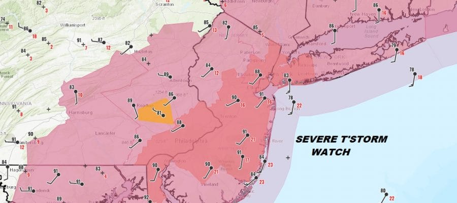
Severe Thunderstorm Watch Expanded Southward All of New Jersey to DCA
The severe thunderstorm watch that runs from Northeast New Jersey to Southeastern New England has been expanded now to include all of New Jersey and Eastern Pennsylvania southward to Maryland which includes all the major cities along I-95 from Washington to Philadelphia to NYC to Hartford to Providence to Boston.The watch will continue through the evening commute.
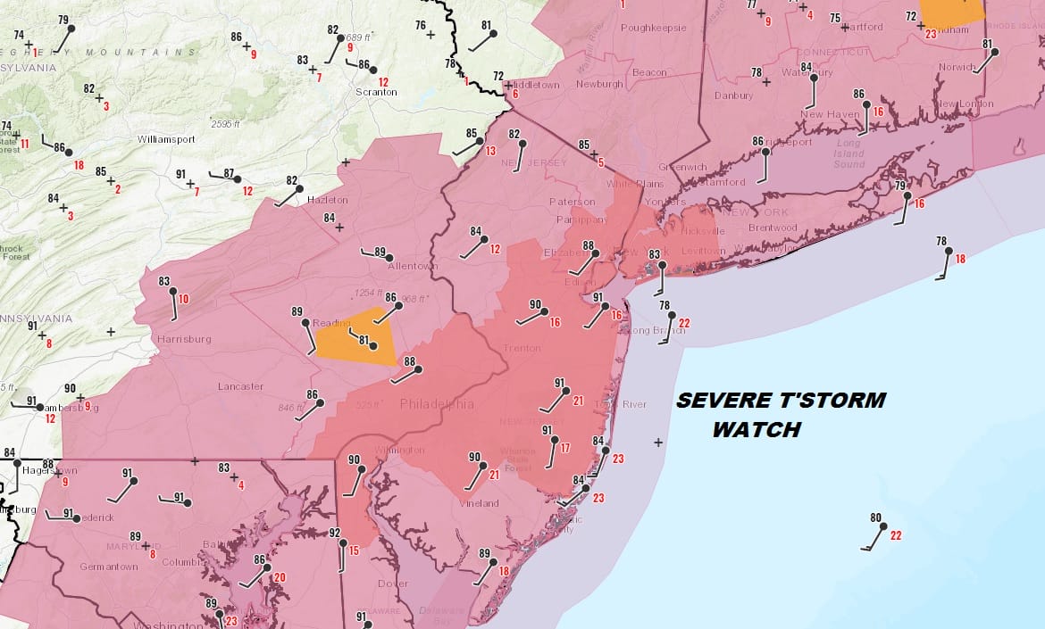
We are seeing thunderstorms now firing up rapidly across Eastern Pennsylvania southward as well as a second line in upstate NY that is swinging southeastward toward the Catskills. Look for deteriorating weather conditions across the area during the evening commute as thunderstorms make their way from west to east.
SATELLITE

NEW JERSEY COUNTIES INCLUDED ARE
ATLANTIC BURLINGTON CAMDEN
CAPE MAY CUMBERLAND GLOUCESTER
HUNTERDON MERCER MIDDLESEX
MONMOUTH MORRIS OCEAN
SALEM SOMERSET SUSSEX
WARREN
PAC001-011-017-025-029-043-045-071-075-077-089-091-095-101-107-
133-220200-
/O.NEW.KWNS.SV.A.0610.190821T1925Z-190822T0200Z/
PA
. PENNSYLVANIA COUNTIES INCLUDED ARE
ADAMS BERKS BUCKS
CARBON CHESTER DAUPHIN
DELAWARE LANCASTER LEBANON
LEHIGH MONROE MONTGOMERY
NORTHAMPTON PHILADELPHIA SCHUYLKILL
YORK
REGIONAL RADAR

Thunderstorms are growing quickly on the local radars as storms develop in Northern New Jersey. We will likely see some severe thunderstorm warnings being issued from these cells. The biggest threat from them will be gusty winds and heavy rains. The odd stronger cell could possibly produce a rotation.
LOCAL RADAR NEW YORK CITY

LOCAL RADAR PHILADELPHIA 

Once these thunderstorms end we will see clouds overnight with most lows in the upper 60s to mid 70s. We could see another severe weather threat on Thursday as a second cold front approaches and the Storm Prediction Center has elevated the risk to marginal for late Thursday afternoon.

We will address the Thursday threat later this evening on our Youtube Channel live stream as well as look ahead toward Friday and the weekend
MANY THANKS TO TROPICAL TIDBITS FOR THE USE OF MAPS
Please note that with regards to any tropical storms or hurricanes, should a storm be threatening, please consult your local National Weather Service office or your local government officials about what action you should be taking to protect life and property.


