September Heat Wave Ends Today
SHOP THE JOESTRADAMUS STORE

September Heat Wave Ends Today
Today will be the last day of this late September heat wave that we have been experiencing. A cold front is approaching from the northwest while Tropical Storm Maria continues to crawl northward off the North Carolina coast. The front is being pushed east by a strengthening jet stream. The upper ridge in the east will break down and this will lead to an easy transition to a cooler air mass that will come in two shots. Today will be another day of sunshine with highs into the 80s in most places except near the shore where the wind off the ocean will keep it noticeably cooler.
SATELLITE LOOP

REGIONAL RADAR

The front has very little to work on so when it does come through tonight it will have very little with it other than a few clouds. The cool down will be in stair step fashion. Thursday looks to be sunny with a fresh north wind so the humidity will be gone and highs will be in the mid to upper 70s.
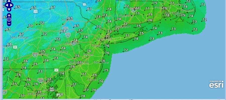
THURSDAY FORECAST HIGH TEMPERATURES

Friday the second shot of cool air will arrive with another cold front Friday night into Saturday morning and that could produce a few showers when it passes. The dayside Friday will be partly sunny with highs in the low to mid 70s. Then the coolest of the cool air will move in for the weekend. Saturday’s highs will be in the 60s and Sunday’s highs will be in the 60s to near 70. The nights will be very cool and Sunday morning many areas except for the warmest urban locations.
NEW APP & BLUETOOTH TO CHECK AIR QUAILTY
 GET JOE A CIGAR IF YOU LIKE

FiOS1 News Weather Forecast For Long Island
FiOS1 News Weather Forecast For New Jersey
FiOS1 News Weather Forecast For Hudson Valley


