Cooler Air Moving In Starting Thursday
SHOP THE JOESTRADAMUS STORE

Cooler Air Moving In Starting Thursday
After another day of very warm and humid conditions we are beginning to see the light at the end of the warm weather tunnel. The signs are subtle but the ridge in the Eastern US is finally beginning to slowly break down but we emphasize slowly. We will still have one more warm humid day ahead of us though temperatures are going to moderate a few more degrees on Wednesday with an ocean wind and Tropical Storm Maria to the south and a cold front now approaching the upper Midwest begins its move to the east. There is not change in the outlook for Tropical Storm Maria as it should begin to slowly edge toward the northeast over the next two days taking tiny but almost major hurricane Lee out to sea with it.
SATELLITE LOOP

REGIONAL RADAR

There is nothing to worry about on the radar though you can see a few echos from Maria along the North Carolina coast. None of that moisture is coming here.
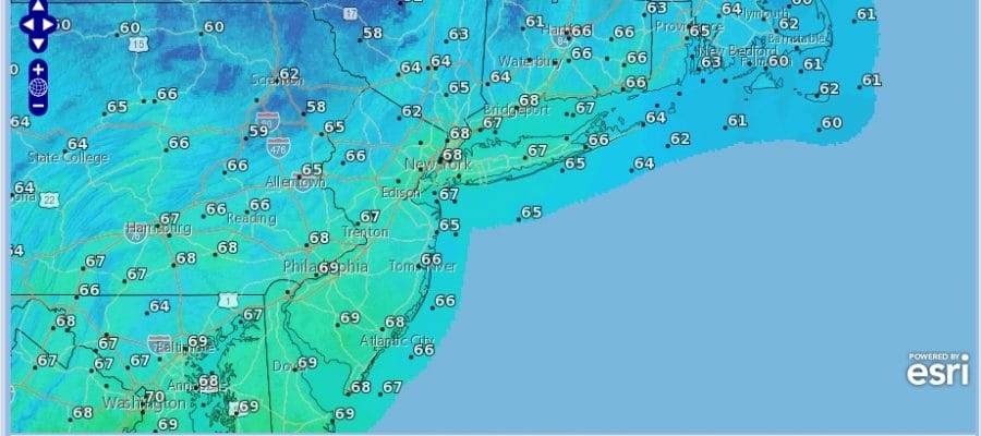
SATURDAY’S FORECAST HIGH TEMPERATURES
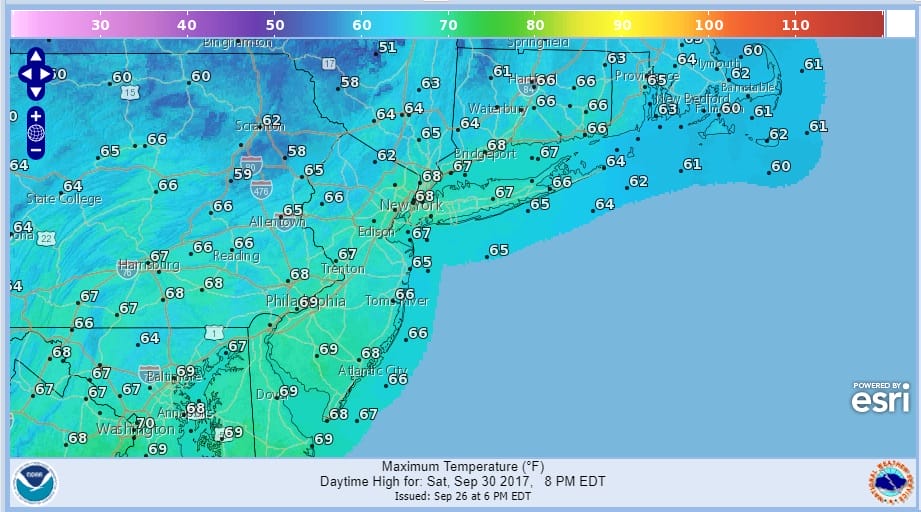
From Thursday through Saturday we will see a gradual downtrend in temperatures. Thursday’s highs will be in the mid to upper 70s and Friday’s will be in the low to mid 70s. There will some sunshine both days with much lower humidity so it will feel better for sure. Friday night another cold front moves through with the chance for showers followed by a second shot of cooler air for Saturday. Highs Saturday will only be in the 60s everywhere and it will certainly feel like fall. Sunday morning’s lows will be in the 40s in most places except for the warmer urban areas where it will be in the lower 50s. Sunday’s highs will be in the 60s to near 70 and both weekend days should feature some sunshine though we may have some lingering clouds early Saturday morning from the second cold front.
 GET JOE A CIGAR IF YOU LIKE

FiOS1 News Weather Forecast For Long Island
FiOS1 News Weather Forecast For New Jersey
FiOS1 News Weather Forecast For Hudson Valley


