Scattered Heavy Thunderstorms This Evening, Severe Weather Risk Late Wednesday
A wave of low pressure is offshore and moving away to the northeast offshore but left behind is a very warm and humid tropical air mass and we are seeing some heavy thunderstorms blowing up in some places this afternoon and evening. We have already seen some flash flooding in parts of New Jersey and the Hudson Valley under a few of these cells. They are not widespread so clearly not everyone is going to get involved in some of these heavier cells but bear in mind that they can produce a couple of inches of rain in 10 to 15 minutes which will trigger some flash flooding issues.
SATELLITE

REGIONAL RADAR

On the regional radar radar you can see the rain with the wave moving offshore and you can also see the pop up heavy thunderstorms that are developing over parts of New Jersey, the Hudson Valley, the Poconos, and the Catskills. Everything is moving very slowly to the east. Notice on the regional radar that the storms are scattered in nature.
LOCAL RADAR NEW YORK CITY

LOCAL RADAR PHILADELPHIA 

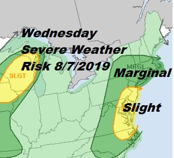
All of this winds down this evening with a warm and very humid night to follow. Lows will be in the low to mid 70s in most places. Then it is on to a hot and humid Wednesday with highs in the upper 80s to lower 90s and a very good chance for thunderstorms. The Storm Prediction Center has elevated the risk for Wednesday to slight risk which we figured they would do.

While there could be some renegade thunderstorms that form during the afternoon the main line comes in during the late afternoon and evening from west to east. The Nam model over the last few days has been rather bullish on the possibility of some strong cells as the front nears the coast. Today’s models support the idea again. Daytime heating is key tomorrow so we will watch to see how much sunshine and how hot it gets Wednesday afternoon.
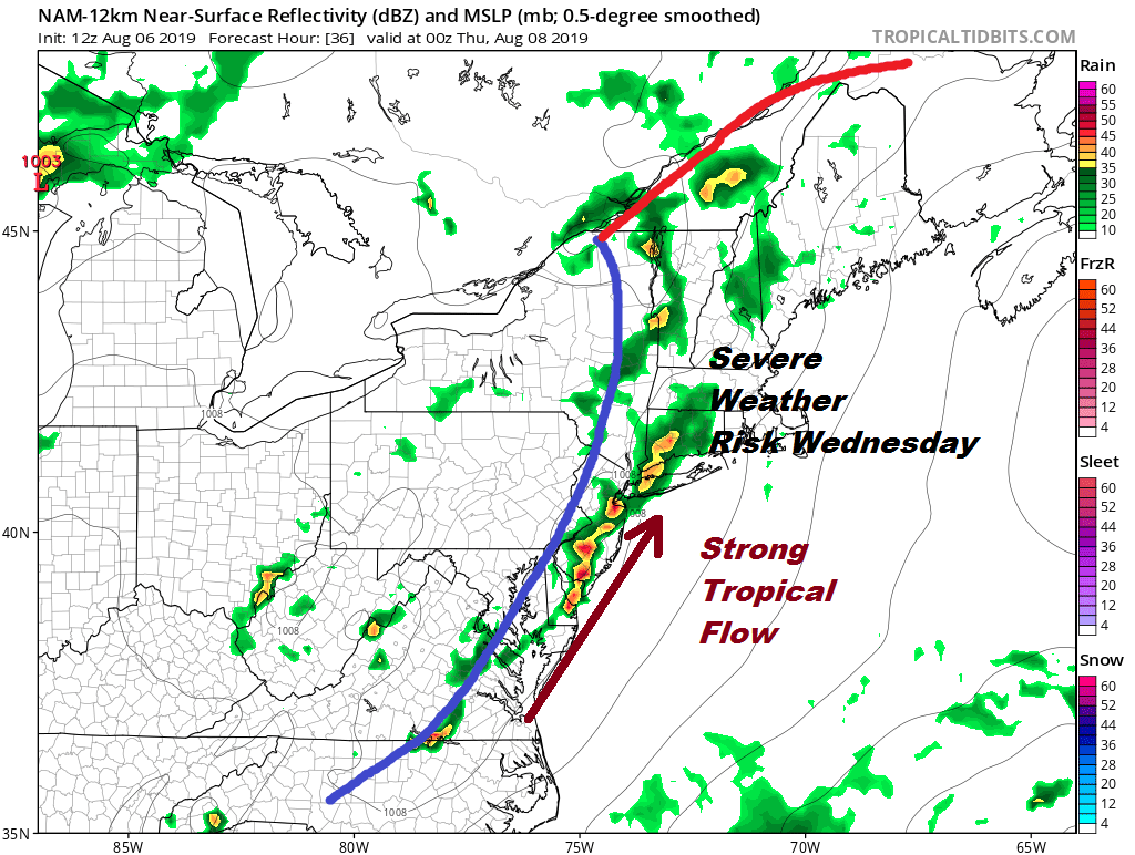
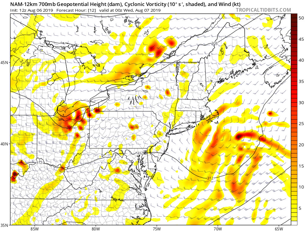
The map above is for 8pm Wednesday evening as the model shows a line of heavy thunderstorms moving through the area from Delaware to Southern New England and Long Island. When we look at the upper air at 10,000 feet you can follow the upper trough along. The patches of winds in excess of 50 kts at this level reflects the thunderstorms and we will probably see some downdrafts from these storms as they move through. Even some rotation can’t be ruled out here. This system is not very different from the others we have seen this summer.
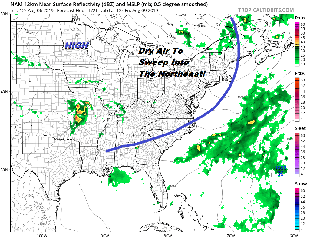
There are no changes in the outlook going forward. Another cold front approaches Thursday with some sunshine with a shade less humidity but still the chance for a late day shower or thunderstorm. The front will pass offshore Thursday night bringing in a nice dry air mass for Friday and the weekend.
The only issue for Friday might be the chance for a shower or a thunderstorm from Southern New Jersey southward as another upper trough passes through. Otherwise the rest of the area will see sunshine and lower humidity with highs in the low to mid 80s. The weekend looks great with sunshine Saturday with highs in the upper 70s and lower 80s. Sunday will be nice and sunny with highs 80 to 85. This will be yet another good weather weekend as we have 4 summer weekends left, including this one that is coming.
MANY THANKS TO TROPICAL TIDBITS FOR THE USE OF MAPS
Please note that with regards to any tropical storms or hurricanes, should a storm be threatening, please consult your local National Weather Service office or your local government officials about what action you should be taking to protect life and property.


