Record Lows Saturday Sunday Morning
RECORD LOWS SATURDAY SUNDAY MORNING
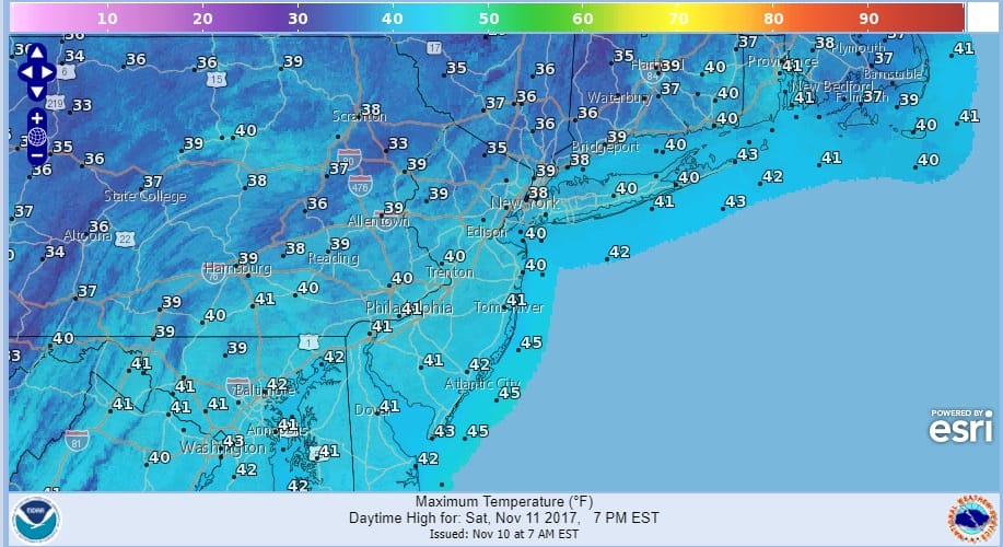
The very cold Canadian air mass is here this morning complete with strong gusty winds and temperatures falling into the 30s where they will stay all day. We at least will see a good deal of sunshine but the wind gusting at times to 40 mph will make it feel like it is down in the low 20s. Then it will be a run toward record lows Saturday morning and a very cold day on Saturday with sunshine but highs just barely around the 40 degree mark.
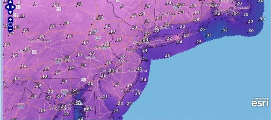
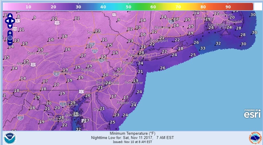
Saturday night into Sunday morning will depend on whether skies are clear and winds are light and variable. If they are we will see lows in the teens and low 20s which will mean more record lows.
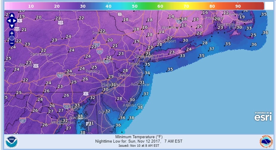
The satellite loop shows just some clouds inland with mostly sunny skies along the coast. The Saturday will be sunny with less wind. Sunday we will see sun giving way to arriving clouds with highs reaching the upper 40s to around or just over 50 so temperatures will at least attempt to rebound toward average.
SATELLITE LOOP

REGIONAL RADAR

Overall next week looks relatively quiet with just weak weather systems moving through Monday and again late Wednesday. Temperatures for much of next week will be near or just a little below average. Weather models however are signalling a strong blocking pattern developing in the long range which could mean that after a long endless summer that lasted to the end of October, we may flip the switch over to winter quickly and before Thanksgiving.
 GET JOE A CIGAR IF YOU LIKE

FiOS1 News Weather Forecast For Long Island
FiOS1 News Weather Forecast For New Jersey
FiOS1 News Weather Forecast For Hudson Valley


