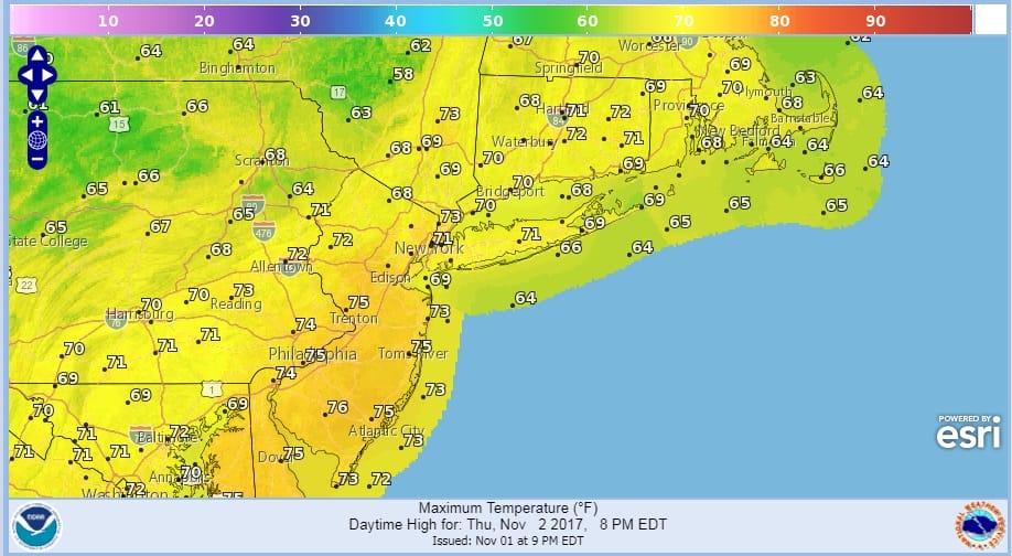
Record Highs Possible Thursday Friday
Record Highs Possible Thursday Friday
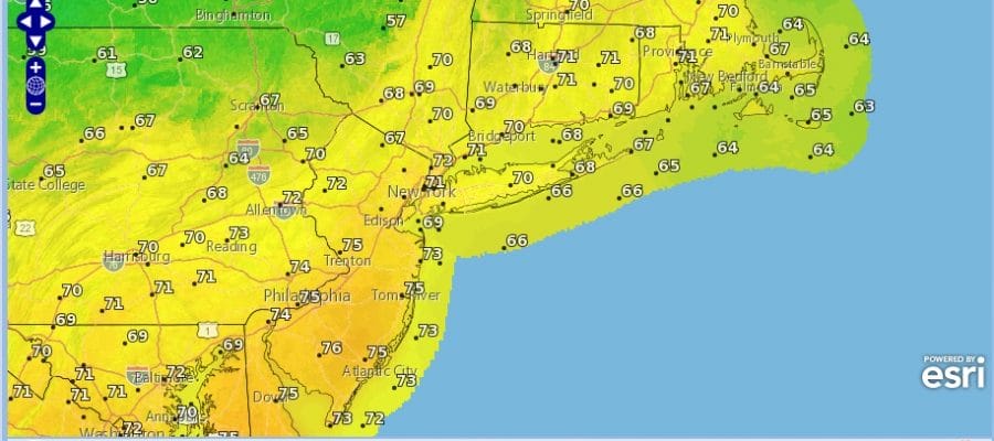
With a warm front moving to our north, we are setting up for the possibility of record highs on Thursday in a few places that have a small data set. Records for NYC & Newark for example are up in the lower 80s as their data sets go back far longer. Other smaller stations have records in the mid 70s so the bar is set rather low. Look for clouds and some sunshine for Thursday with most highs between 70 and 75 degrees.
RECORD HIGHS THURSDAY
RECORD HIGHS FRIDAY
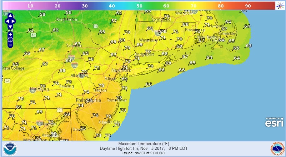
Satellite loop shows clouds to the west and north and also some patchy clouds over us. We will see some sun through those clouds. A cold front from the Great Lakes moves through on Friday. The front will be weak so we will see clouds and a few passing showers late in the day. It will be another day with highs in the 70s.
SATELLITE LOOP

REGIONAL RADAR

LOCAL RADAR NEW YORK CITY

LOCAL RADAR PHILADELPHIA


WEEKEND OUTLOOK
The weather pattern into next week will allow for changes every 2 or 3 days. We will go through the same warm front cold front set up this weekend. Saturday will be the better of the two weekend days with some sun and clouds but highs will be in the 50s. Sunday we will see clouds and a few showers as another warm front approaches. Then it is back to 70 for Monday until another cold front passes. Once that goes by it looks like much of next week will be on the cool side. There could be a chance for some rain later next week as low pressure goes by to our south.
Next week we will see the pattern gradually shift to a cooler look and JOESTRADAMUS has more on this.
 GET JOE A CIGAR IF YOU LIKE

FiOS1 News Weather Forecast For Long Island
FiOS1 News Weather Forecast For New Jersey
FiOS1 News Weather Forecast For Hudson Valley


