RECORD HIGHS POSSIBLE SUNDAY COOL SHOT MONDAY INTO WEDNESDAY
RECORD HIGHS POSSIBLE SUNDAY
COOL SHOT MONDAY INTO WEDNESDAY
We had a bit of a tough time transitioning over to the warm humid air mass on Saturday as clouds held on tough in some places and less so in others. But now that the southwest flow is taking over and the next cold front is approaching we are setting up for a very warm Sunday with some sunshine developing after some morning low clouds and fog. Temperatures will reach into the 80s in many locations and some record highs will be challenged. However the warm weather will depart as the front moves through Sunday night. We can already see the clouds from that on the satellite loop heading in our direction. There could be a few showers with that front Sunday evening.
SATELLITE LOOP

REGIONAL RADAR

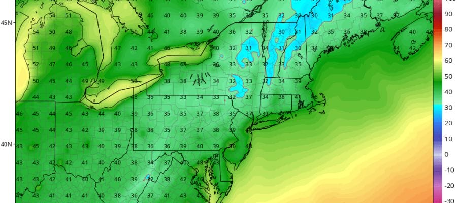
At least the radars should be quiet into most of Sunday before the showers move through. After that a shot of cool air from Canada will take over as the warm weather pattern takes a break for a few days. Monday and Tuesday highs will be just in the 60s and Tuesday morning will be quite cool with lows in the 30s to lower 40s making it probably the first good night for wood burning in the fireplace.

The week ahead looks mostly dry and it could be dry right through next Sunday as another big upper ridge will build into the Eastern US late this week bringing another warm up. Longer term we could see the pattern flip to a colder one during the last week of October. We will discuss that further on Sunday.
HURRICANE OPHELIA HEADS TOWARD IRELAND 115 MPH WINDS CATEGORY 3
LATEST JOESTRADAMUS VIDEO
 GET JOE A CIGAR IF YOU LIKE

FiOS1 News Weather Forecast For Long Island
FiOS1 News Weather Forecast For New Jersey
FiOS1 News Weather Forecast For Hudson Valley


