Record Highs Possible First Autumn Weekend
Record Highs Possible First Autumn Weekend
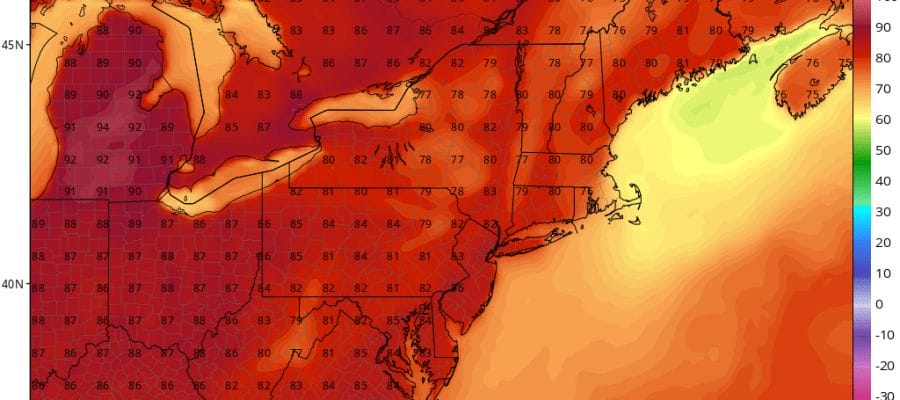
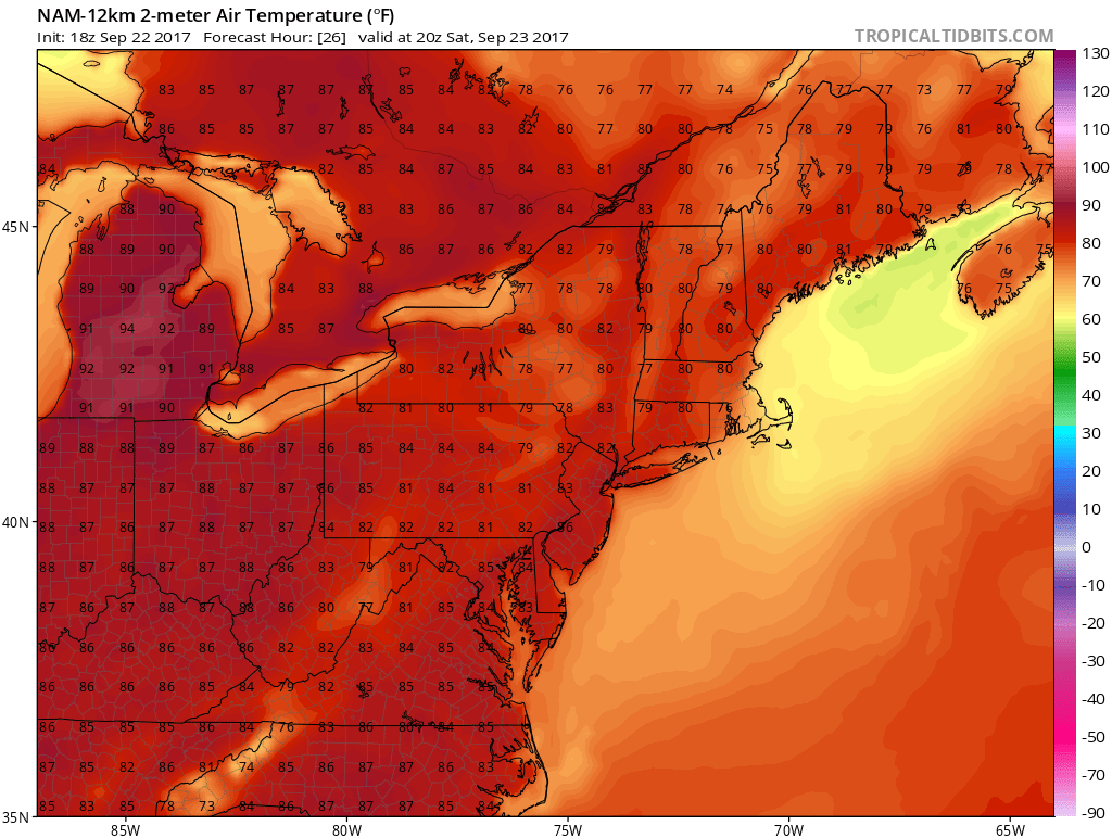
This weekend is the first full weekend in the new Autumn season but as usual somebody forgot to tell the atmosphere. The weather pattern in the Eastern US is under a big ridge of high pressure in the upper levels of the atmosphere which means very warm weather for us. In fact it will be so warm that some record highs are possible especially on Sunday when some places could come close to 90 degrees.
NAM MODEL TEMPS 4PM SATURDAY
On the satellite loop we can see the remnant low that was Tropical Storm Jose southeast of Cape Cod. It hasn’t moved much today but it looks like it will begin a slow eastward drift and gradually dissipate over the next few days. No rain is in the forecast through at least Monday with this upper high in place.
SATELLITE LOOP

REGIONAL RADAR

LOCAL RADAR NEW YORK CITY
The radar is showing some sprinkles rotating westward from the remnant low of Tropical Storm Jose. Those sprinkles should disappear overnight.

LOCAL RADAR PHILADELPHIA


Im going to assume we will have no issues with Hurricane Maria as odds favor it going out to sea. I have not seen anything that sways me from that idea. That means warm weather continues through Wednesday though by then the flow may become a bit more onshore and that could hold temperatures down a bit. By Thursday a cold front comes through and we will see a change to much cooler autumnal weather for the end of next week and next weekend.
With regards to Maria and the long range, check out the latest JOESTRADAMUS post.
 GET JOE A CIGAR IF YOU LIKE

FiOS1 News Weather Forecast For Long Island
FiOS1 News Weather Forecast For New Jersey
FiOS1 News Weather Forecast For Hudson Valley


