Maria Could Come Close To The Outer Banks of North Carolina Midweek
Hurricane Maria continues to move north northwest this morning with 120 mph winds. The satellite presentation this morning us fair with a large well developed eye. An Air force recon is reroute to investigate.
SATELLITE LOOP

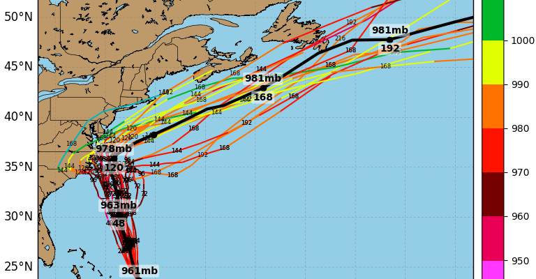
Oveenight weather models have shifted noticeably to the left or westward with some models bringing Maria perilously close to the North Carolina Outer Banks by midweek.
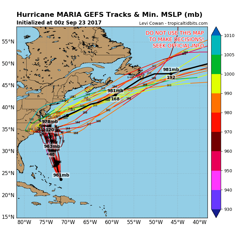
Above is the Gfs and all its member models with the forecast tracks. While the all bring Maria close they also then turn it sharply to the northeast after next Thursday morning. The jet stream from Canada is forecast to dip southward and push Maria out to sea to our south and east and this still appears to be the most likely outcome. We will explore this further later today.
In the meantime our weather looks great for the weekend with sunshine today and temperatures reaching the low to mid 80s. Sunday look for sunshine with near record highs in the 80s to near 90 degrees in some places.
FiOS1 News Weather Forecast For Long Island
FiOS1 News Weather Forecast For New Jersey
FiOS1 News Weather Forecast For Hudson Valley