
Raw Rainy Wednesday Mothers Day Weekend Unusually Cold & Windy
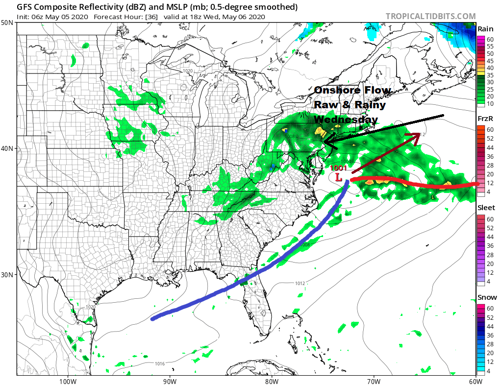
We are starting the day with sunshine across our area from Eastern Pennsylvania to Southern New England but clouds will be increasing today as the next low heads our way. Cooler air moved in overnight and temperatures today will be contained in the upper 50s and lower 60s. While there is no rain anywhere close by at the moment we will see rain moving into Southern Pennsylvania and Southern New Jersey late this afternoon or this evening as low pressure moves east.
SATELLITE

REGIONAL RADAR

Rain will spread slowly northeastward overnight and Wednesday will be a chilly raw rainy day with highs just in the upper 40s and lower 50s in most places. Rainfall amounts should be on the order of a quarter of an inch or so. Most of the rain from this system will be light and it should be of the on and off variety. This low pulls away Wednesday night and we should see improving weather conditions on Thursday. Some sunshine returns and highs will be back into the 60s.
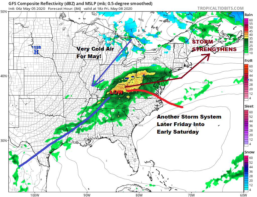
Friday brings the next storm system with increasing clouds and rain arriving Friday late morning and afternoon and lasting into early Saturday morning. This will be another raw day with highs just into the 50s in most places. This storm system strengthens Saturday and we are going see a very cold weekend for May. Temperatures will average 15 degrees or more below average and we could even see some snow Saturday in parts of Northern Pennsylvania to Northern New England. Highs may only be in the 40s to perhaps some lower 50s at best. Winds will be gusting past 40 mph at times.
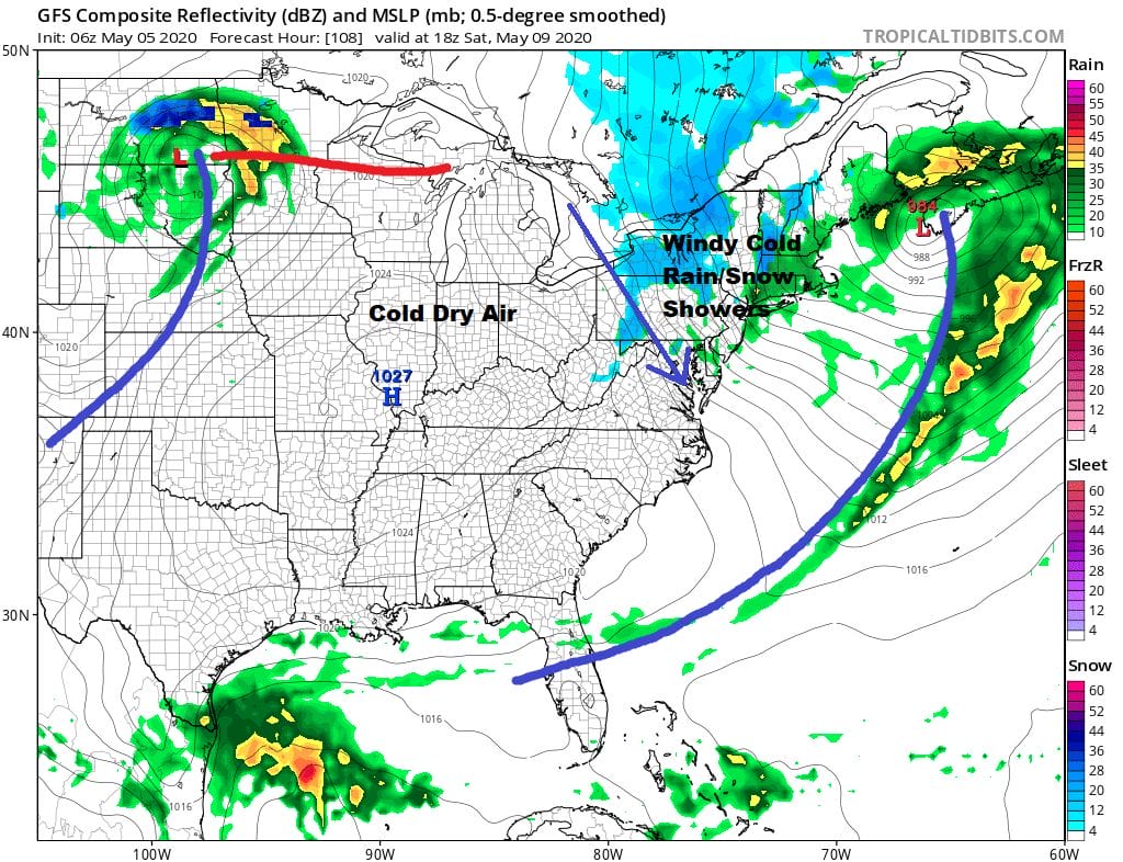
This is a map you might see in the winter or in early spring versus mid spring but you play the hand you are dealt. Saturday night into Sunday morning will be quite cold and there is the risk for some freezes Sunday morning especially inland.
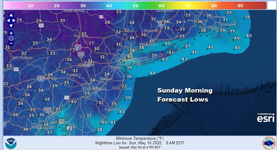
Sunday Mother’s day will be windy at the start but the winds could come down a bit as the day wears on We should see more in the way of sunshine but highs will be just in the 50s at best. We should see the cold ease a bit early next week.
BE SURE TO DOWNLOAD THE FREE METEOROLOGIST JOE CIOFFI WEATHER APP &
ANGRY BEN’S FREE WEATHER APP “THE ANGRY WEATHERMAN!
MANY THANKS TO TROPICAL TIDBITS FOR THE USE OF MAPS
Please note that with regards to any severe weather, tropical storms, or hurricanes, should a storm be threatening, please consult your local National Weather Service office or your local government officials about what action you should be taking to protect life and property.


