DOWNLOAD MY NEW FREE JOESTRADAMUS WEATHER APP FOR ALL DEVICES
THE APP IS ABSOLUTELY FREE TO ALL BUT CONSIDERING SUBSCRIBING TO PATREON FOR A WEATHER EXPERIENCE FREE OF ADS, EXCLUSIVE VIDEOS FOR MEMBERS ONLY AND MUCH MORE…STARTS AT $2 A MONTH..MESSAGE ME AT ANY TIME
Raw Rainy Later Today Tonight Decent Weekend
Rain Thunderstorms Monday
We are in the process of normalizing the atmosphere after two very bone dry days with virtually cloud free skies. The chilly onshore flow is underay, clouds are thickening up, and we have rain in the cards for later today and tonight. There is a lead area of precipitation that is swinging through Eastern Pennsylvania and Northwest New Jersey this morning and there might very well be some sleet or wet snow in the mix. It is a thin arm of moisture that runs out well ahead of the main area of showers to the south and southwest.
SATELLITE

REGIONAL RADAR

Radars have come alive and you can see the precipitation on the regional radar with that leading edge moving through now mainly west of the coast and the more expanded are southwest in Virginia and North Carolina. The areas are moving northeast. The steadier rain arrives later this afternoon and tonight. In the meantime we will sit in cloudy raw conditions with temperatures going no where fast. Highs at best will be in the upper 30s in the Hudson Valley & Northwest New Jersey and low to mid 40s just about everywhere else.
LOCAL RADAR NEW YORK CITY

LOCAL RADAR PHILADELPHIA


We will work through the rain tonight and it should end during the early morning hours. We still maintain the view that the weather this weekend will be decent. Clouds Saturday morning will give way to some sunshine with highs in the 60s. Sunday we will see the reverse with sunshine giving way to arriving clouds with highs in the 60s.
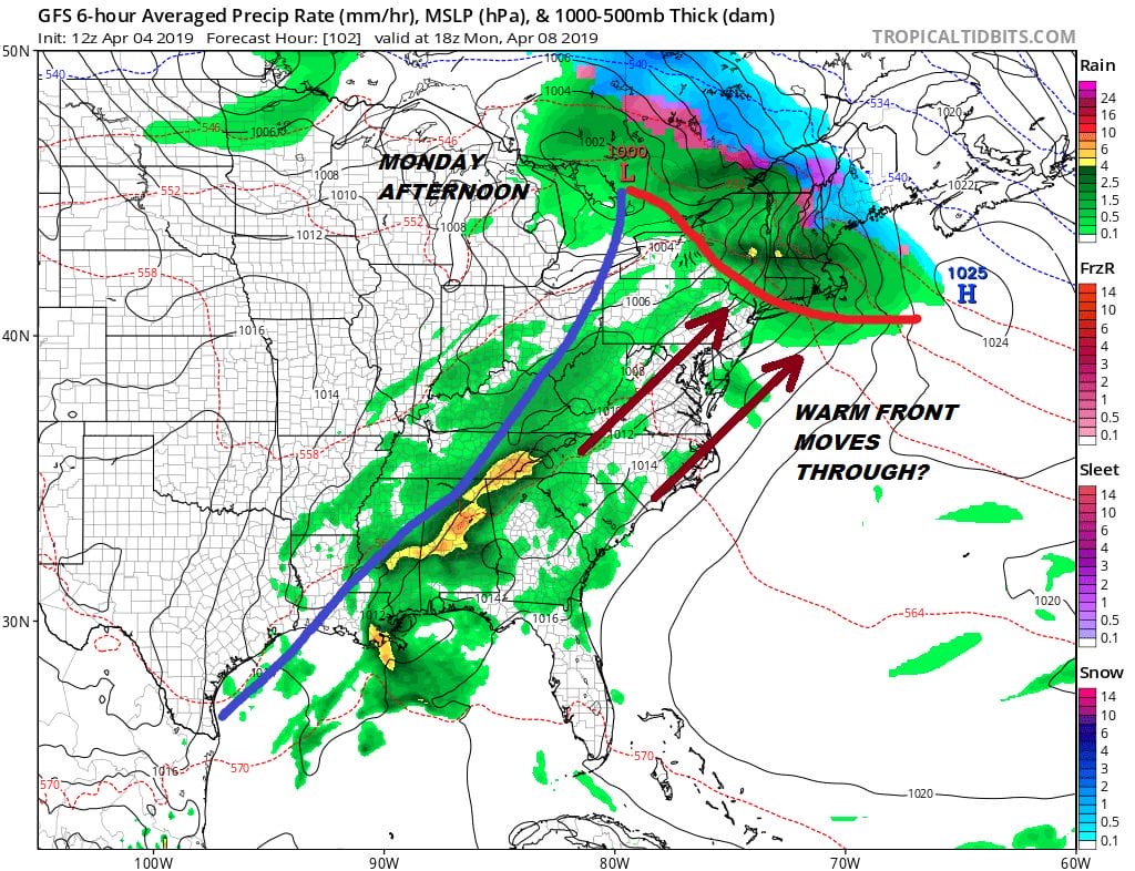
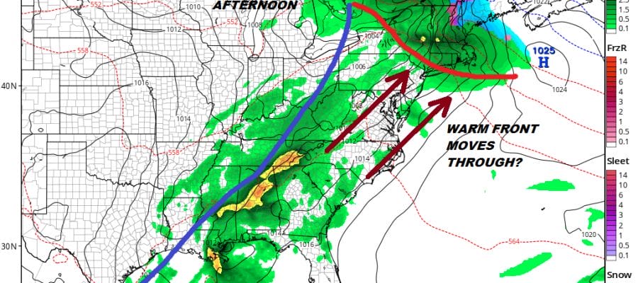
Sunday night and Monday bring the next warm front cold front combination though at least this time around we will be starting off on a higher platform temperature wise. Rain comes Sunday night into Monday morning as the warm front tries to go by. Assuming it does and we don’t know how far north it will make it, showers and some thunderstorms are possible later Monday afternoon into Monday night. Highs Monday could have a wide range with temperatures in the 40s to lower 50s north of the warm front to 60s and even 70 is possible south of the front. It is a matter of where and that is our job to figure out this weekend. Tuesday we should see sunshine and a west wind before a second weaker cold front arrrives late in the day. This could give temperatures the opportunity to reach into the 70s on Tuesday even in coastal areas before it turns chilly again for the middle of next week.
MANY THANKS TO TROPICAL TIDBITS FOR THE USE OF MAPS
Please note that with regards to any tropical storms or hurricanes, should a storm be threatening, please consult your local National Weather Service office or your local government officials about what action you should be taking to protect life and property.


