
DOWNLOAD MY NEW FREE JOESTRADAMUS WEATHER APP FOR ALL DEVICES
THE APP IS ABSOLUTELY FREE TO ALL BUT CONSIDERING SUBSCRIBING TO PATREON FOR A WEATHER EXPERIENCE FREE OF ADS, EXCLUSIVE VIDEOS FOR MEMBERS ONLY AND MUCH MORE…STARTS AT $2 A MONTH..MESSAGE ME AT ANY TIME
Raw Rainy Friday Better Weekend Showers Sunday Night Monday
The next weather system is getting ready to move in for what will be a raw cold and occasionally rainy Friday. Clouds will be coming in overnight and the onshore flow around a cold high to the north will gain traction. This will send temperatures down in the 30s just about everywhere by morning. To the west we can see the heavier overcast and radars are showing rain and some heavy thunderstorms extending from the Ohio Valley south into the Central Gulf coast.
SATELLITE

REGIONAL RADAR

Friday morning some precipitation will move across Eastern Pennsylvania into Northern New Jersey and the Hudson Valley. This first weak shot arrives around day break and there could be some sleet in the mix as the precipitation gets underway. Then we set in clouds until a steadier rain moves in during the mid to late afternoon and continues into tomorrow night. Temperatures tomorrow will be going no where as they will be stuck in the low to mid 40s. Some inland areas in the Hudson Valley may have a tough time getting out of the 30s.
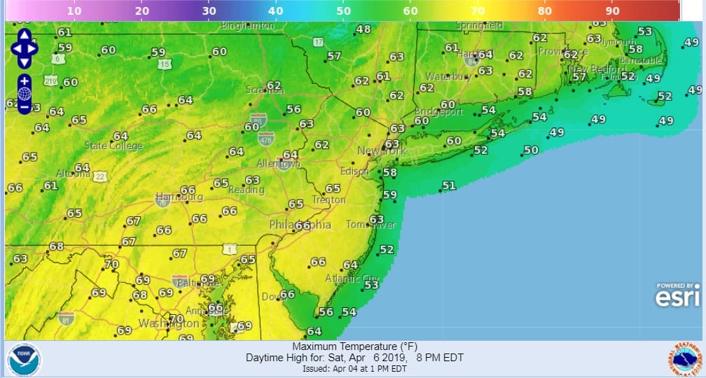
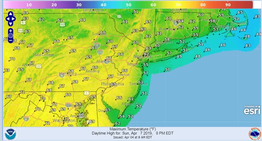
The good news is that the rain moves out Friday night and while there may be some leftover clouds early Saturday morning, we should break out into some sunshine in most areas by mid morning..along the coast by noon at the latest. Saturday night will be nice and clear. Sunday we should see sunshine for the first part of the day but some clouds will start arriving in the afternoon as a warm front heads our way from the southwest. Sunday’s highs will be in the 60s. Sea breezes both days will keep temperatures cooler along coastal areas and south facing shorelines.
Sunday night and Monday it is a warm front cold front combination. Warm fronts always struggle and models were implying that the warm front would have no chance thanks to blocking developing in the North Atlantic. However it seems that the block is going to take a little longer to evolve and models are a bit weaker with it. This changes the outlook for early next week where we will deal with showers on Monday with temperatures in to the 60s.
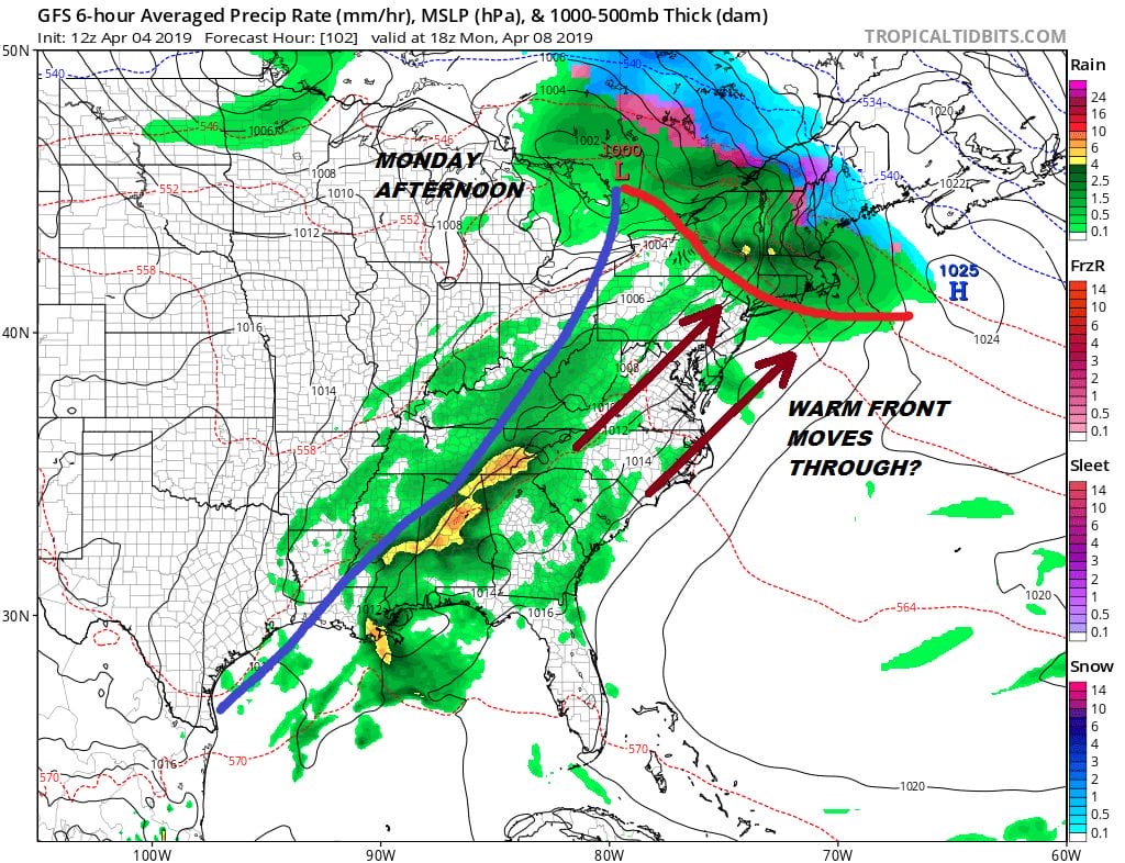
After the warm front goes by we could be at risk for some showers and thunderstorms Monday evening and night as the cold front moves through. If this scenario plays out next Tuesday could be a nice sunny warm day with temperatures in the 70s before a second front and colder air comes in Tuesday night and cools things down for Wednesday.
MANY THANKS TO TROPICAL TIDBITS FOR THE USE OF MAPS
Please note that with regards to any tropical storms or hurricanes, should a storm be threatening, please consult your local National Weather Service office or your local government officials about what action you should be taking to protect life and property.


