Raw Cloudy Day Ahead Some Sun Returns Tuesday Showers Thunderstorms Thursday

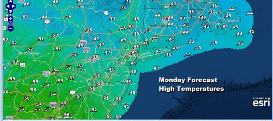
Our recent round of what I describe as doom and gloom Seattle like weather continues today though far less rain fell yesterday and last night for most areas. Our storm system took on an east northeast west southwest tilt keeping most of the rain well inland and north and leaving far less as you adventured closer to the coast. We still have low pressure near Cape Cod today and it is not going anywhere nor are the clouds and the northeast wind going away for today. This will leave us overcast and raw with most highs just in the upper 40s to some lower 50s.
SATELLITE

REGIONAL RADAR

Watching the motion on the regional radar you can see the broad counterclockwise circulation and large dry hole that sits between Southeastern Pennsylvania and Central New England. We may see some areas of patchy rain develop as the day wears on but for much of the time today it will be rain free for most areas. What rain does fall should be on the light side.
LOCAL RADAR NEW YORK CITY

LOCAL RADAR PHILADELPHIA


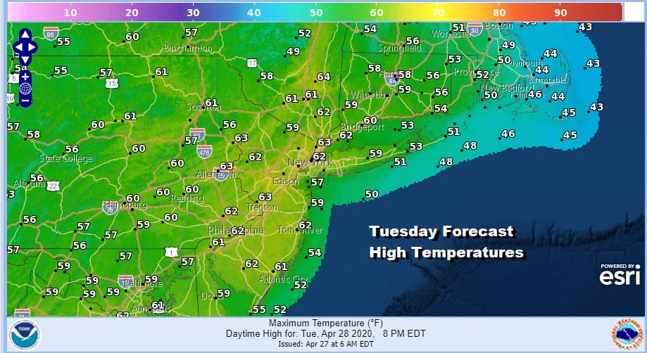
Weather conditions should start to improve somewhat tonight as this weather system pulls away to the northeast and skies may partially clear toward morning. This should set us up for a better day on Tuesday with some sunshine. Highs should be back up into the upper 50s and lower 60s in most places. Now there will be some clouds around especially across Southern Pennsylvania and Maryland to Southern New Jersey as a dying disturbance moves through with a shrinking area of showers that should fall apart.
The next weather system moves to the Great Lakes Wednesday and then pushes east into Thursday. A southerly flow develops ahead of it. We will also have a warm front to the south. Clouds will be back. There could be a passing showers on Wednesday. Highs will be in the 50s from Central New Jersey north and east but 60s are likely south and west into Southern Pennsylvania and Maryland.
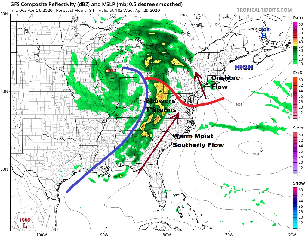
We will likely see some showers and thunderstorms later Wednesday night into Thursday with highs in the 60s. We will likely have some leftover clouds on Friday with some genuine improvement coming over next weeke
DOWNLOAD THE FREE METEOROLOGIST JOE CIOFFI WEATHER APP &
BE SURE TO DOWNLAD ANGRY BEN’S FREE WEATHER APP “THE ANGRY WEATHERMAN!
MANY THANKS TO TROPICAL TIDBITS FOR THE USE OF MAPS
Please note that with regards to any severe weather, tropical storms, or hurricanes, should a storm be threatening, please consult your local National Weather Service office or your local government officials about what action you should be taking to protect life and property.


