
Patchy Rain Doom Gloom Sunday Monday, Dry Tuesday Showers Thunderstorms Thursday
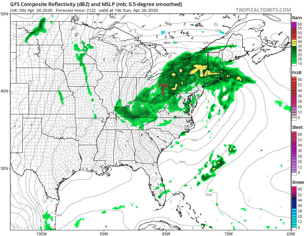
The second half of the weekend sadly is not as good as the first half was. The northeast wind has kicked in. We have low pressure in West Virginia that is going to redevelop along the Delaware/New Jersey coast later today and tonight. This is going to mean that the northeast to east flow will be in control here right into Monday keeping things raw and somewhat wet though it doesn’t rain straight through. The rain comes in waves with some patchy areas of heavy rain later today into tonight. Temperatures will be going no where as we will be stuck mostly in the upper 40s to middle 50s.
SATELLITE

REGIONAL RADAR

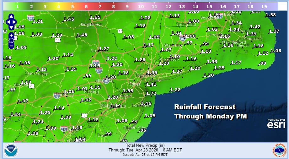
Cleary we are socked in with clouds today on the satellite picture and we can see the patchy nature of the rain on the regional and local radars with some gaps in the mix. Precipitation is lifting northeastward into Upstate NY and New England. There are a few embedded areas of moderate to heavy rain in them in the mix. Rainfall amounts forecast remain on the order of an inch to an inch and a half.
LOCAL RADAR NEW YORK CITY

LOCAL RADAR PHILADELPHIA


Unfortunately this system is slow moving so the we will be sitting in clouds overnight into Monday night and we will still be dealing with patches of rain on and off into Monday evening. Well to the north in upstate NY and in Northern New England snow lovers will catch some wet snow from this and we could see some wet snow in the mix in elevated areas from the Hudson Valley to the Catskills and even into the Poconos though it shouldn’t amount to much. Monday’s temperatures will struggle again with highs just in the upper 40s to mid 50s.
Let us move on to Tuesday where I am hoping for some improvement but it may be a tougher sell given the first system pulling out so slowly and no real dry push of air coming in behind it. I will lean to a mix of sun and clouds. Some models showing some showers moving southeast from Western Pennsylvania and drying up and we will go with that idea but I will want to see that idea continue on weather model runs later today and Monday. Highs Tuesday will be back into the 60s.
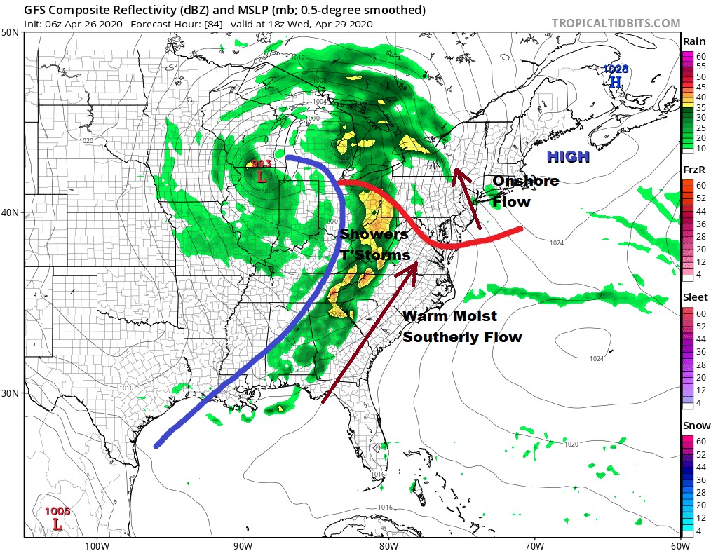
Wednesday brings the next weather system on the scene as low pressure heads for the Great Lakes and a strong southerly flow will eventually set up. Clouds are back. There will be a warm front to the south that will struggle to get through. Southeast winds will keep temperatures in the 50s and possibly closer to near 50 or even upper 40s along coastal areas until the warm front passes. Then it will be showers and thunderstorms Wednesday night into Thursday and some of that rain is going to be on the heavy side.
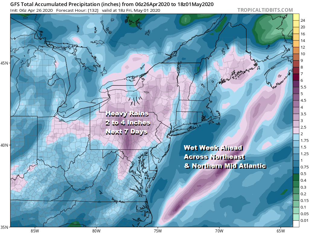
In fact between what we get today and Monday and what falls Wednesday night into Friday will be substantial across much of the Northeast and Northern Mid Atlantic especially inland where 2 to 4 inches of rain will fall. This will be spread out over the course of the next 5 days which means that we will hope for some improvement next weekend.
BE SURE TO DOWNLOAD THE FREE METEOROLOGIST JOE CIOFFI WEATHER APP &
ANGRY BEN’S FREE WEATHER APP “THE ANGRY WEATHERMAN!
MANY THANKS TO TROPICAL TIDBITS FOR THE USE OF MAPS
Please note that with regards to any severe weather, tropical storms, or hurricanes, should a storm be threatening, please consult your local National Weather Service office or your local government officials about what action you should be taking to protect life and property.


