
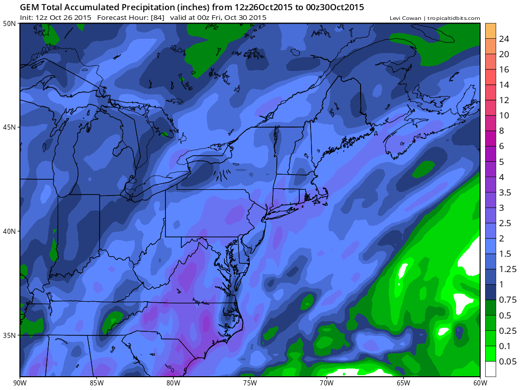
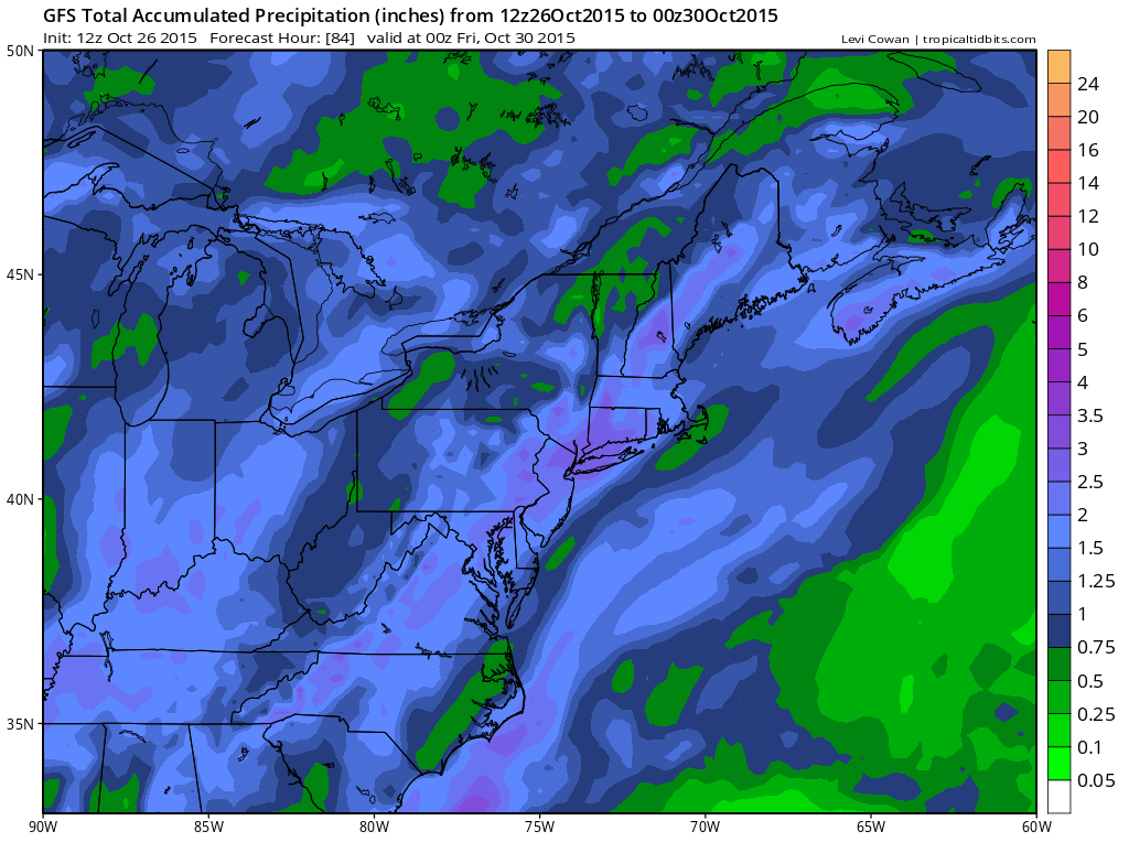
Afternoon models show no major changes regarding the approaching rain however the models have become more robust with total rainfall amounts showing 3 inch plus rainfalls on the GFS model and the Canadian model. Even today’s European doubled its rainfall forecast amounts into the 1 to 2 inch range for most areas. I feel pretty confident on the 1 to 2 inches and certainly there could be locally higher amounts especially if some thunderstorms get embedded in the overall rain area. The approaching front has tropical moisture plus we have a strong southeast inflow over us that should provide a little extra added punch.
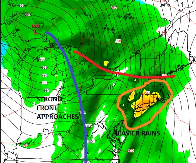
The models may also starting to pick up on the remnants of Hurricane Patricia getting into the mix here as we get into the short range. The other issue is that the gfs model and the Canadian model have more over running precipitation during the day Wednesday where as the European has most of the rain with the front itself and shows less during the day Wednesday which probably accounts for the precipitation difference. I think there will be some over running rain ahead of the main cold front and there should also be some thunderstorms in the mix as well Wednesday evening into the first part of Wednesday night.
Until then tonight looks nice and clear with cold spots in the upper 20s to lower 30s with most lows in the mid 30s to mid 40s in the warmer urban areas. Tuesday we should start with sunshine and then it gives way to arriving clouds with most highs in the upper 50s to lower 60s.
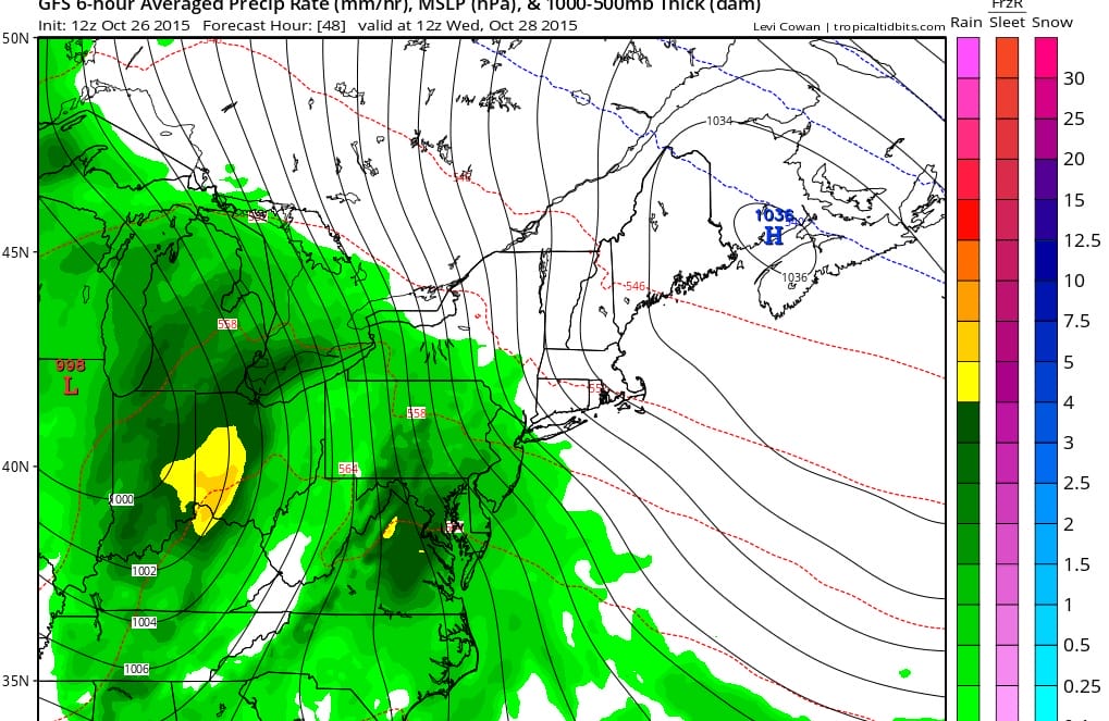
Rain arrives in western areas overnight and by morning should be close to the coast. Im going to lean toward the more over running look of the gfs and the Canadian. Rain becomes heavy at times during the afternoon and into the evening hours on Wednesday.
The faster GFS would have the rain done overnight Wednesday night leaving Thursday dry. Even though chillier air is behind this front it might take a little while before it moves in. The daytime Thursday should see decreasing clouds and increase sun with temperatures in the mid to upper 60s before it cools off by Friday morning. Friday looks dry with sunshine with highs in the 50s. The next weather system doesn’t approach until Sunday and given the look of the upper air that system is going to be weakening as it approaches. Halloween we will see sunshine giving way to some arriving clouds with highs in the 50s to near 60. Right now we will include some light rain or drizzle Saturday night or on Sunday though I’m not 100 percent sold on this yet.


