Rain Tonight Weather Improves Weekend Questions

We are waiting for a cold front to move through the area tonight and with it there will be downpours. The satellite picture shows a ton of clouds and the onshore flow has kept things rather raw as temperatures have been struggling in the 50s along the coast an the lower 60s inland. Some dense fog has developed as well as warmer air aloft is overrunning the onshore flow. Rainfall amounts should average around a 1/2 inch or so in most places.
SATELLITE

REGIONAL RADAR

Radars locally are not doing a good job picking up the light rain or drizzle that is around but this evening showers and some heavier downpours to the west are loading up on the regional radar. Those showers should get in here toward the end of the evening commute.
LOCAL RADAR NEW YORK CITY

LOCAL RADAR PHILADELPHIA


Once this play through showers will end from west to east during the early morning hours. This will set us up for improving weather conditions on Wednesday with some early clouds quickly giving way to sunshine. It may take a bit longer for clouds to exit coastal areas but here too sunshine should dominate by mid to late morning on Wednesday. HIghs will reach the mid and upper 60s. Thursday looks great with lots of sunshine and highs in the 60s.
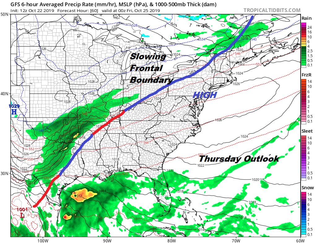
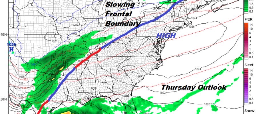
Friday we should see some sunshine but there will be clouds around as a disturbance slides to our north. Highs will be in the 60s. Another cold front approaches but we think rain holds off until Saturday as the front slows down and low pressure heads our way from the southwest. Weather models are keying on the low tracking further west which might buy us some dry time on Saturday.
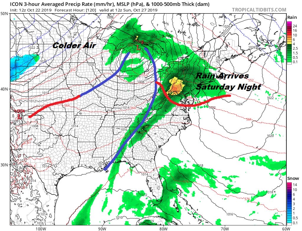
If the west track plays out look for rain to arrive Saturday night and lasting into Sunday afternoon until the front passes. We are seeing a strengthening northern jet stream next week and that will bring some rather chilly air for the middle and latter part of next week. Joestradamus will address this further in a long range post later today.
MANY THANKS TO TROPICAL TIDBITS FOR THE USE OF MAPS
Please note that with regards to any severe weather, tropical storms, or hurricanes, should a storm be threatening, please consult your local National Weather Service office or your local government officials about what action you should be taking to protect life and property.


