Long Range Joestradamus Sees Halloween Cold Pattern Later Next Week
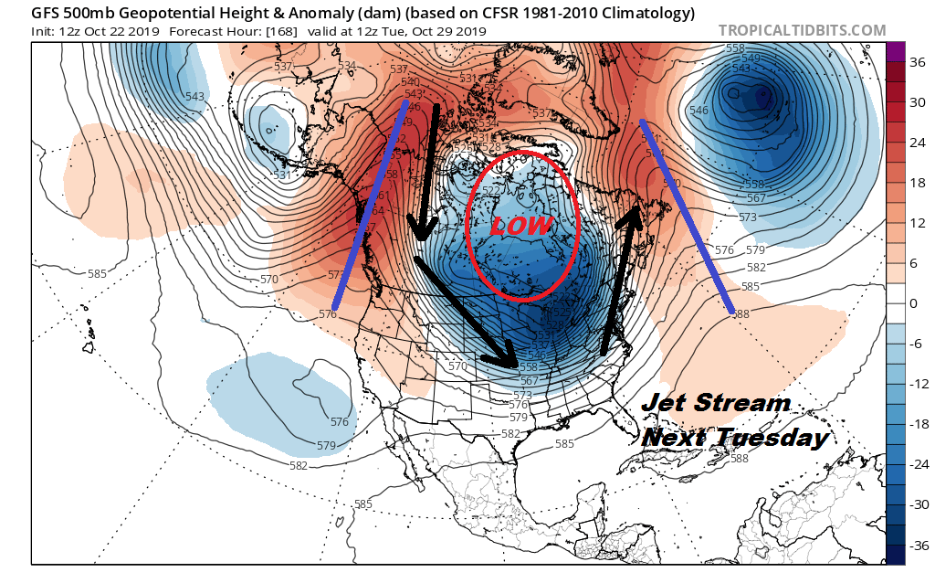
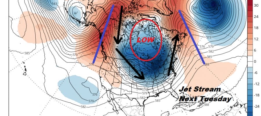
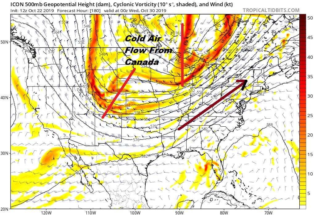
We are struggling with the weekend forecast because of the changes that are underway with the jet stream pattern across North America. Next week we will be seeing a strengthening vortex in Canada over Hudson Bay. On either side of this vortex or two strong ridges in marked in blue. One is on the Atlantic side and the other in the Pacific. This creates a “Canadian connection” for cold air to spread into the Rockies and Plains late in the weekend and the spreading across the Great Lakes and into the Eastern US early next week. There is nothing unusual here regarding the pattern which seems to moving along in an orderly fashion by following the calendar. We are going to rely a bit more on the European/Icon idea which means we will probably have another cold front deal with Tuesday into Wednesday of next week.
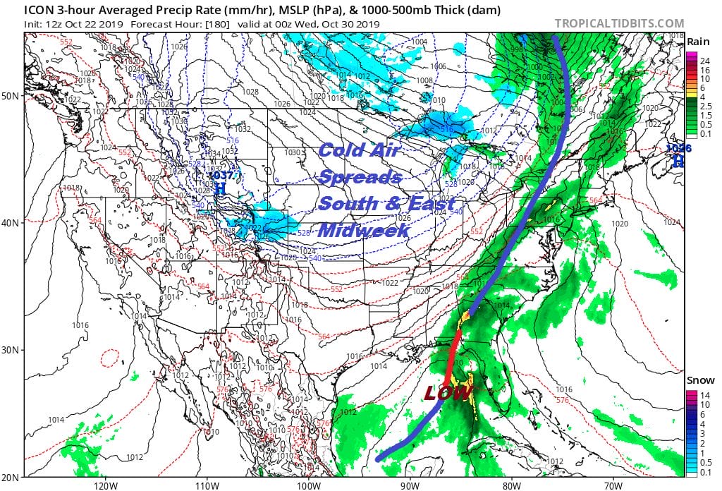
It is likely that we will have to wait for some sort of wave to go by on Wednesday to bring that cooler air in but the upper air certainly suggests that we will see those chilly temperatures arrive later Wednesday and in time for Halloween.
With this Canadian connection setting up we will probably see the first lake effect snow showers around the Northern Great Lakes and perhaps late next week in areas around Lake Erie and Lake Ontario. The colder flow from Canada will mean below average temperatures for the period of October 29 through November 5th.

This doesn’t look like a pattern that holds much beyond the first 4 or 5 days of November as the chess pieces in the upper air are likely to rearrange themselves again. it appears that the upper flow will flatten out from west to east after this brief shot of chilly air so revert back to seasonal temperatures after this plays out. For snow lovers, the answer to the obvious question here is NO!
MANY THANKS TO TROPICAL TIDBITS FOR THE USE OF MAPS
Please note that with regards to any severe weather, tropical storms, or hurricanes, should a storm be threatening, please consult your local National Weather Service office or your local government officials about what action you should be taking to protect life and property.