Showers Arrive Later Today, Dry Wednesday Thursday, Showers Friday Night Saturday
A large storm is moving northward into Canada north of Lake Superior today. This swings a cold front to the east coast. We also have a bit of an onshore low in play today thanks to Sunday’s low which remains offshore in a very weakened state. Clouds will thicken up today and there could be a little patchy light rain or drizzle until the main front makes its final approach late today and tonight. Temperatures today will reach into the lower 60s with clouds and a bit of an east wind holding temperatures back today. Not much rain is forecast during the day. The bulk of the showers will come tonight.
SATELLITE

REGIONAL RADAR

We are beginning to see showers on the regional radar in Western Pennsylvania and Western NY moving northeastward. On the local radars we are seeing some patches of light rain breaking out well ahead of the front but those patches are widely scattered.
LOCAL RADAR NEW YORK CITY

LOCAL RADAR PHILADELPHIA


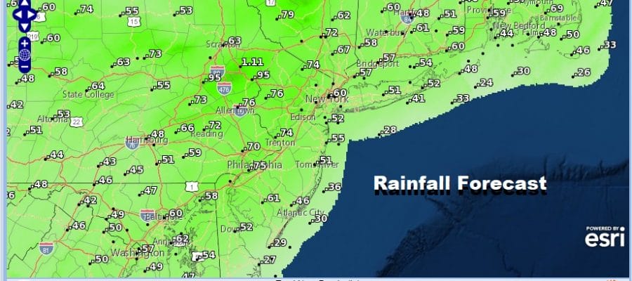
Showers this evening and tonight should be ending from west to east during the early morning hours. Temperatures overnight will hold in the 50s. Rainfall amounts could be in the 1/2 inch plus range if the front can hold its own as it moves east.

Once the front passes weather conditions will improve before daybreak on Wednesday and we should see skies go partly to mostly sunny from the get go. Highs Wednesday will be in the mid to upper 60s. The same holds for Thursday with lots of sunshine and highs again will be in the mid to upper 60s.
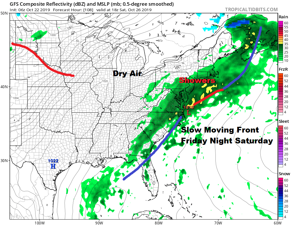
Friday brings the next cold front which looks to be slow moving in nature. There are weather model differences here as the European model is weaker with this front and would actually argue for some showers late Friday or Friday night followed by improving weather conditions on Saturday. It would actually argue for a nice weekend. We are going to lean optimistic here as the upper air doesn’t look overly supportive here for a stalled front and a follow up wave. So lets go for early clouds Saturday giving way to some sunshine and Sunday should feature some sunshine with highs both days into the 60s.
MANY THANKS TO TROPICAL TIDBITS FOR THE USE OF MAPS
Please note that with regards to any severe weather, tropical storms, or hurricanes, should a storm be threatening, please consult your local National Weather Service office or your local government officials about what action you should be taking to protect life and property.


