
Rain Stays Mostly Offshore Brushing Coastal NJ,
Brief Heavier Rain Southern New England Long Island

Weather in 5/Joe & Joe Weather Show Latest Podcast
Rain Stays Mostly Offshore Brushing Coastal NJ,
Brief Heavier Rain Southern New England Long Island
A frontal boundary remains stalled off the East Coast and the satellite pictures and loops show clouds from Central New England southward into the Carolinas. Low pressure is forming in Eastern North Carolina and that low will head northeast offshore. Certainly most if not all of the area will be in clouds today. The question of rain though is an easier one. The low will move northeast and just far enough offshore so that the western edge of the rain will brush coastal New Jersey later today. A more solid hit of rain will come to areas east of NYC with the potential for some brief heavy rain over Southern New England late today and for the first half of tonight.
SATELLITE

We can see the wall of rain to the south on both the regional and local radars. Rains will move northeast through the Delmarva Peninsula as the low develops. The western edge sharply cuts off leaving areas in much of New Jersey, Eastern and Southern Pennsylvania and most of Maryland out of the rain area.
WEATHER RADAR

WEATHER RADAR


With clouds dominating all day long that will leave temperatures to top out in the 70s. Perhaps some areas to the west and inland in Pennsylvania and northwest into Upstate NY could see some breaks off sun through the high clouds pushing highs closer to 80. Areas to the east of NYC will be left in the low to mid 70s.
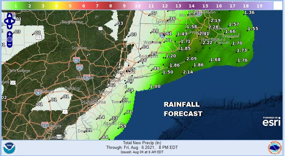
You can see the heaviest rain on the rainfall forecast map lies across Eastern Long Island and Southeastern New England on the order of 1 to 2 inches in that area while to the west amounts drop off rapidly and sharply cut off once you reach NYC and Coastal NJ. 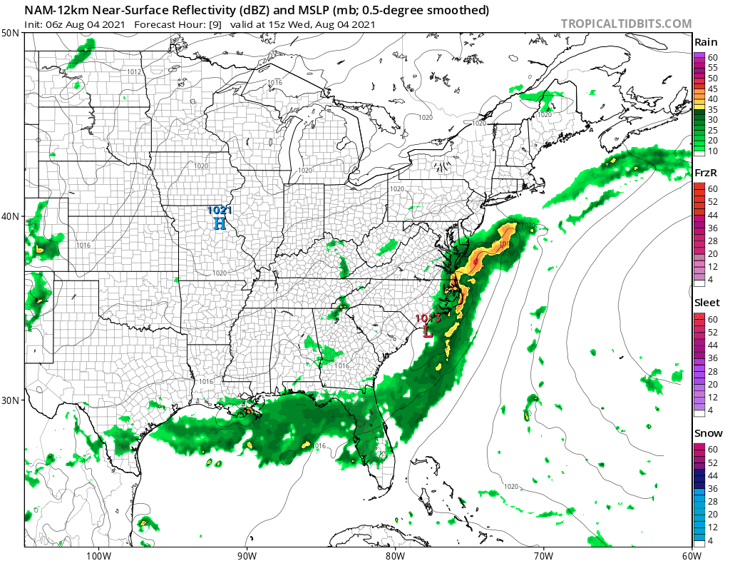
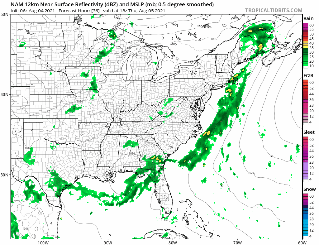
The frontal boundary remains stalled offshore Thursday and we have one more wave of low pressure to get through. All the rain from this wave stays offshore but once again clouds will be an issue limiting the sun especially near the coast. Thursday highs will be in the upper 70s and lower 80s with the warmer temperatures inland. No rain is forecast from this wave.
The last wave pulls out most of the clouds Friday and the frontal boundary disappears as high pressure in the Atlantic builds back westward. You can wave goodbye to the low humidity as we head into very warm and humid conditions starting Friday and lasting through the weekend and into next week. Clouds give way to developing sun Friday with highs reaching the low and middle 80s. Saturday and Sunday will be very warm and humid with some sunshine. We will throw in the chance for a shower or thunderstorm. Highs will be in the mid 80s to near 90 degrees both days. The August dog days are arriving!
BE SURE TO DOWNLOAD THE FREE METEOROLOGIST JOE CIOFFI WEATHER APP &
ANGRY BEN’S FREE WEATHER APP “THE ANGRY WEATHERMAN!

MANY THANKS TO TROPICAL TIDBITS & F5 WEATHER FOR THE USE OF MAPS
Please note that with regards to any severe weather, tropical storms, or hurricanes, should a storm be threatening, please consult your local National Weather Service office or your local government officials about what action you should be taking to protect life and property.


