Rain Round Two Wednesday
Rain Round Two Wednesday

A view of the Southeast US regional radar shows the development of thunderstorms on across Northern Mississippi and Tennessee. This is the second wave that is rotating around the strong upper air storm. The satellite loop shows the large circulation dominating the weather throughout most of the Eastern US. We got a solid 1 to 2 inches of rain today

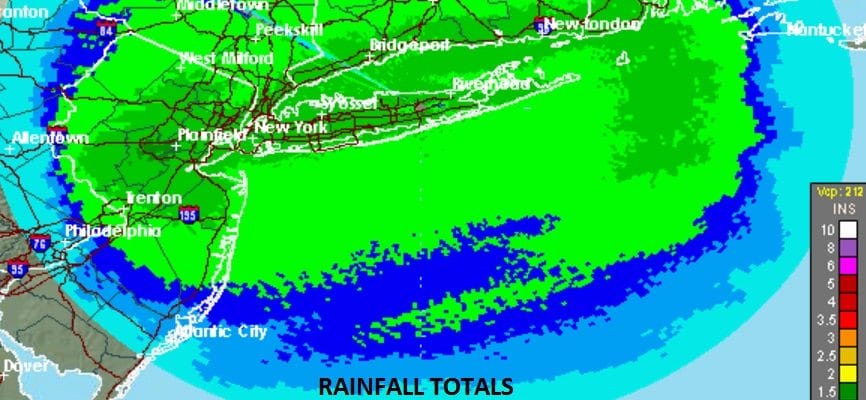
The Northeast US regional radar shows the first round of rain pulling out and now we just have some residual showers left along with some fog and drizzle. This will be the case for the overnight.


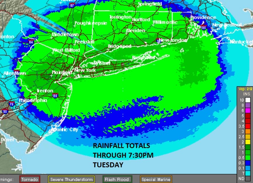
I don’t expect too much to happen during Wednesday morning though some showers might start to increase over Southern areas of New Jersey and Southeastern Pennsylvania. Gradually we will see more areas of rain develop but there will be breaks in between. There will also be a few thunderstorms in the mix as well. We should be able to grind out another inch or so of rain out of this with some locally higher amounts possible around thunderstorms.
Weather conditions begin to improve on Thursday with some sunshine returning. Colder air follows Friday and into the weekend with temperatures trending closer to average.
With regards to the long range things are getting a little volatile on the models. JOESTRADAMUS has more on this.
SHORT & LONG RANGE VIDEO ANALYSIS
SNOW REMOVAL COMPANIES FOR YOUR WINTER NEEDS
LONG ISLAND ROCKLAND COUNTY Connecticut

![]()

FiOS1 News Weather Forecast For Long Island
FiOS1 News Weather Forecast For New Jersey
FiOS1 News Weather Forecast For Hudson Valley
NATIONAL WEATHER SERVICE SNOW FORECASTS
LATEST JOESTRADAMUS ON THE LONG RANGE
Weather App

Don’t be without Meteorologist Joe Cioffi’s weather app. It is really a meteorologist app because you get my forecasts and my analysis and not some automated computer generated forecast based on the GFS model. This is why your app forecast changes every 6 hours. It is model driven with no human input at all. It gives you an icon, a temperature and no insight whatsoever.
It is a complete weather app to suit your forecast needs. All the weather information you need is right on your phone. Android or I-phone, use it to keep track of all the latest weather information and forecasts. This weather app is also free of advertising so you don’t have to worry about security issues with your device. An accurate forecast and no worries that your device is being compromised.
Use it in conjunction with my website and my facebook and twitter and you have complete weather coverage of all the latest weather and the long range outlook. The website has been redone and upgraded. Its easy to use and everything is archived so you can see how well Joe does or doesn’t do when it comes to forecasts and outlooks.
Just click on the google play button or the apple store button on the sidebar for my app which is on My Weather Concierge. Download the app for free. Subscribe to my forecasts on an ad free environment for just 99 cents a month.
Get my forecasts in the palm of your hand for less than the cost of a cup of Joe!


