
Rain Moving In On Thursday
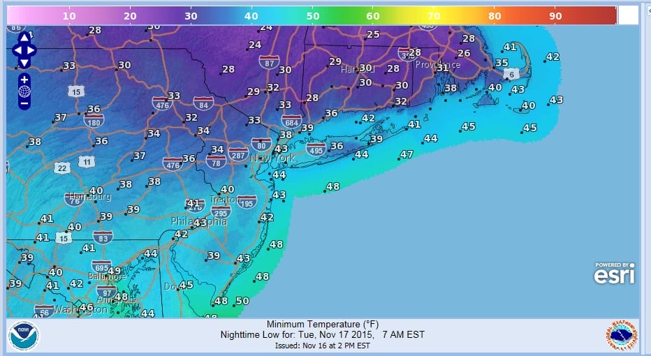
Thursday looks to be the day for what will probably be an all day threat of rain or showers. Some of the downpours could be heavy and even a thunderstorm probably can’t be ruled out. The next cold front will be passing through late Thursday evening and is the cause of this. However until then we have a few things to get through and nothing terribly annoying. Tonight looks clear but it will turn colder with lows in the 30s to near 40 in most areas but some 20s are possible in areas north and northeast of New York City.

First off we have a back door cold front coming in tonight which will turn the winds to the north and then northeast. Colder air from Northern New England will be coming southward and that means today’s highs in the low to mid 60s won’t be repeated on Tuesday though we should have a good deal of sunshine for much of the day. Highs on Tuesday will not be much above the upper 40s to lower 50s for the entire area from Eastern Pennsylvania through New Jersey, Southeast NY and Southern New England, including Long Island and the Lower Hudson Valley.
Wednesday we run into cloud issue as the onshore flow starts to feed in moisture ahead of the cold front. But the rain from the front will hold off until the early morning hours in western New Jersey and Eastern Pennsylvania, and around or just after daybreak elsewhere. The front keeps on moving and the rains should be out Thursday evening from west to east.
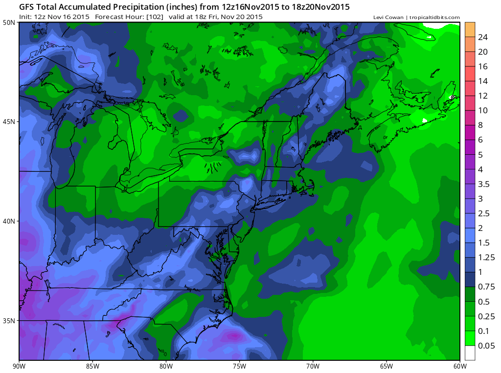
I’m liking the gfs profile for the rainfall forecast amounts of around an inch or so with greater amounts to the west. It makes sense given the nature of the front. We should dry out and turn colder Friday into Saturday. Colder air will be building in all weekend and as it arrives on Sunday there could be a few showers..or even some snow showers in colder elevated areas depending on intensity. The air aloft coming in is going to be cold enough so it will be a question of how cold the layers are. We managed to do it in mid October with ground temps in the mid to upper 40s so it is not impossible. As for long range JOESTRADAMUS will be doing a long range update later this evening. However in case you missed it, check out the links below of the most recent posts.


