
JOESTRADAMUS First Snow For Midwest This Weekend, Colder Northeast
The first snow for Midwest areas will be happening this evening so places like Chicago, Milwaukee and Detroit could see their first accumulations as will Cleveland and Buffalow to a lesser extent. The GFS loves to overdo so at the very least lets cut these amounts in half and you come up with a pretty reasonable idea of the first accumulating snows for these cities being on the order of a coating to a couple of inches and from the stanpoint of normal it would come pretty much on schedule in spite of the warmer then normal Novemeber that has been the story since the month began.
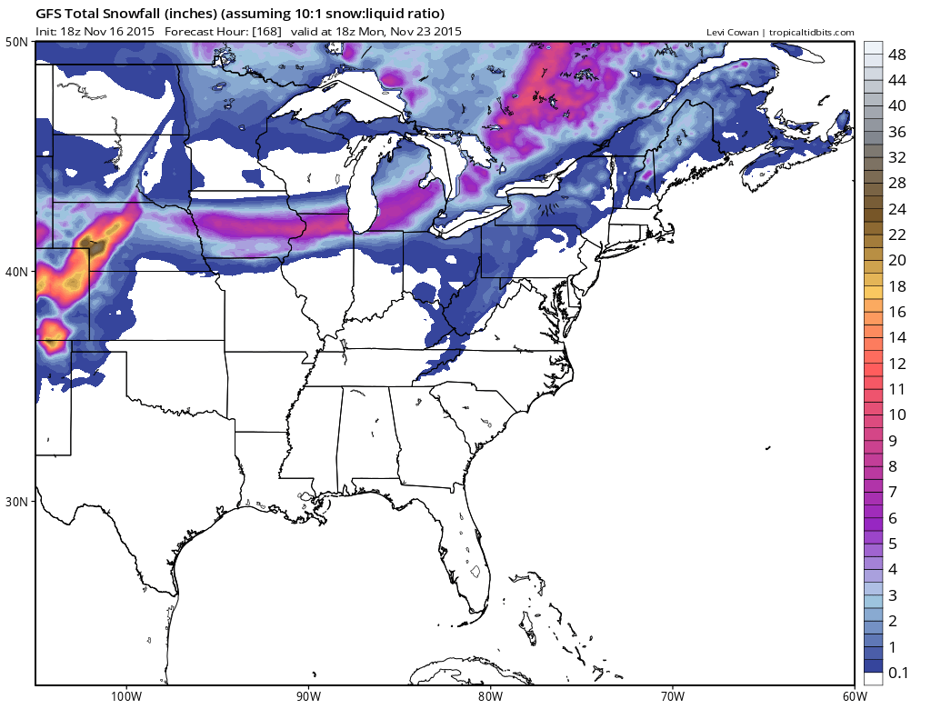
Now what is driving this is Thursday’s cold front that moves through here has the first shot of cold air coming in which in reality is not all that cold. A wave develops on the second more important front that will be reaching us here during Saturday night.
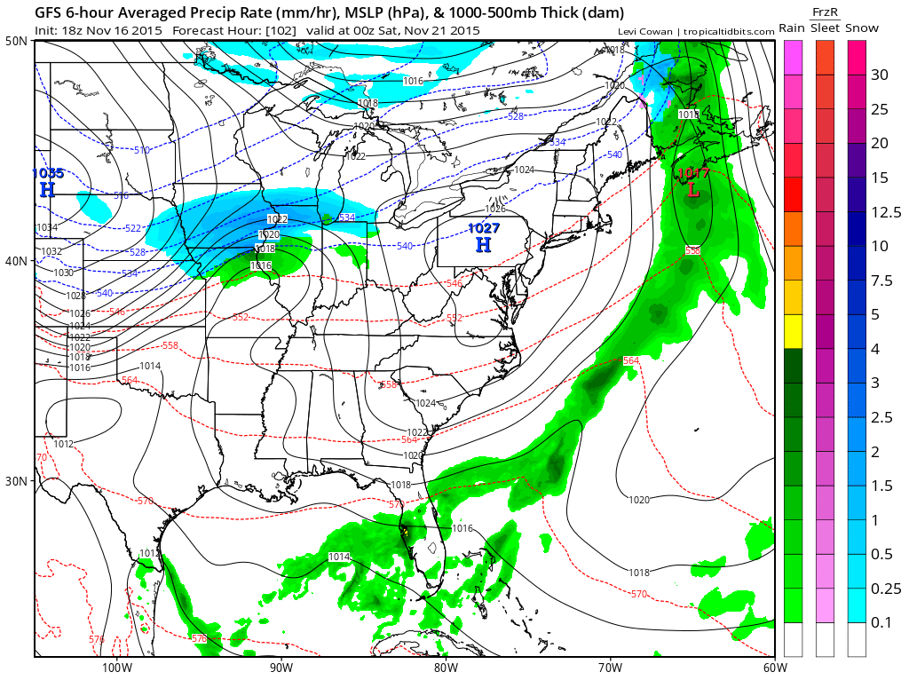
You can see the wave pretty well coming out of Central Missouri. Cold air is going to be moving down out of central Canada as the jet stream pattern has opened up Canada to some cold air for the first time since mid October. By Saturday night low pressure will be moving into the eastern Great Lakes with a trailing cold front approaching us. Im thinking there will be some showers Saturady night into Sunday morning before the cold air come in for Sunday and Monday. Lake effect snows will be occurring in upstate NY.
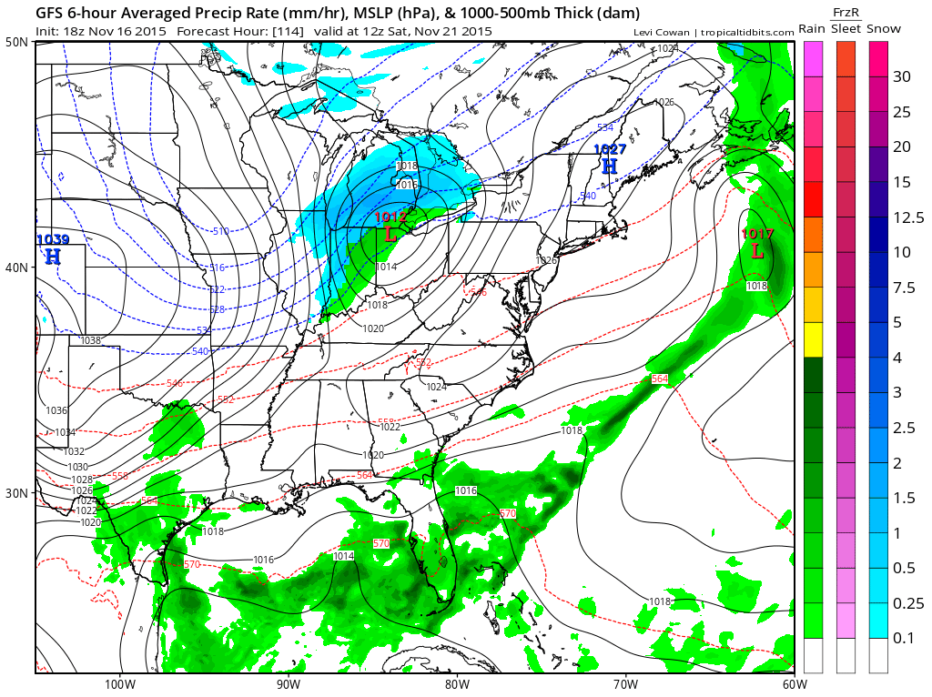
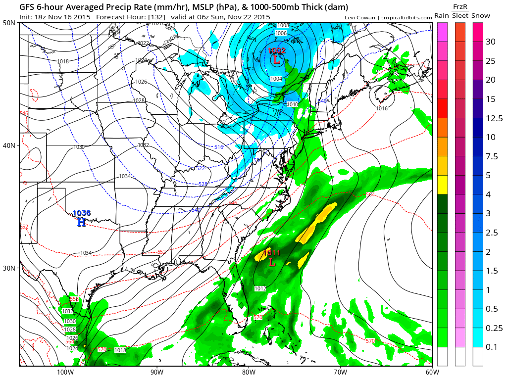
The front is going to pass offshore Sunday morning. I’m thinking some flurries and snow showers are possible Sunday especially in higher elevations. Very cold air aloft and even some low level cold air could be enough to do it. Back in the cold shot of mid October we say snow flurries with temperatures in the upper 40s. I think this air mass will be colder and the low level cold air will be colder as well. Cheap thrill if it happens. And the answer to the the question is..NO THIS WAVE IS NOT GOING TO TRACK FURTHER SOUTH!
Longer term next week, I think it will still be cold Tuesday and possibly into Wednesday as the models may be pulling out the cold air a little too quickly. At least that is my view at this point that high pressure will build to the north and take its time getting out of here. It should be chilly into Wednesday and then perhaps moderate a bit on Thursday Thanksgiving day. I will look at the long long range later this evening or perhaps with an overnight post depending on my schedule.