Rain Grazes Coastal Areas Wednesday Morning
CHRISTMAS SHOPPING BARGAINS
Rain Grazes Coastal Areas Wednesday Morning
Low pressure is developing off the Southeast Coast. Satellite loops show a twist in the clouds moving northeastward. Weather models over the last few days have been terrible handling this. Each model run has brought this closer to the coast and further north. It looks like rain will be affecting coastal areas of New Jersey to NYC, Southern Connecticut and Long Island with rain Wednesday morning. The western edge is a tough call and there will be a sharp cutoff just inland of the coast.
GFS RAINFALL FORECAST WEDNESDAY MORNING

Models today are showing a solid stripe of half an inch of rain from Southern New Jersey to Long Island into Southern New England. Amounts tail off to well under a quarter of an inch north and west of NYC & Philadelphia. We are pretty much in line with this. Though it does make for a wet start to the day along the coast. Skies will clear out Wednesday afternoon from west to east. Temperatures tonight will settle in the mid 40s to near 50 and probably hold in the low 50s on Wednesday.
SATELLITE LOOP

REGIONAL RADAR

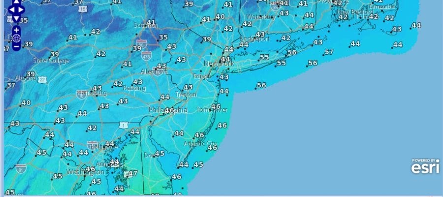
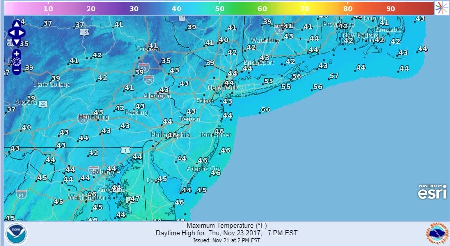
Thanksgiving Day forecast remains unchanged with sunshine and few clouds. It will be chilly with highs just in the low to mid 40s.
The rest of the holiday weekend remains uneventful. Friday will be nice and Sunny with highs back to near 50. Saturday will be warm again with highs in the mid to upper 50s with the chance for a late day shower. Then it turns colder again on Sunday though the cold shot now appears to be much more manageable than early shown as the cold air backs off. There are still no storms of consequence in sight into the first part of next week.
 GET JOE A CIGAR IF YOU LIKE

BLACK FRIDAY SHOPPING BARGAINS AND COUPONS
FiOS1 News Weather Forecast For Long Island
FiOS1 News Weather Forecast For New Jersey
FiOS1 News Weather Forecast For Hudson Valley


