Rain Arriving Tonight Winter Weather Advisories NE Pennsylvania
Catskills, Northern Connecticut
We managed to squeeze out a little extra sunshine today before the clouds rolled in this afternoon. Temperatures climbed up through the 40s but they have now settled near the 40 degree mark this evening. The air isn’t all that cold. Even in areas to the north where Winter Weather Advisories are posted temperatures are marginal This is precisely why we don’t expect much to happen from this system other than rain.
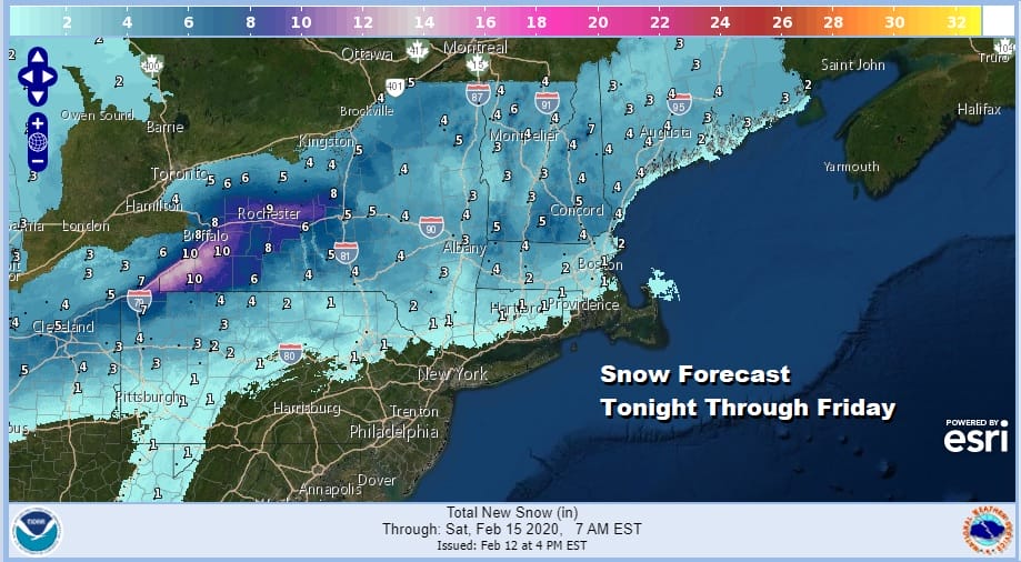
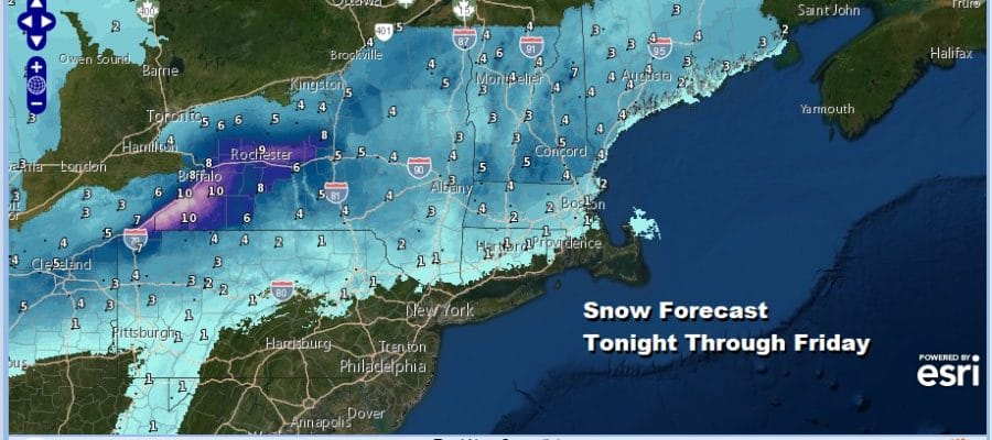
Not much has changed in the forecast for snow tonight with the highest amounts mainly north of I-90 in NY State and in Vermont, New Hampshire and Maine. Snow amounts in Northwest Pennsylvania reflect some backside and lake effect enhancement late Thursday into Friday.
SATELLITE

REGIONAL RADAR

As the clouds continue to roll in and thicken up we are seeing rain on the radars showing up now in Pennsylvania and points west and southwest and local radars are also beginning to pick up on the precipitation as it moves northeast. The northern fringe of this will start as snow in Northern Pennsylvania and in areas north and west of Route 84 in the Hudson Valley and Connecticut. On the southern flank of the snow area a coating to an inch or so is possible before it changes to rain overnight. Everyone else sees a raw chilly rain.
LOCAL RADAR NEW YORK CITY

LOCAL RADAR PHILADELPHIA


This all starts to end from west to east from mid morning to early afternoon. Rainfall amounts look to be mostly on the order to a quarter to maybe as much as a half inch. This doesn’t look like a big rain maker. The low doesn’t develop like the one we saw late last week.
Behind the low is the coldest weather of the winter for the Northeast which isn’t saying much really since arctic intrusions have been virtually non existent since mid December. Temperatures Thursday will reach their highs in the upper 40s to mid 50s early and then start to east. By Friday morning we will be in the 20s to near 30 with a gusty wind.

Gusty winds continue Friday with ineffective sunshine and highs just in the upper 20s and lower 30s and we will head down to what should be the coldest night of the winter with Saturday morning lows in the low teens and single digits in many areas under clear skies.
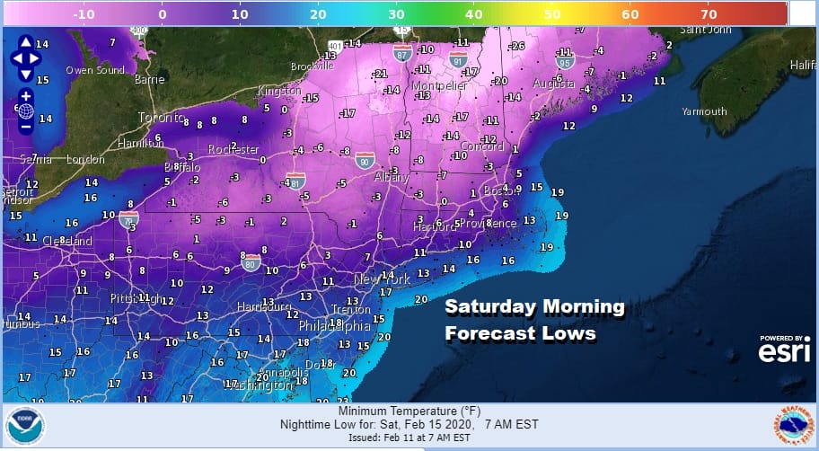
As the holiday weekend gets underway look for a very cold but sunny Saturday with most highs in the upper 20s and lower 30s. Temperatures will rebound Sunday ahead of a weak cold front with clouds and some sun. Highs will be back in the 40s. The front goes by Sunday night with clouds and maybe an isolated shower. Monday Presidents Day we will see some sunshine with highs in the 40s. The next cold front and the next chance for showers will be on Tuesday which means we will actually go 4 days without any rain and obviously no snow. Long range nothing has changed since yesterday and the snow drought in the I-95 corridor continues possible through the end of the month.
BE SURE TO DOWNLOAD THE FREE METEOROLOGIST JOE CIOFFI WEATHER APP &
ANGRY BEN’S FREE WEATHER APP “THE ANGRY WEATHERMAN!
MANY THANKS TO TROPICAL TIDBITS FOR THE USE OF MAPS
Please note that with regards to any severe weather, tropical storms, or hurricanes, should a storm be threatening, please consult your local National Weather Service office or your local government officials about what action you should be taking to protect life and property.


