Rain Arrives Late Tuesday Cold Air Arrives Wednesday
SHOP THE JOESTRADAMUS STORE
Rain Arrives Late Tuesday Cold Air Arrives Wednesday
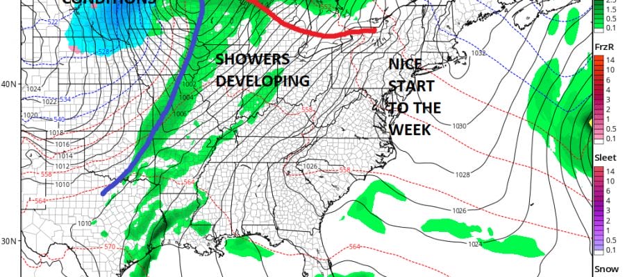
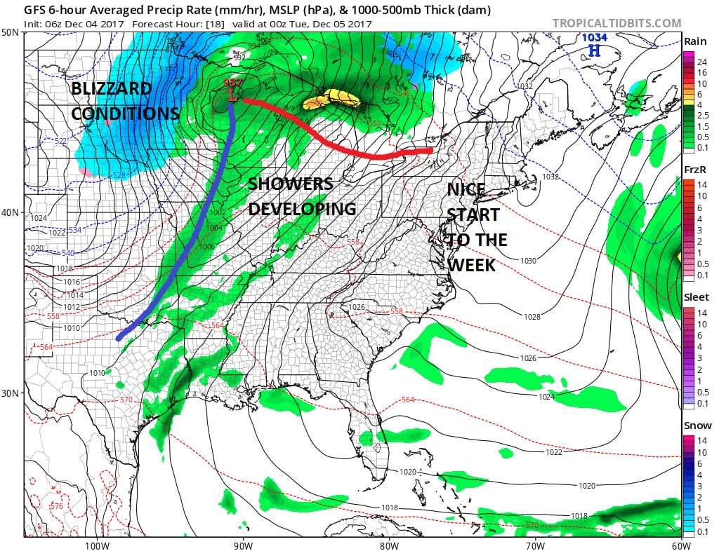
We begin the new week with some sunshine thanks to dry air that has moved in. The clouds from overnight have departed. Meanwhile to the northwest in the Eastern Dakotas and Minnesota snow is falling with blizzard conditions in some areas as low pressure moves northeastward to Lake Superior.
We here are sitting with high pressure moving off the coast and we should see a fair amount of sun today with highs reaching into the 50s in most places. The initial shot of clouds to the west should pass to our north and west today but later tonight some clouds will begin to increase. Overnight temperatures probably won’t fall much and be in a range of 35 to 45.
SATELLITE LOOP

REGIONAL RADAR

Tuesday brings a cloudy day with a few showers developing as the day wears on and more numerous showers arriving late in the day and Tuesday night. The showery nature of the rains means that rainfall amounts will vary considerably. Some places will get up to an inch or while others will see a half inch or less.
NAM RAINFALL FORECAST

Once the front goes by the well advertised colder pattern begins with temperatures Wednesday falling from near 60 early in the day to near 40 by late afternoon. Thursday looks dry with some sunshine and highs just in the upper 30s to lower 40s. Then we will watch to see whether a wave develops on the old cold front to bring a chance for a little rain or wet snow here on Friday and then another system swings out of the midwest with the chance for some snow Saturday night into Sunday morning. At the moment neither system looks to be problematic.
 GET JOE A CIGAR IF YOU LIKE

FiOS1 News Weather Forecast For Long Island
FiOS1 News Weather Forecast For New Jersey
FiOS1 News Weather Forecast For Hudson Valley


