Quiet Week Ahead of Christmas Eve Christmas Day, No Major Storms

Weather in 5/Joe & Joe Weather Show Latest Podcast
Quiet Week Ahead of Christmas Eve Christmas Day, No Major Storms
It waited to the end of the Autumn season to produce the coldest day before we turn the corner to winter. Many folks didn’t get out of the 30s today even though we had a fair amount of sunshine. Now we head into a night of clear skies and that should take temperatures down nicely into the mid 20s to lower 30s. The satellite doesn’t show much in the way of clouds. The radars are for the most part nice and quiet and we are in rather good shape for the overnight period.
SATELLITE

WEATHER RADAR

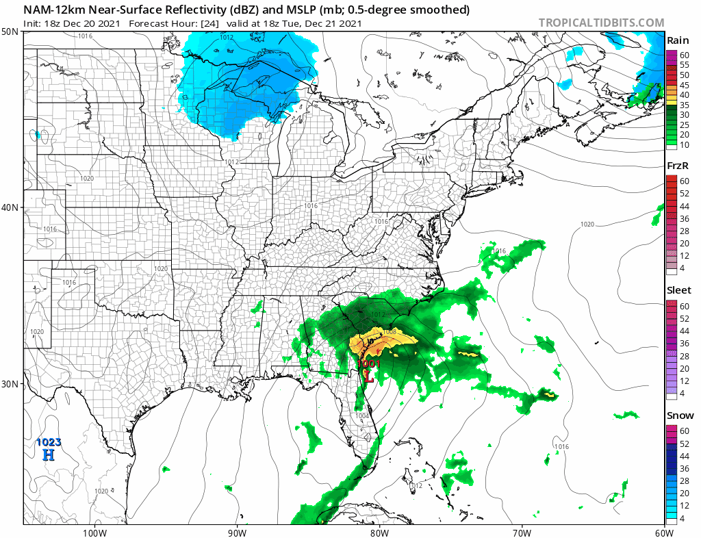
Tuesday we watch low pressure along the Carolinas start to straddle northward. This looked to be a phased, then un-phased, and now I would call it a semi phased situation. We will likely see sunshine giving way to some high clouds Tuesday. Highs should be in the low to mid 40s. The low will track offshore Tuesday night and it might clip Eastern Long Island AND Southern New Jersey with some rain early Wednesday morning.
The low is going to head to the northeast toward Nova Scotia and Newfoundland never really phasing with Canadian energy. That keeps it from getting too cold here. Wednesday sees a nice day of sunshine with highs reaching the mid to upper 40s. There really isn’t much cold air to speak of anywhere in the Northeast or for that matter, across much of the US. Thursday was to be a day of cold air coming into the East from Eastern Canada and clearly that is not happening. So lets enjoy a nice Thursday with some sun and highs in the upper 30s and lower 40s.
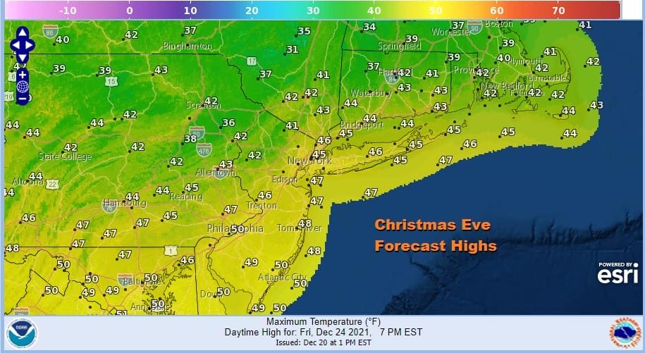
Friday Christmas Eve is actually going to be a decent day and on the mild side average. What was supposed to be a day of highs in the 30s has now turned into a day of highs in the mid to upper 40s. Last year as I recall it was a day of thunderstorms before a cold front passed. Maybe one of these years soon it might snow again for Christmas. A warm front approaches Friday night and Christmas morning
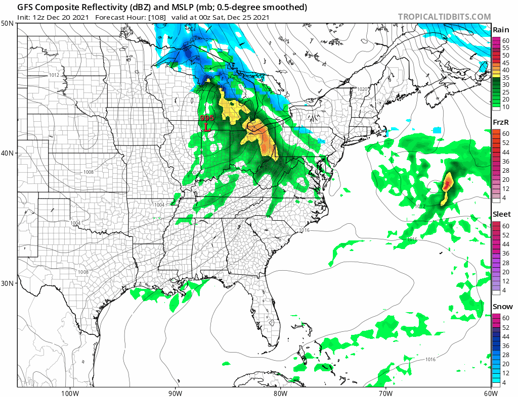
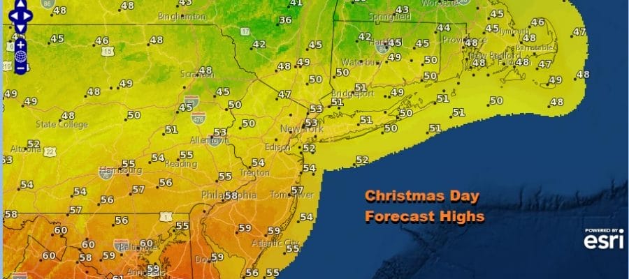
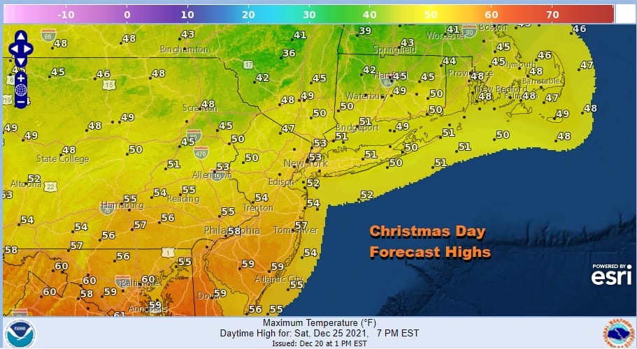
We will see some rain showers Friday night and into early Christmas morning but I think we should break out into some sunshine during the afternoon Saturday. This was supposed to be a day where highs were going to be in the 30s. Instead if the sun comes out soon enough, highs will be in the warm 50s!
Saturday night and then Sunday and Monday look to be dry and colder. I don’t see anything truly extraordinary for next week. There isn’t a lot of cold air around. There aren’t any weather systems that promise to bring snow chances next week. The last week of December looks to go out benign as the ring the bells for the New Year.
BE SURE TO DOWNLOAD THE FREE METEOROLOGIST JOE CIOFFI WEATHER APP &
ANGRY BEN’S FREE WEATHER APP “THE ANGRY WEATHERMAN!

MANY THANKS TO TROPICAL TIDBITS & F5 WEATHER FOR THE USE OF MAPS
Please note that with regards to any severe weather, tropical storms, or hurricanes, should a storm be threatening, please consult your local National Weather Service office or your local government officials about what action you should be taking to protect life and property.


