Quiet Chilly Weather Continues Through Weekend Pattern Realigns Next Week

Weather in 5/Joe & Joe Weather Show Latest Podcast
Quiet Chilly Weather Continues Through Weekend Pattern Realigns Next Week
Sunday’s storm system is still sitting off the coast of New England today. You can see it clearly on the satellite picture to the east of Cape Cod and in fact the center has actually backed in a little westward. That backs clouds in westward from time to time and some bands of rain on the regional radar make it back to Cape Cod from time to time. For now on the regional radar those bands are pushing back into Eastern Maine. For Eastern Pennsylvania to Southern New England it is a clouds and sun kind of day with temperatures topping out in the upper 30s to near 40 or so. For areas in Maryland Delaware and Northern Virginia, more sun, fewer clouds and highs reaching into the lower 40s.
SATELLITE


There really isn’t much that changes over the next 5 days which means each day of the next 5 will be about the same. Thursday we look at sunshine and Friday we see sun and high clouds. Saturday should be partly sunny and the same goes for Sunday. Highs each day in the upper 30s to around 40 with lows at night in the 20s to near 30 which is pretty much close to average for this time of year.
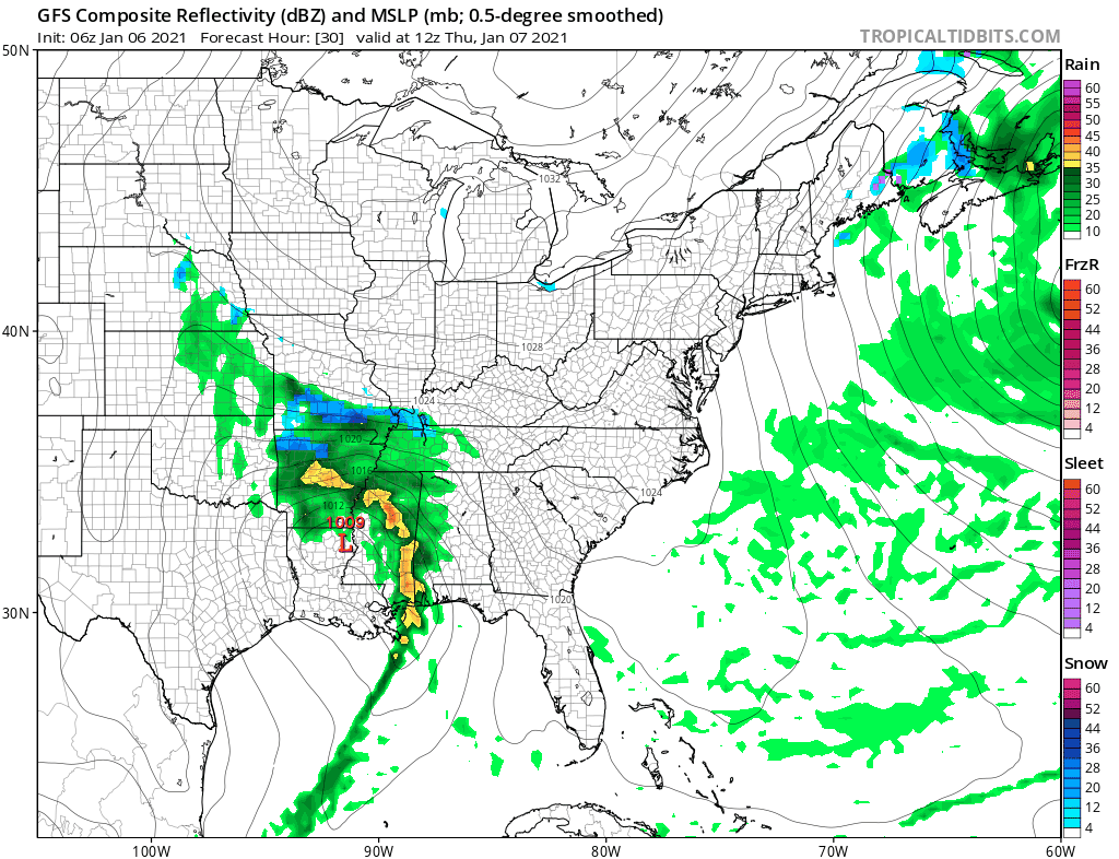
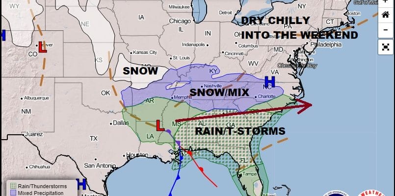
The strong blocking pattern continues until further notice and that is taking storms on a southern track. One such storm moves across the south on Thursday and exits the east coast Friday night into Saturday. This is going to likely bring snow to areas from Northern Georgia to Southern Virginia especially in the mountains of Western Carolinas. However due to the very strong blocking (see low east of Cape Cod) there is no room for the storm to climb northward. Instead it gets shoved eastward and there is no chance for any kind of northward shift given the strength of the block.
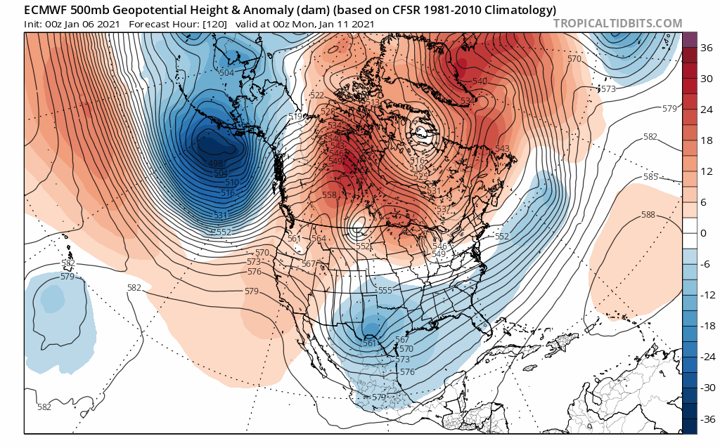
Next week however brings big changes in the upper pattern across the Pacific that will open the door for colder arctic air to start moving southward into the US. The change in the pacific is a big one as we go to abnormally lower pressures to abnormally higher pressures. The block in the Atlantic seems to relax enough to allow a follow up storm system to develop in the Gulf of Mexico and head up the coast about a week from now. The key to this will be the block relaxing just enough to allow for some room. Beyond that storm system it looks like a winter pattern gains a foothold in the long range.
We will be discussing both the storm prospects as well as the winter pattern in greater detail on my weather platform on Patreon as well as live tonight on the Joe & Joe Weather Show.
BE SURE TO DOWNLOAD THE FREE METEOROLOGIST JOE CIOFFI WEATHER APP &
ANGRY BEN’S FREE WEATHER APP “THE ANGRY WEATHERMAN!
MANY THANKS TO TROPICAL TIDBITS FOR THE USE OF MAPS
Please note that with regards to any severe weather, tropical storms, or hurricanes, should a storm be threatening, please consult your local National Weather Service office or your local government officials about what action you should be taking to protect life and property.


