Quiet Autumn Weather Into Saturday Wetter Pattern Evolves Next Week

Weather in 5/Joe & Joe Weather Show Latest Podcast
Quiet Autumn Weather Into Saturday Wetter Pattern Evolves Next Week

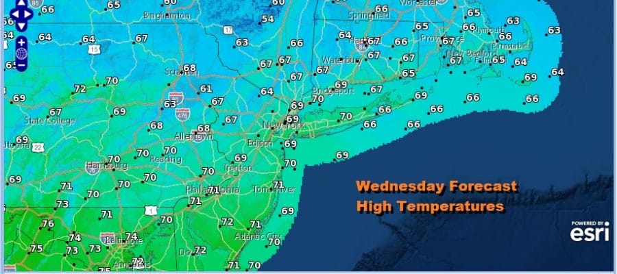
We are at the beginning of a long dry stretch of weather that takes us through the rest of the week and the first half of the weekend. We are under a cool northerly flow of air thanks to a trough off the East Coast. Yesterday’s cold front continues to move slowly southeast and we should see sunshine today with nothing more than some passing clouds. Temperatures this afternoon will be topping out between 65 and 70 degrees. Radar shows some leftover showers offshore and moving southeastward and the radars can go on hiatus for awhile.
SATELLITE

WEATHER RADAR

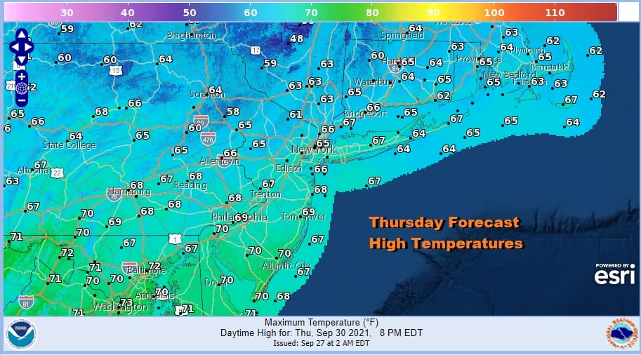
Moving through the rest of the week it is fairly straight forward. The upper trough off the East Coast will keep Hurricane Sam well offshore. We will see clear skies tonight with most lows in the 40s inland and low to mid 50s in warmer urban locations and along the coast. Thursday looks nice with sunshine taking highs to the 60s everywhere.
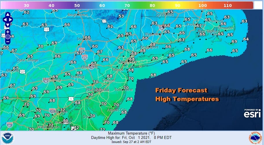
Our nice weather continues on Friday after another cool start we will see sunshine taking highs again to the 60s after starting the day in the 40s to lower 50s. It is a nice finish to the week and now we can move on to the weekend.
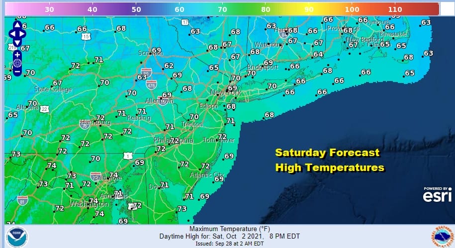
The trough off the East Coast and the northerly flow from Eastern Canada will relax on Saturday as weather systems start to move again. Hurricane Sam passes east of Bermuda and gets kicked away to the northeast. This will allow weather systems to start moving again across the US. Saturday will be another nice day of sunshine with highs in the upper 60s to lower 70s.
As weather systems begin to move again it seems that Sunday we will see some changes as low pressure heads to the Great Lakes. It seems that clouds and some rain will move across Upstate NY and into New England Sunday but it leaves areas to the south with clouds and the chance for some scattered showers. Temperatures Sunday will be back into the 70s.
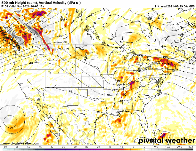
Next week looks to bring about a different sort of upper air weather pattern and the opposite of what we have right now. Instead of a northerly flow of dry air, we will be on the other end of the spectrum as a low cuts off to the west and creates a southerly flow in the Eastern US. At the very least it will make it more humid and then attention turns to developments to the south. This is one of those times with a southerly flow that we do not want to see a tropical storm develop. Pressures will be low in the Northwest Caribbean and over the Bahamas so those areas will have to be watched. Otherwise we will have opportunities for showers next week though probably more toward the middle and latter part of next week.
BE SURE TO DOWNLOAD THE FREE METEOROLOGIST JOE CIOFFI WEATHER APP &
ANGRY BEN’S FREE WEATHER APP “THE ANGRY WEATHERMAN!

MANY THANKS TO TROPICAL TIDBITS & F5 WEATHER FOR THE USE OF MAPS
Please note that with regards to any severe weather, tropical storms, or hurricanes, should a storm be threatening, please consult your local National Weather Service office or your local government officials about what action you should be taking to protect life and property.


